

Water and soil conservation monitoring method based on unmanned aerial vehicle low-altitude remote sensing and object-oriented classification
An object-oriented, machine-low-altitude technology, applied in image analysis, computer parts, character and pattern recognition, etc., can solve the problems of poor applicability and low work efficiency, and achieve low equipment cost, fast sampling rate, and non-contact measurement of the range Effect
- Summary
- Abstract
- Description
- Claims
- Application Information
AI Technical Summary
Problems solved by technology
Method used
Image

Examples
Embodiment
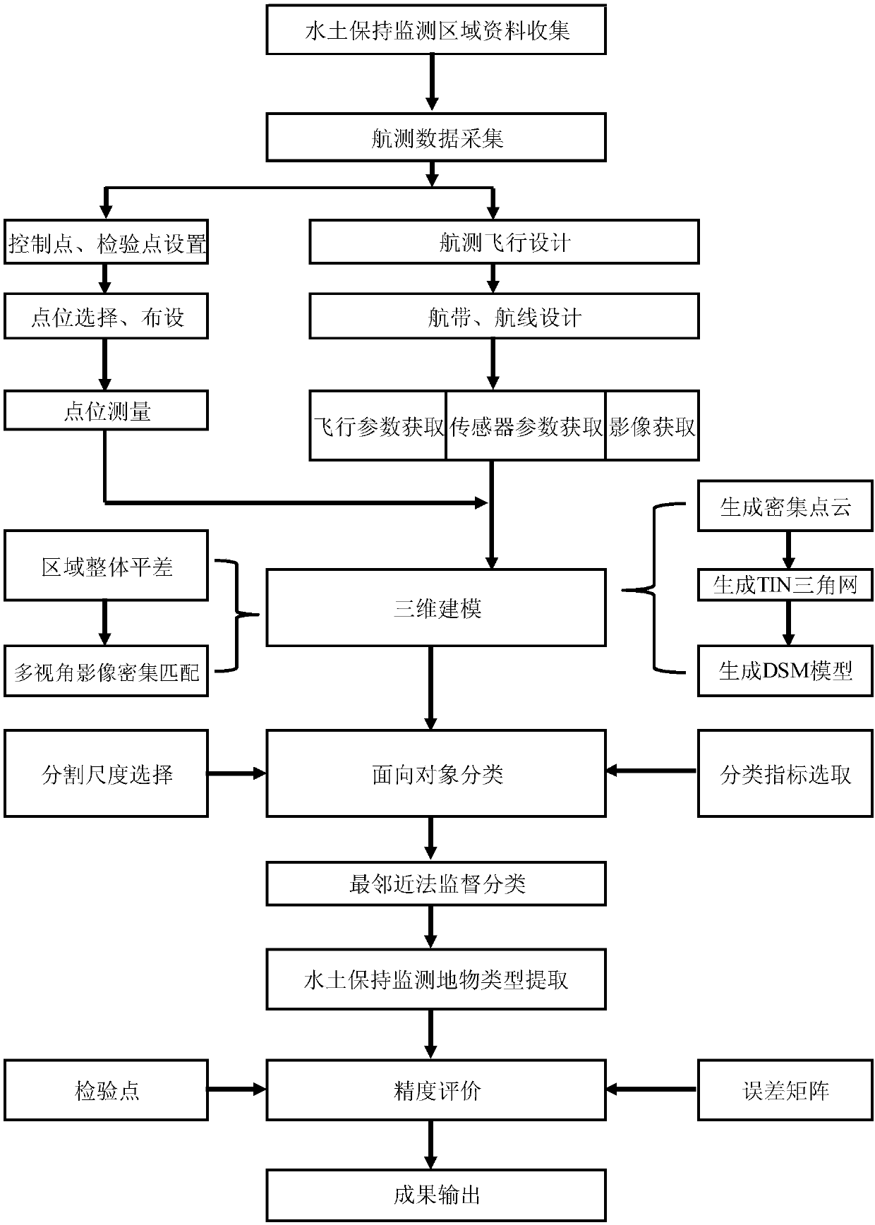
[0052] The technical solutions of the present invention will be further described below in conjunction with the drawings and examples. The examples are only to help readers better understand the technical solutions of the present invention, and are not intended to limit the protection scope of the claims of the present invention.
[0053] The water and soil conservation monitoring method based on UAV low-altitude remote sensing and object-oriented classification provided by the embodiment can greatly improve the ability of accurate, efficient, quantitative acquisition, analysis, calculation and processing of different monitoring index data in the soil and water conservation monitoring work, and also revolutionize Significantly changed the display effect and method of monitoring results. The application of new technology can fill the technical gap in soil and water conservation monitoring work without conventional monitoring methods and means for quantitative monitoring content,...
PUM
 Abstract
Description
Claims
Application Information