Automatic extraction method for urban road network information of high resolution remote sensing image

A technology of urban road network and remote sensing image, applied in the field of remote sensing image processing and intelligent recognition

Inactive Publication Date: 2018-04-24
CHINA UNIV OF GEOSCIENCES (BEIJING)
View PDF2 Cites 25 Cited by
  • Summary
  • Abstract
  • Description
  • Claims
  • Application Information

AI Technical Summary

Problems solved by technology

[0010] Step 4. For the holes in the planar road, the breaks between road sections, and the noise problems of "same-spectrum foreign objects", the road is further corrected, and the foundation for the topological connection of road extraction is la...

Method used


Image

  • Automatic extraction method for urban road network information of high resolution remote sensing image
  • Automatic extraction method for urban road network information of high resolution remote sensing image
  • Automatic extraction method for urban road network information of high resolution remote sensing image

Examples


Embodiment 1

[0029] A method for automatically extracting urban road network information from high-resolution remote sensing images, characterized in that it comprises the following steps:

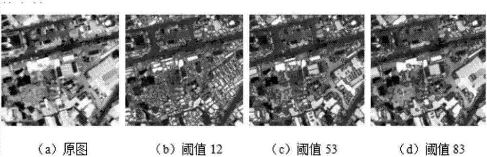
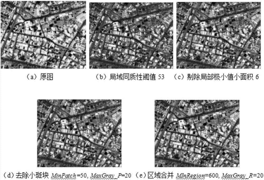
[0030] Step 1. Based on the improved watershed segmentation algorithm, select an appropriate local homogeneity threshold, eliminate small areas with local minimum values, remove small patches and merge regions to solve the over-segmentation problem;

[0031] Based on the watershed segmentation algorithm, and aiming at the over-segmentation problem of the algorithm in image segmentation, improved methods such as selection of local homogeneity threshold, elimination of small area of ​​local minimum value, removal of small patches and area merging are proposed, and through correlation Experiments prove the effectiveness of the improved method.

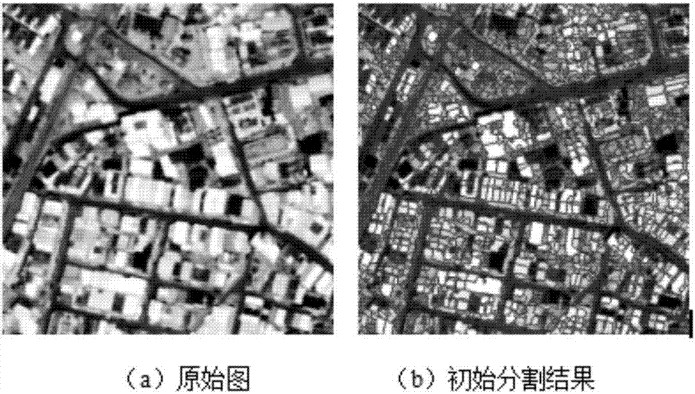
[0032] Although the segmentation speed of the watershed is very fast, due to the strong sensitivity of the algorithm to weak edges, the segmentation results are o...


PUM


Abstract

The invention discloses an automatic extraction method for the urban road network information of a high resolution remote sensing image. The automatic extraction method is characterized in comprisingthe following steps that: S1: on the basis of an improved watershed segmentation algorithm, selecting a proper local homogeneity threshold value, rejecting a local minimum small-area region, removingsmall plaques, and carrying out region combination to solve an over-segmentation problem; S2: in an object-oriented method, adopting geometrical characteristics and context characteristics, utilizingurban road network characteristics to extract a road image object and process occlusion problems in an image; S3: quickly and accurately extracting the position of a road intersection through an automatic extraction method of the road intersection in the high resolution image, and providing a basis for the topological connection of a road; and S4: aiming at the problems, including holes in surfaceshaped roads, fracture among road sections and the noise of "same spectrum with different objects" to lay a foundation for the topological connection of road extraction, and adopting two topologicalconnection methods to effectively connect road interruptions among road strips and road intersection positions for the large road interception in the road extraction result to further perfect the roadnetwork information.

Description

technical field [0001] The invention relates to a method for automatically extracting urban road network information from high-resolution remote sensing images, and belongs to the technical field of remote sensing image processing and intelligent identification technologies. Background technique [0002] Although the relevant research on automatically extracting roads from remote sensing images has been carried out for decades and has achieved a lot of research results, it is still in the experimental stage and there is still a big gap from practical application. Based on the existing research results, it can be found that the difficulties of automatic road extraction mainly include the following aspects: First, the automatic extraction of roads mainly depends on the contrast between the road and the surrounding objects or environment, while buildings, parking lots, etc. Ground objects with similar characteristics to roads and noises such as trees and shadow occlusion consti...

Claims


Application Information

Patent Timeline
IPC IPC(8): G06K9/00G06T7/11G06T7/136
CPCG06T7/11G06T7/136G06T2207/20036G06T2207/10032G06V20/182
Inventor 姚国清蔡红玥汪茂
Owner CHINA UNIV OF GEOSCIENCES (BEIJING)
Why Eureka
Try Eureka