Method for automatically selecting ground control points during interference measurement of synthetic aperture radar
A technology of synthetic aperture radar and ground control point, which is applied in the field of surveying and mapping and remote sensing information application, and can solve the problems of heavy workload of human-computer interaction
- Summary
- Abstract
- Description
- Claims
- Application Information
AI Technical Summary
Problems solved by technology
Method used
Image
Examples
Embodiment
[0046] In this embodiment, the multi-temporal SAR SLC image sequence (the present invention is also suitable for SAR SLC images acquired by other satellites) acquired by the Italian COSMO SkyMed satellite and covering part of the Hengduan Mountains is used for multi-time series InSAR analysis (SBAS-InSAR mode) acquisition When the regional surface is deformed, the need for GCP in the de-flattening effect, satellite orbit parameter correction and re-de-leveling, slant distance-ground distance conversion, geocoding and other links is taken as an example.
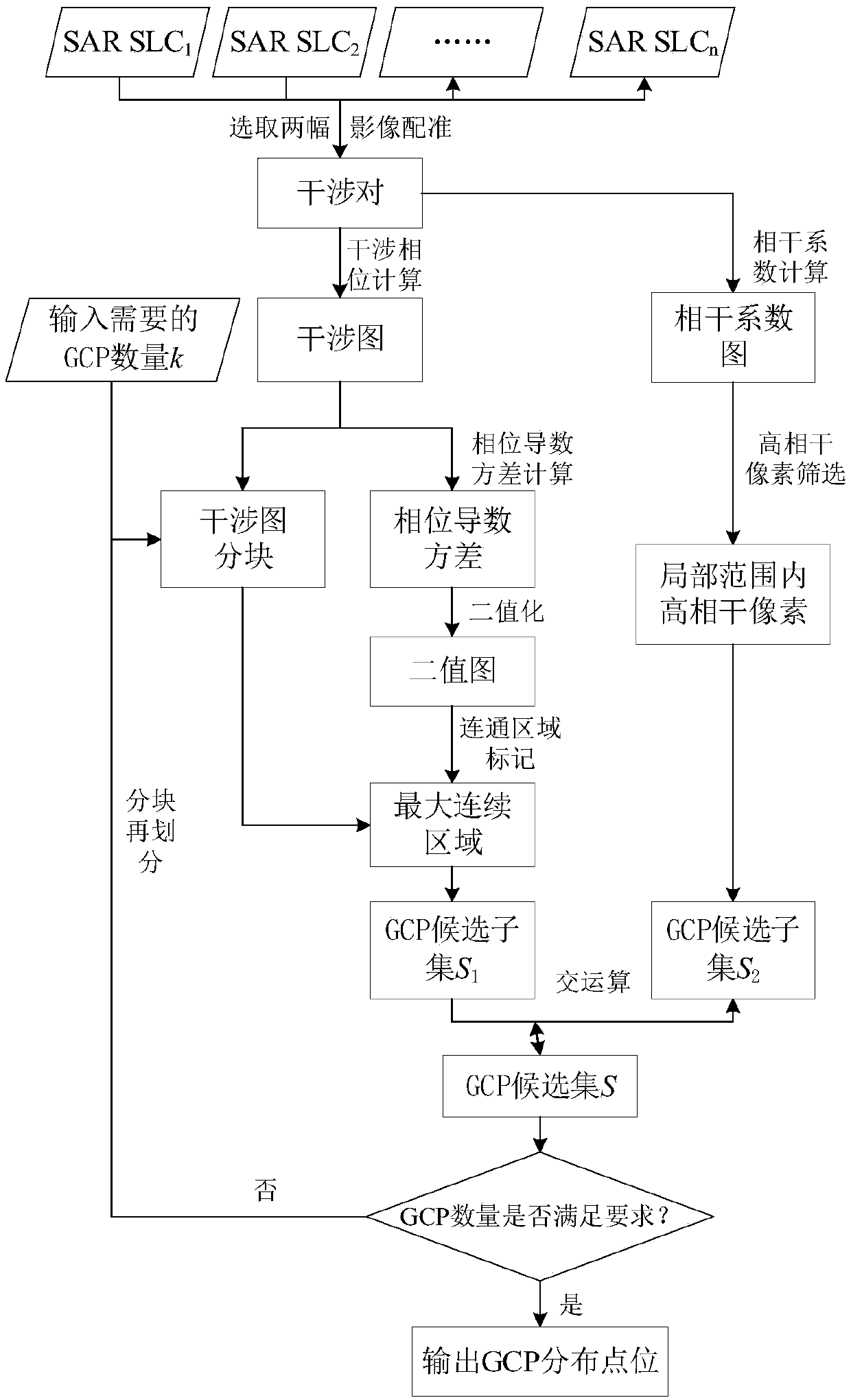
[0047] Such as figure 1 As shown, the automatic selection method of ground control points in the SAR interferometry implemented in this implementation, the process is as follows:
[0048] Step 1, image preprocessing and calculation of interferometric phase and coherence coefficient
[0049] From the multi-time series COSMO SkyMed SAR SLC (or other satellite SAR SLC images) image sequence that repeatedly covers the same area, ...
PUM
 Abstract
Description
Claims
Application Information
 - R&D
- Intellectual Property
- Life Sciences
- Materials
- Tech Scout
- Unparalleled Data Quality
- Higher Quality Content
- 60% Fewer Hallucinations
Browse by: Latest US Patents, China's latest patents, Technical Efficacy Thesaurus, Application Domain, Technology Topic, Popular Technical Reports.
© 2025 PatSnap. All rights reserved.Legal|Privacy policy|Modern Slavery Act Transparency Statement|Sitemap|About US| Contact US: help@patsnap.com


