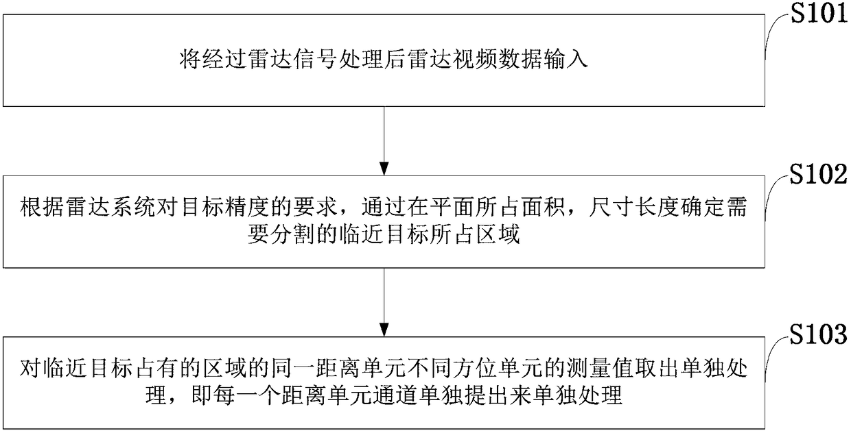
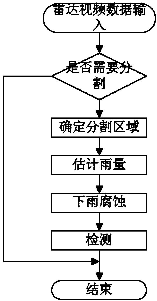
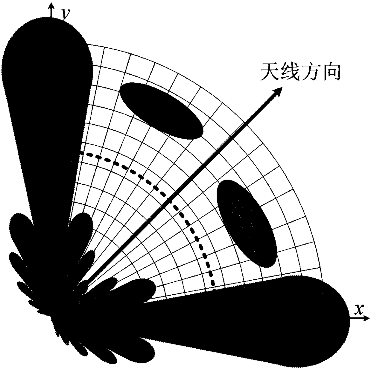
Radar adjacent target segmentation method based on rain erosion algorithm
A target segmentation and erosion algorithm technology, applied in radio wave measurement systems, instruments, etc., can solve problems such as large measurement values, difficulty in maintaining a stable single target track, and inability to segment targets, achieving good results
- Summary
- Abstract
- Description
- Claims
- Application Information
AI Technical Summary
Problems solved by technology
Method used
Image
Examples
Embodiment 1
[0038] In recent years, scholars at home and abroad have proposed various bionic algorithms by simulating the habits of biological populations or natural phenomena in nature. In order to divide the measured values of adjacent targets, the invention simulates the process of rain scouring mountains to form river valleys, and proposes a rain erosion algorithm.
[0039]Mountains and valleys are very common in nature. Some valleys are formed by the erosion of rivers between mountain peaks. And these small rivers are usually fed by raindrops that fall on these mountain peaks. The raindrops fall randomly on the mountain, and flow down the mountain due to the effect of gravity and the shape of the mountain. A large number of raindrops flow down the mountain and gradually converge into small streams, and the small streams continue to converge into larger rivers. The terminus of the river is usually a barrier lake or a plain beyond the mountains. After the stream washes over the m...
Embodiment 2
[0053] The radar adjacent target segmentation method based on the rain erosion algorithm is the same as that in Embodiment 1
[0054] The effect of the present invention is further described in the experiment below
[0055] actual data
[0056] Use measured data to illustrate the effect of the method of the present invention. Image 6 It is a part extracted from the measured data. The abscissa and ordinate represent the azimuth and distance axes, respectively. Image 6 with Figure 7 Medium colors from black to white indicate increasing measurements, Image 6 It is to extract the unprocessed part of the measured value, and the slightly white part is the clutter area; Figure 7 It is the measurement value retained after clutter processing, target detection and rain erosion algorithm; from the results, there are a total of 8 targets marked by different numbers. Among them, target 3 and target 4 are in the same distance unit as target 7 and target 8, and the azimuths are re...
PUM
 Abstract
Description
Claims
Application Information
 - R&D
- Intellectual Property
- Life Sciences
- Materials
- Tech Scout
- Unparalleled Data Quality
- Higher Quality Content
- 60% Fewer Hallucinations
Browse by: Latest US Patents, China's latest patents, Technical Efficacy Thesaurus, Application Domain, Technology Topic, Popular Technical Reports.
© 2025 PatSnap. All rights reserved.Legal|Privacy policy|Modern Slavery Act Transparency Statement|Sitemap|About US| Contact US: help@patsnap.com


