Street center line extraction method

An extraction method and centerline technology, which is applied in the field of road centerline extraction, can solve the problems of uneven centerline and low calculation efficiency

Active Publication Date: 2018-11-16
SOUTHEAST UNIV
View PDF5 Cites 33 Cited by
  • Summary
  • Abstract
  • Description
  • Claims
  • Application Information

AI Technical Summary

Problems solved by technology

Among them, the vector data extraction methods based on the road surface include the vertical line family method, the grid shape transformation method, the method based on the Delaunay triangulation network, etc., and the above methods have the disadvantages of low operation efficiency and uneven centerline.

Method used


Image

  • Street center line extraction method
  • Street center line extraction method
  • Street center line extraction method

Examples


Embodiment Construction

[0072] Below in conjunction with accompanying drawing and specific embodiment the present invention is described in further detail:

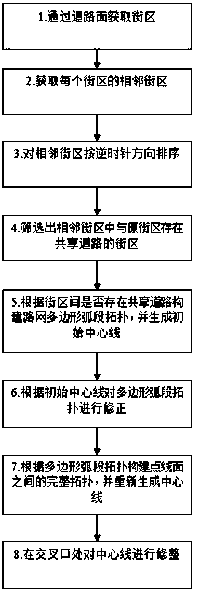
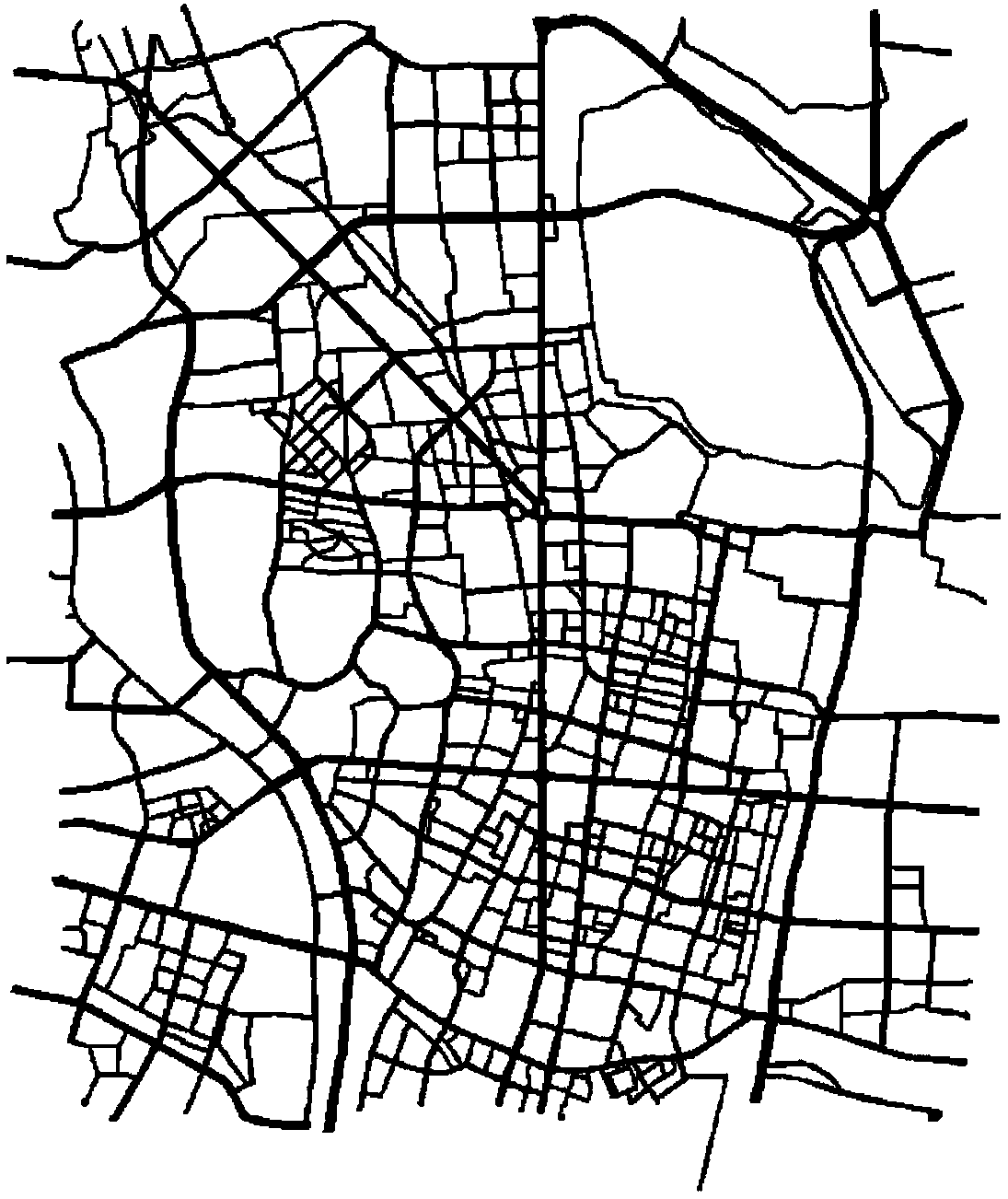
[0073] The invention discloses a method for extracting the center line of a road, which establishes the spatial topological relationship of point, line, and plane objects in the geometric network of the road by constructing blocks surrounded by road surfaces, and provides start and stop reference conditions for extracting the center line of road sections. The invention can automatically generate the topological relationship of the road network, has high computing efficiency, and the result of the road center line has the characteristics of accurate position and smooth shape.

[0074] The embodiment of the present invention is based on ArcMap software and ArcGIS Engine secondary development environment, with shapefile format road surface vector data as a sample, a method for extracting the road centerline in shapefile format is provided, comprisin...


PUM


Abstract

The invention discloses a street center line extraction method. A spatial topological relation of point, line and plane objects in a geometric network of a street is built by building a street block surrounded by street planes, so as to provide start and stop reference conditions for the extraction of a street center line. The method comprises the following steps: acquiring the street block according to the street planes; acquiring adjacent street blocks of each street block; sequencing the adjacent street blocks according to an anticlockwise direction; screening out a street block having a shared street with the original street block from the adjacent street blocks; building a polygonal segmental arc topology of a road network according to whether the shared street exists between the street blocks or not, and generating an initial center line; correcting the polygonal segmental arc topology according to the initial center line; building a complete topology among points, lines and planes according to the corrected polygonal segmental arc topology, and regenerating a center line; and finishing the center line at an intersection. The street center line extraction method solves the problem in extraction of the street center line from vector data of the street planes and can acquire a topological relation of the road network; and a center line extraction result has the advantages of precise position and smooth shape.

Description

technical field [0001] The invention relates to the field of geographic information systems, in particular to the technical field of geographic information data processing, and in particular to a road centerline extraction method. Background technique [0002] The road centerline plays an important role in geographic information systems, and its related functions include: First, express the geometric shape and spatial position of the road through the road centerline vector data, which is the basis for the synthesis of traditional road network maps and the basis for small-scale road visualization The second is to obtain the road network topology through the connection relationship of the road centerline, so as to provide the basis for traffic network analysis such as path planning; the third is to establish a relationship between the relevant elements along the road and the road centerline through the linear reference method, so as to provide a basis for traffic facilities. ,...

Claims


Application Information

Patent Timeline
Patent Type & Authority Applications(China)
IPC IPC(8): G06T7/60
CPCG06T7/60
Inventor 蔡先华胡卓良
Owner SOUTHEAST UNIV
Why Eureka
Try Eureka