Disaster-causing precipitation threshold value division method and system for precipitation type landslide hazard of power grid channel
A precipitation-type and channel-based technology, which is applied in excavation, infrastructure testing, construction, etc., can solve the problems of lack of precipitation threshold for precipitation-type landslide disasters, and achieve the effects of improving prediction and early warning capabilities, clear thinking, and strong practicability
- Summary
- Abstract
- Description
- Claims
- Application Information
AI Technical Summary
Problems solved by technology
Method used
Image

Examples
Embodiment 1
[0054] The method for dividing the disaster-causing precipitation threshold value of the grid channel precipitation type landslide disaster of the present embodiment includes the following steps:
[0055] S1: Obtain geological condition evaluation data, topographical data, historical daily precipitation data of meteorological stations in the past 20 years and historical data of geological disasters in power grid channels obtained from the census of land and resources departments. The historical data of geological disasters in power grid channels include: line operation and maintenance units in the past 10 years The reported information on the geological disasters secondary to rainstorms near the transmission line can be used to obtain the specific location of the geological disasters near the line through the coordinates of the tower.
[0056] S2: Query the census data of the land department. The census data of geological conditions released by the Ministry of Land and Resourc...
Embodiment 2
[0082] This embodiment is an application example of Embodiment 1 applied to the western region of the Sichuan Basin in July 2018. A method for dividing the disaster-causing precipitation threshold of a power grid channel precipitation-type landslide disaster in this embodiment includes the following steps:
[0083] S1: Data collection.
[0084] Collect the geological condition evaluation data obtained from the census of the land department; collect the DEM data of the GIS terrain digital elevation model, the data resolution is 100m*100m; collect the daily precipitation data of the local meteorological stations in the past 20 years; collect the historical data of geological disasters in the power grid channel.
[0085] S2: Classification of geological conditions for power grid channels.
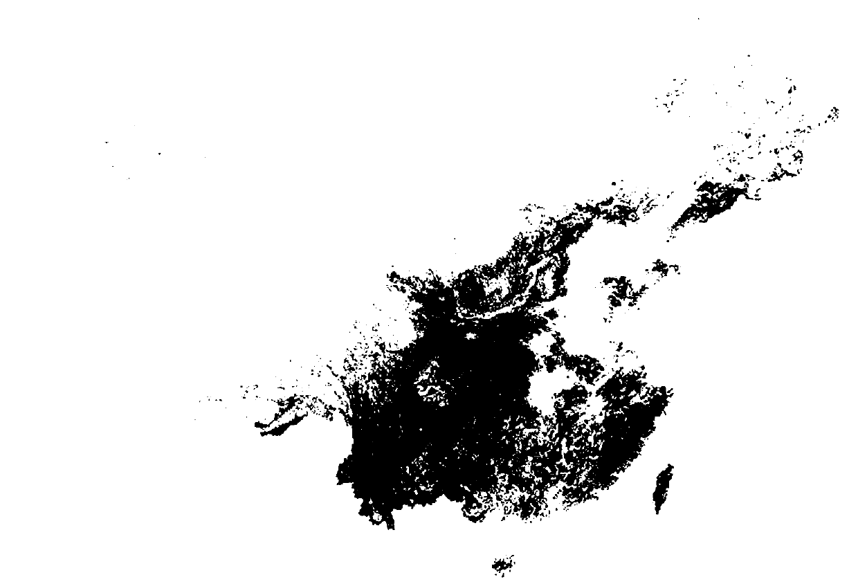
[0086] figure 2 It is the national geological condition hazard assessment grade publicly released by the Ministry of Land and Resources. This map can be obtained publicly from the relevant ...
Embodiment 3
[0099] This embodiment provides a computer system, including a memory, a processor, and a computer program stored in the memory and operable on the processor. When the processor executes the computer program, the steps in any of the foregoing embodiments are implemented.
[0100] In summary, the present invention aims at the linear distribution characteristics of power transmission channels, analyzes the precipitation characteristics of power grid channels under different environmental conditions, and delimits scientific disaster-causing precipitation thresholds. The prediction and early warning ability of landslide disaster.
PUM
 Abstract
Description
Claims
Application Information