

Regional network plane adjustment method for spaceborne synthetic aperture radar image
A synthetic aperture radar and area network technology, applied in photogrammetry/video measurement, radio wave reflection/re-radiation, instruments, etc., can solve problems that are difficult to meet generalized unified processing procedures and restrict large-scale practical applications, etc. question
- Summary
- Abstract
- Description
- Claims
- Application Information
AI Technical Summary
Problems solved by technology
Method used
Image


Examples
Embodiment Construction
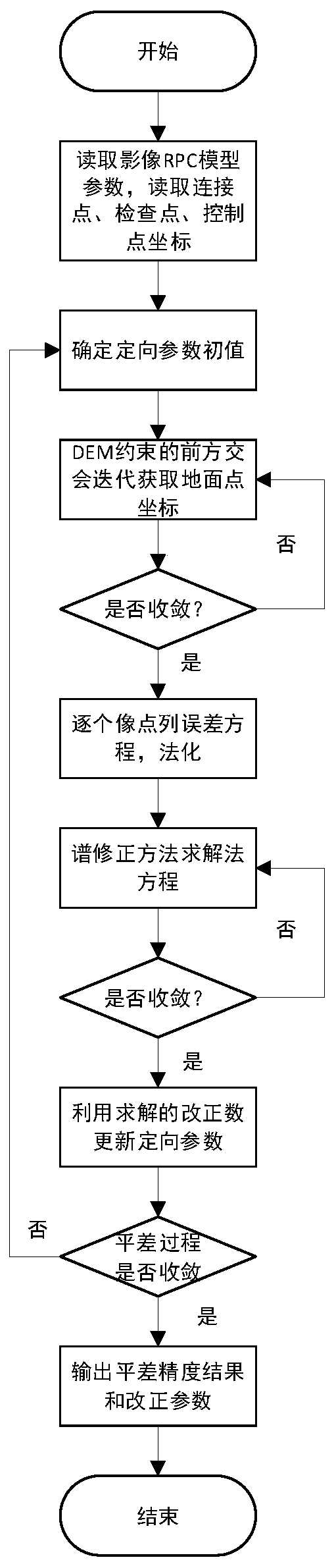
[0092] The technical solutions of the present invention will be further described below in conjunction with the accompanying drawings and embodiments.
[0093] like figure 1 As shown, the present invention provides a method for block plane adjustment of spaceborne synthetic aperture radar images, comprising the following steps:
[0094] Step 1. Read the SAR image, use matching technology or manual collection to select the same-named point in the overlapping area of adjacent spaceborne SAR images as the connection point between the images, and at the same time, puncture the control points and The image square coordinates of the checkpoints, among them, the principle of control point layout should be distributed in the four corners of the survey area as much as possible; organize the RPC parameter file format in line with international standards; at the same time organize the coordinate information of connection points, control points and checkpoints and save them as correspon...
PUM
 Abstract
Description
Claims
Application Information