Supercharge Your Innovation With Domain-Expert AI Agents!

Vehicle localisation using the ground surface with an event camera

一种事件、地表的技术,应用在利用再辐射、卫星无线电信标定位系统、地面导航等方向,能够解决高功率使用易碎高速相机等问题

Pending Publication Date: 2019-05-03
MACHINES WITH VISION LTD
View PDF15 Cites 9 Cited by
  • Summary
  • Abstract
  • Description
  • Claims
  • Application Information

AI Technical Summary

Problems solved by technology

However, this requires high power usage, fragile parts and high-speed cameras

Method used


Image

  • Vehicle localisation using the ground surface with an event camera
  • Vehicle localisation using the ground surface with an event camera
  • Vehicle localisation using the ground surface with an event camera

Examples


Embodiment Construction

[0084] The inventors have devised a way of determining the position of a vehicle that is not only less expensive (in mass production), more compact, more discreet and more efficient than conventional solutions. It also determines position with millimeter accuracy and works at actual vehicle speeds. Other advantages include robustness to environmental factors, simpler acquisition of mapping data, fewer maps required, and lower power and processing requirements.

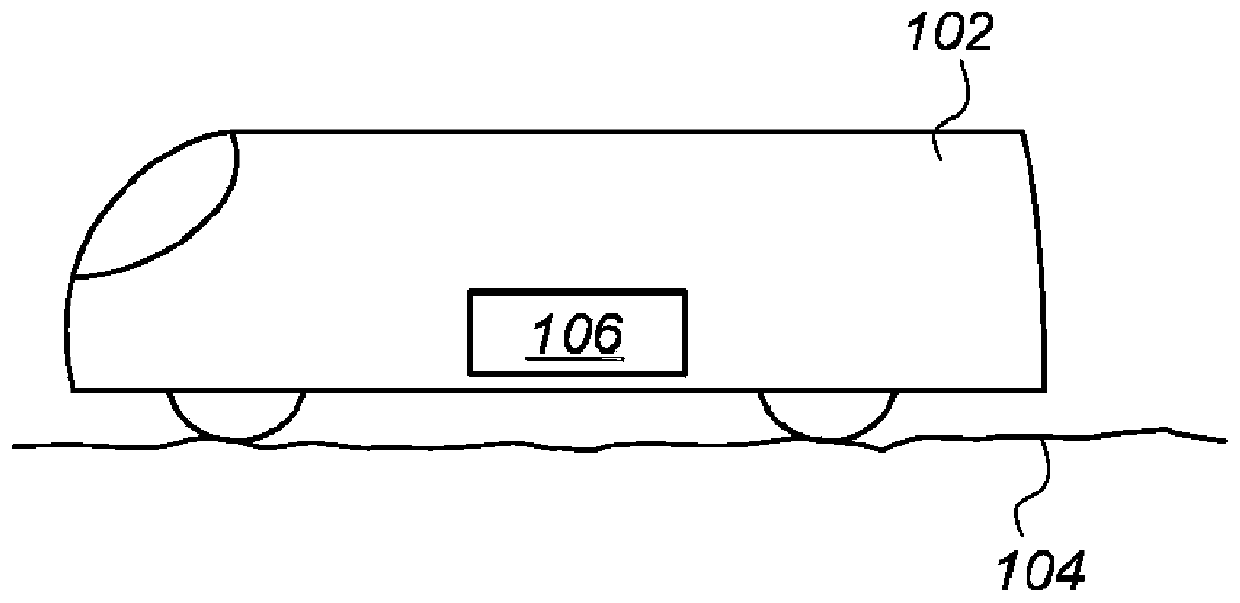
[0085] In the following embodiments, the example surface is a road surface. In the case of autonomous vehicles, road surfaces are particularly important surfaces because road surfaces often form networks that enable autonomous vehicles to travel over large geographical areas.

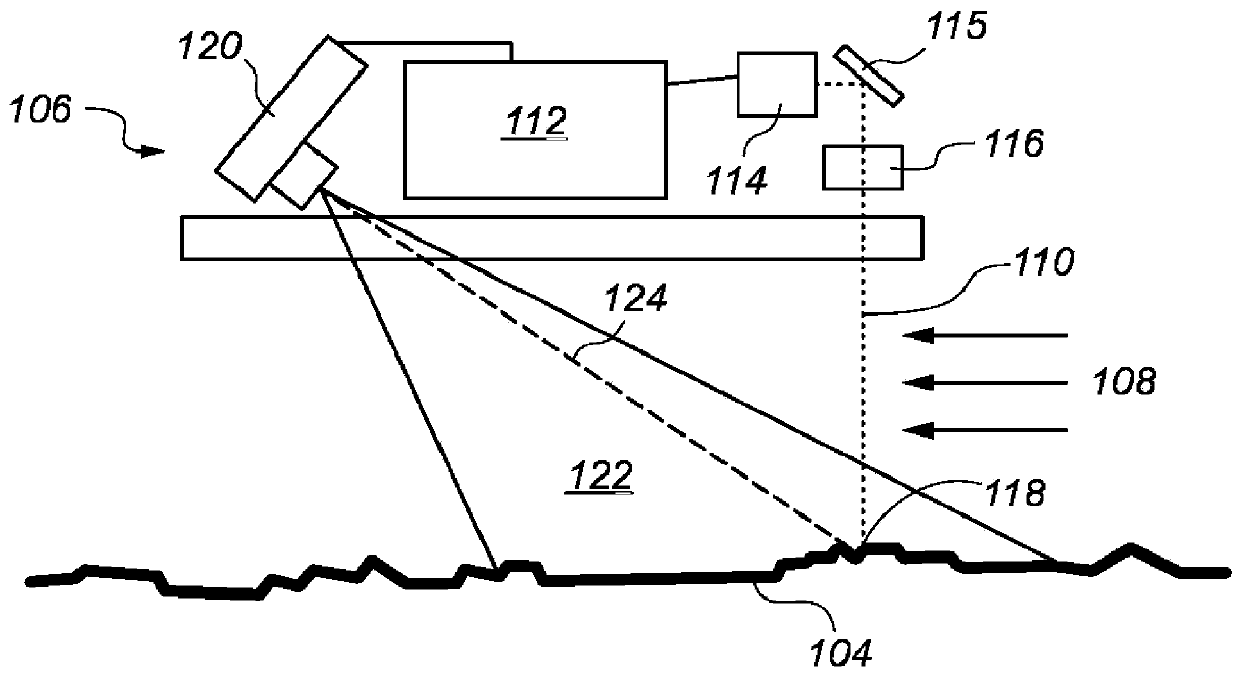
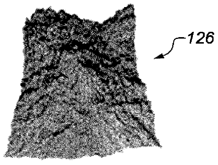
[0086] In one embodiment, the patch of road surface beneath the vehicle is observed for markers to uniquely determine the vehicle's position. A laser scanner with a laser structured light source can be used which can capture range measurements...


PUM


Abstract

A method for estimating a location of a vehicle such as a car or train includes: Obtaining (402) change events from an event camera's observations of a ground surface moving relative to the vehicle, the change events arising from the ground surface moving relative to the vehicle; determining (403) a signature of the ground surface from the change events; and estimating the location using the signature (406-412). The change events may be processed to produce an 1st invariant representation of a ground surface patch (403) for use as the signature. Alternatively, range measurements representing apatch may be used as the signature. A map is constructed (404) comprising the representations of the ground surface patches including the locations of the patches. The same patch of ground surface issubsequently measured (406) thereby obtaining a sequence of change events which are processed (407) to produce a 2nd representation. The 2nd representation is matched (410) to the map of 1st invariant representations. The location of the vehicle on the ground is determined (412) based on the match.

Description

technical field [0001] The present invention relates to methods and systems for estimating vehicle position. Background technique [0002] A highly autonomous vehicle needs to determine its position relative to the road. Global navigation satellite systems such as GPS (Global Positioning System) and GLONASS (Global Navigation Satellite System) have a resolution of the order of meters, which is not accurate enough. Various augmentation schemes exist, such as RTK (Real Time Kinematic) and Differential GPS, but these require additional infrastructure based on the ground. [0003] Accurate positions of non-autonomous vehicles are also sometimes required. In the railway industry, for example, measuring trains are used to check the geometry of the track and detect faults to ensure safe and reliable operations. These trains need to report the location of these problems with high accuracy. [0004] Even though GNSS improves autonomous and non-autonomous vehicles, there may often...

Claims


Application Information

Patent Timeline
Patent Type & Authority Applications(China)
IPC IPC(8): G01B11/25G01C21/00G01S19/48
CPCG01B11/25G01B11/2522G01C21/04G06T2207/10016G06T2207/10028G06T2207/30244G06T2207/30252G06T7/74G01S17/89G01S19/485
Inventor 安东尼·艾希布鲁克
Owner MACHINES WITH VISION LTD
Features
  • R&D
  • Intellectual Property
  • Life Sciences
  • Materials
  • Tech Scout
  • Unparalleled Data Quality
  • Higher Quality Content
  • 60% Fewer Hallucinations
Learn More