Geological compass with positioning and length measuring function
A functional and geological technology, applied in the direction of compass, satellite radio beacon positioning system, measuring device, etc., to reduce equipment cost, reduce load, and solve the effect of wear and tear
- Summary
- Abstract
- Description
- Claims
- Application Information
AI Technical Summary
Problems solved by technology
Method used
Image
Examples
Embodiment Construction
[0029] In order to make the object, technical solution and advantages of the present invention more clear, the present invention will be further described in detail below in conjunction with the examples. It should be understood that the specific embodiments described here are only used to explain the present invention, not to limit the present invention.
[0030] The application principle of the present invention will be described in detail below in conjunction with the accompanying drawings.
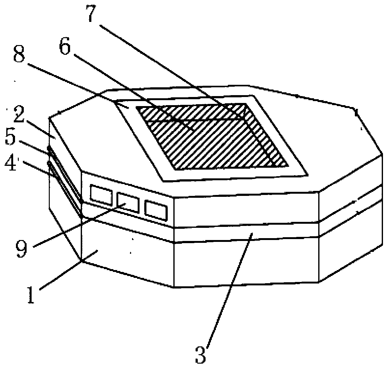
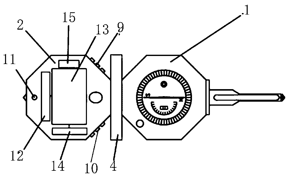
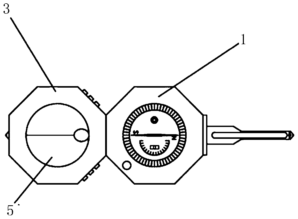
[0031] Such as figure 1 As shown, the geological compass with positioning and length measurement functions provided by the embodiment of the present invention includes: a chassis 1, a first upper cover 2, a second upper cover 3, a rotating shaft 4, a mirror 5, a display screen 6, a groove 7, Protective layer 8 , GPS positioning control button 9 , laser ranging control button 10 , laser emission hole 11 , laser range finder 12 , lithium ion battery 13 , GPS locator 14 , memory 15 .
...
PUM
 Abstract
Description
Claims
Application Information
 - R&D
- Intellectual Property
- Life Sciences
- Materials
- Tech Scout
- Unparalleled Data Quality
- Higher Quality Content
- 60% Fewer Hallucinations
Browse by: Latest US Patents, China's latest patents, Technical Efficacy Thesaurus, Application Domain, Technology Topic, Popular Technical Reports.
© 2025 PatSnap. All rights reserved.Legal|Privacy policy|Modern Slavery Act Transparency Statement|Sitemap|About US| Contact US: help@patsnap.com


