Information acquisition method for agricultural insurance land parcel
An information collection and plot technology, applied in the field of agricultural insurance, can solve the problems of large workload of information collection and high professional requirements for salesmen, and achieve the effect of easy data management, easy archiving and preservation, and high efficiency
- Summary
- Abstract
- Description
- Claims
- Application Information
AI Technical Summary
Problems solved by technology
Method used
Image
Examples
Embodiment Construction
[0038] In order to make the purpose, technical solution and advantages of the present invention more clear, the present invention will be further described in detail below with reference to the accompanying drawings and examples.
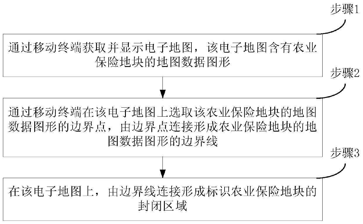
[0039] Such as figure 1 As shown, the information collection method of the agricultural insurance plot in the embodiment of the present invention mainly includes:
[0040] Step 1. Acquiring and displaying an electronic map through a mobile terminal, which contains map data graphics of agricultural insurance plots;
[0041] Step 2, select the boundary points of the map data graphics of the agricultural insurance plots on the electronic map by the mobile terminal, and connect the boundary points to form the boundary lines of the map data graphics of the agricultural insurance plots;
[0042] Step 3. On the electronic map, the closed areas marked by the agricultural insurance plots are formed by connecting the border lines.
[0043] It should be note...
PUM
 Abstract
Description
Claims
Application Information
 - R&D
- Intellectual Property
- Life Sciences
- Materials
- Tech Scout
- Unparalleled Data Quality
- Higher Quality Content
- 60% Fewer Hallucinations
Browse by: Latest US Patents, China's latest patents, Technical Efficacy Thesaurus, Application Domain, Technology Topic, Popular Technical Reports.
© 2025 PatSnap. All rights reserved.Legal|Privacy policy|Modern Slavery Act Transparency Statement|Sitemap|About US| Contact US: help@patsnap.com


