Regional feature extraction, database establishment and intersection identification method based on GPS track

A technology of regional feature and extraction method, which is applied in the field of regional feature extraction based on GPS trajectory, database establishment and intersection recognition, can solve the problems of slow GPS trajectory feature extraction, slow geographical area recognition speed, and poor versatility of intersection recognition, etc., to achieve Reduce the number and calculation dimensions, good versatility, and reduce the effect of data volume

Active Publication Date: 2019-05-28
NORTHWEST UNIV
View PDF4 Cites 13 Cited by
  • Summary
  • Abstract
  • Description
  • Claims
  • Application Information

AI Technical Summary

Problems solved by technology

[0005] Aiming at the defects and deficiencies in the prior art, the purpose of the present invention is to provide a geographical area feature extraction method based on GPS track, which solves the problems of slow and inefficient extraction of GPS track features in the prior ar

Method used


Image

  • Regional feature extraction, database establishment and intersection identification method based on GPS track
  • Regional feature extraction, database establishment and intersection identification method based on GPS track
  • Regional feature extraction, database establishment and intersection identification method based on GPS track

Examples


Embodiment 1

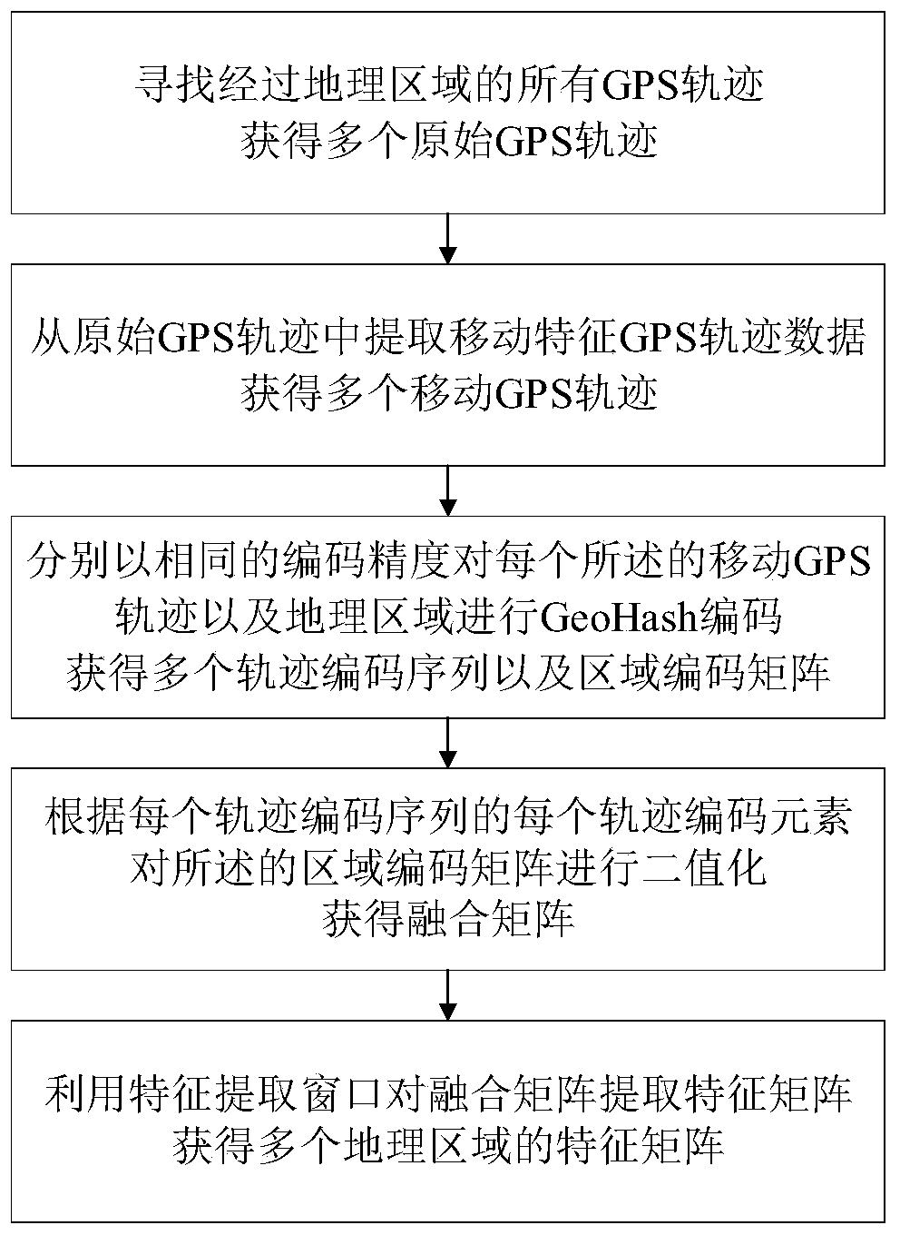
[0047] Such asfigure 1 As shown, in this embodiment, an area feature extraction method based on a GPS track is provided, which is used to extract features of a geographical area that the GPS track passes through, and the geographical area is a rectangular geographical area.

[0048] In this embodiment, when extracting features of a geographic region, the known information includes the latitude and longitude coordinates of the geographic region, such as figure 2 As shown in , the road features in a rectangular geographical area in Haidian District, Beijing are extracted, and the features include intersection features and non-intersection features. Therefore, in this embodiment, when extracting the features of intersections and non-intersections in the geographical area, it is equivalent to obtaining a black box.

[0049] The described method is carried out according to the following steps:

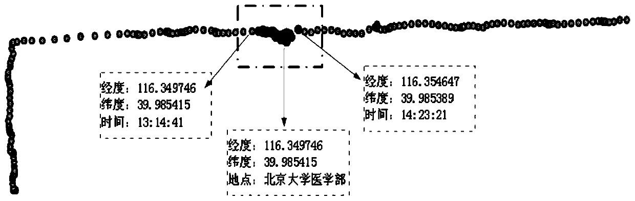
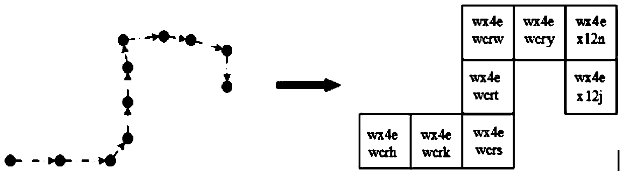
[0050] Step 1, searching for all GPS tracks passing through the geographical area, an...

Embodiment 2

[0085] A method for establishing an area feature database based on GPS tracks, the area feature database includes a plurality of standard feature matrices, and the categories of the standard feature matrix include intersections and non-intersections.

[0086] Since the shapes of urban intersections are diverse, the diversity of intersection shapes should be fully considered in the process of intersection identification. Therefore, in this embodiment, the categories of the standard feature matrix can be further subdivided. For example, the geographical area of ​​intersection includes geographical areas of intersections such as crossroads and T-junctions, and the geographical area of ​​non-intersections includes geographical areas other than geographical areas of intersections such as road geographical areas and building geographical areas.

[0087] The described method is carried out according to the following steps:

[0088] Step A, adopting the regional feature extraction met...

Embodiment 3

[0103] A method for identifying intersections based on GPS tracks, said method comprising:

[0104] Using the regional feature extraction method based on the GPS track in embodiment one to extract the feature matrix for the geographical area to be identified, obtain the feature matrix of a plurality of geographical areas to be identified;

[0105] In this example, obtain as Figure 11 The feature matrix of the geographic region to be recognized in the form of an image shown has a size of 15*15 elements.

[0106] Calculate the Euclidean distance between the feature matrix of each geographical area to be identified and all standard feature matrices in the regional feature database in embodiment two, wherein the feature matrix of the geographical area to be identified is the same size as the standard feature matrix;

[0107] In this embodiment, the idea of ​​the KNN clustering algorithm is used to calculate the Euclidean distance between the feature matrix and the standard featu...


PUM


Abstract

The invention discloses an area feature extraction, database establishment and intersection recognition method based on a GPS track, and the method comprises the steps: dividing an original track intoa'moving section 'and a'staying section' at an extreme track data preprocessing end, and reserving a'moving section 'track with obvious road geometric features for identifying an intersection; carrying out GeoHash coding on latitude and longitude coordinates of a moving segment track, and converting the latitude and longitude coordinates into a coding track sequence; meanwhile, coding and partitioning the track activity area according to the same GeoHash coding precision to obtain an area coding matrix; Constructing a binarized fusion matrix by using the coding track sequence and the region coding matrix, and then extracting a feature matrix set of the intersections and the non-intersections; Adopting a KNN algorithm with a sliding window to identify the intersection, and determining theposition of the intersection; According to the method provided by the invention, the number of to-be-processed track points and the calculation dimension are effectively reduced, and the data size isreduced, so that the algorithm is superior to a data set based on a latitude and longitude coordinate system in recognition efficiency.

Description

technical field [0001] The invention relates to the field of GPS track data processing, in particular to a GPS track-based area feature extraction, database establishment and intersection identification method. Background technique [0002] The transportation hub presented in the GPS trajectory network contains the location information of road network intersections. By analyzing the GPS trajectory data of moving objects, mining the location of road intersections is the basis and key to establish road network topology. It plays a role in many fields. Important values, such as: traffic analysis of urban intersections, construction of intelligent traffic maps, update of vehicle navigation maps, etc. [0003] When the existing technology recognizes the intersection in the geographical area, it often analyzes the images of the intersection and the ordinary road to identify, but there are still some cases where the map of the geographical area cannot be obtained, so the geographic...

Claims


Application Information

Patent Timeline
IPC IPC(8): G06K9/62G06F16/29
Inventor 高原王东冯宏伟施元磊
Owner NORTHWEST UNIV
Why Eureka
Try Eureka