Vehicle and road coordinated ultra-wideband (UWB) based highly reliable fused vehicle positioning method

A vehicle-road coordination and fusion positioning technology, which is applied to satellite radio beacon positioning systems, instruments, and measuring devices, can solve the problems of limited ease of use of vehicle-mounted satellite navigation, low positioning accuracy and reliability, and improve accuracy Effects of Sex and Reliability

Active Publication Date: 2019-06-28
SOUTHEAST UNIV
View PDF5 Cites 21 Cited by
  • Summary
  • Abstract
  • Description
  • Claims
  • Application Information

AI Technical Summary

Problems solved by technology

[0005] Technical issues: Aiming at the limited ease of use of vehicle-mounted satellite navigation and low positioning accuracy and reliability in urban environments, Ultra-Wideband (UWB) was introduced on the basis of traditional vehicle-mounted satellite and inertial integrated navigat

Method used


Image

  • Vehicle and road coordinated ultra-wideband (UWB) based highly reliable fused vehicle positioning method
  • Vehicle and road coordinated ultra-wideband (UWB) based highly reliable fused vehicle positioning method
  • Vehicle and road coordinated ultra-wideband (UWB) based highly reliable fused vehicle positioning method

Examples


Embodiment Construction

[0048] The application will be further described in detail below in conjunction with the accompanying drawings and embodiments. It should be understood that the specific embodiments described here are only used to explain related inventions, not to limit the invention.

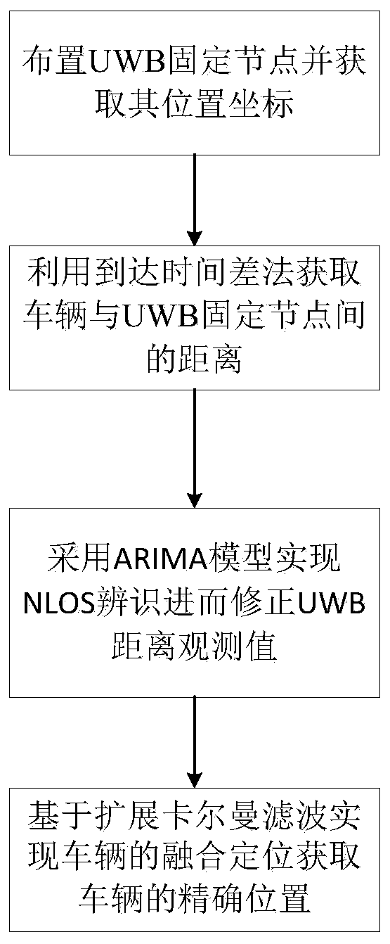
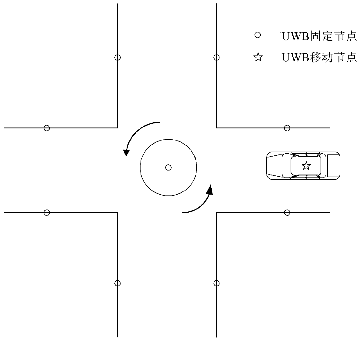
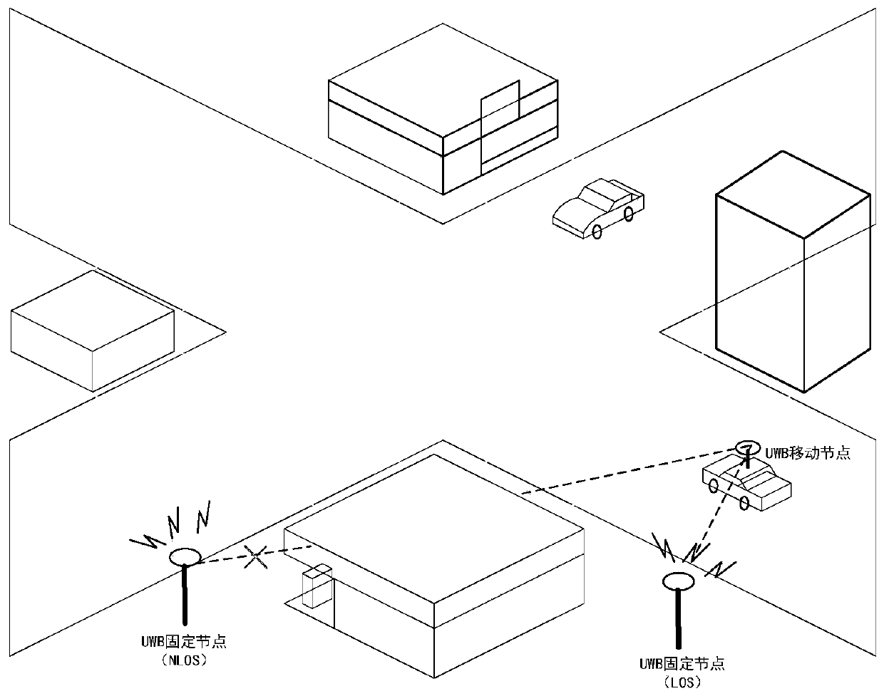
[0049] With the development and progress of the economy and society, the number of motor vehicles in my country has increased rapidly, and road traffic is facing huge challenges. In order to solve the increasingly severe urban traffic problems, Intelligent Vehicle Infrastructure Cooperative Systems (IVICS) came into being It has gradually become the latest development direction of intelligent transport systems (Intelligent Transport Systems, ITS) research. Whether it is the application of vehicle-road coordination or the realization of intelligent transportation, it is inseparable from high-precision vehicle positioning technology: only under the premise of realizing accurate and reliable vehicle positioning, t...


PUM


Abstract

The invention discloses a highly reliable fused vehicle positioning method in the vehicle and road coordinated scene, and aims at solving the problems that vehicle satellite navigation in the urban environment tends to be limited and is low in positioning accuracy and reliability. On the basis of traditional vehicle-mounted satellite and inertia combined navigation, the UWB positioning technologyis introduced, UWB nodes are laid reasonably, and an NLOS (Not Line of Sight) error processing algorithm is combined, so that an observed UWB value error is reduced. Further, fused vehicle positioningis realized on the basis of an expanded Kalman filtering algorithm. Compared with the traditional vehicle-mounted satellite and inertia combined navigation, the method is high in reliability in the urban environment especially in the complex environment that satellite signals are shielded (as in a canyon or crossing), and the vehicle can be positioned continuously, completely and reliably in realtime.

Description

technical field [0001] The invention relates to the field of vehicle navigation and positioning, in particular to a highly reliable fusion positioning method for vehicles in an urban vehicle-road collaborative environment. Background technique [0002] With the development and progress of the economy and society, the number of motor vehicles in my country has increased rapidly, and road traffic is facing huge challenges. In order to solve the increasingly severe urban traffic problems, Intelligent Vehicle Infrastructure Cooperative Systems (IVICS) came into being It has gradually become the latest development direction of intelligent transport systems (Intelligent Transport Systems, ITS) research. Whether it is the application of vehicle-road coordination or the realization of intelligent transportation, it is inseparable from high-precision vehicle positioning technology: only under the premise of realizing accurate and reliable vehicle positioning, the real-time dynamic inf...

Claims


Application Information

Patent Timeline
IPC IPC(8): G01S19/46G01S19/47G01C21/16
Inventor 李旭高怀堃韦坤
Owner SOUTHEAST UNIV
Why Eureka
Try Eureka