
A co-orbit multi-point target imaging task planning method for an agile satellite

A technology for target imaging and mission planning, used in the aerospace field

Active Publication Date: 2019-06-28
WUHAN UNIV
View PDF5 Cites 10 Cited by
  • Summary
  • Abstract
  • Description
  • Claims
  • Application Information

AI Technical Summary

Problems solved by technology

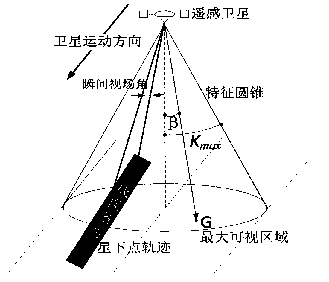
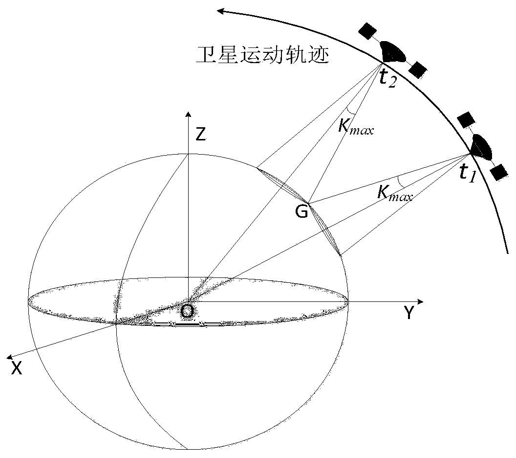
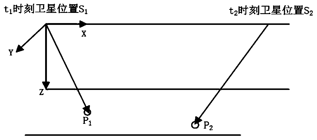
[0004] The purpose of the present invention is to solve the task planning problem of the same-orbit multi-point target imaging task based on the agile satellite, and provide a method for planning the same-orbit multi-point target imaging task of the agile satellite. The point target is regarded as an independent imaging task, and the same-orbit point target imaging task planning model is established to determine the imaging time and observation sequence of the point target by the satellite. The observation sequence is the imaging sequence; The best attitude maneuvering method for multi-point target imaging, and then obtain the optimized observation plan to meet the imaging task requirements to the greatest extent

Method used


Image

  • A co-orbit multi-point target imaging task planning method for an agile satellite
  • A co-orbit multi-point target imaging task planning method for an agile satellite
  • A co-orbit multi-point target imaging task planning method for an agile satellite

Examples


Embodiment Construction

[0064] In order to better illustrate the purpose and advantages of the present invention, the content of the invention will be further described below in conjunction with the accompanying drawings and examples.

[0065] An agile satellite-based imaging mission planning method for multi-point targets in the same orbit, such as Figure 13 As shown, including step S1-step S7:

[0066] Firstly, the problem of the same-orbit multi-point target imaging task of agile satellites is transformed into a mathematical model. That is to build a multi-point target imaging task planning model on the same track, and the method for constructing the multi-point target imaging task planning model includes:

[0067] Assume that the sun altitude angle meets the requirements of optical imaging during the mission time, and the target at any point p m can be instantaneously imaged, where m ∈ [1,n]. That is, when the main optical axis of the satellite points to a point target, the imaging of the poi...


PUM


Abstract

The invention provides a common-orbit multi-point target imaging task planning method for an agile satellite. The method comprises the steps that S1, determining n point targets needing to be imaged and imaging moments corresponding to the n point targets; S2, obtaining an imaging moment set x and a set p of n point targets corresponding to the imaging moment set x according to the sequence of theimaging moments corresponding to the n point targets; S3, sequentially taking i from 1 to n-1;selecting j from 2 to n, i is smaller than j, and determining a set a of public vertex values corresponding to a set p; S4, obtaining an attitude constraint undirected graph structure according to the public vertex value set a; Step S5, performing block orientation on the attitude constraint undirected pattern structure to obtain an attitude constraint directed pattern structure, and obtaining a plurality of groups of imaging sequences according to the attitude constraint directed pattern structure;and S6, selecting at least one group of image sequence from the plurality of groups of image sequences as an optimal imaging sequence.

Description

technical field [0001] The invention belongs to the field of aerospace, and in particular relates to a task planning method for co-orbit multi-point target imaging of an agile satellite. Background technique [0002] Driven by the high-resolution project, aerospace remote sensing technology continues to develop, and my country has made a series of breakthroughs and gratifying achievements in the field of aerospace remote sensing. Remote sensing satellites are developing in the direction of high maneuverability and high resolution, and have entered a new stage of realizing rapid and high-resolution earth observation. Due to the joint effect of the satellite's attitude maneuver and orbital motion, the execution efficiency of satellite imaging has been greatly improved. Therefore, agile satellite imaging technology will become an important direction for the development of space satellites in the future. [0003] At present, the main research objects of agile satellite imaging...

Claims


Application Information

Patent Timeline
Patent Type & Authority Applications(China)
IPC IPC(8): G06Q10/04G06Q10/06
Inventor 沈欣李仕学张过蒋永华刘钰霖
Owner WUHAN UNIV
Learn More