Two-dimensional positioning method for two base stations

A two-dimensional positioning and base station technology, applied in positioning, measuring devices, instruments, etc., can solve the problems of high complexity, high cost, and relatively high cost, and achieve the effect of low complexity, good robustness, and reduced processing performance requirements

Inactive Publication Date: 2019-07-23
赵瑞祥
View PDF0 Cites 8 Cited by
  • Summary
  • Abstract
  • Description
  • Claims
  • Application Information

AI Technical Summary

Problems solved by technology

[0004] Problems with this technology: Real-time positioning system RTLS is a new positioning system, and its relative cost is still relatively high. In the process of engineering implementation, not only the positioning accuracy and effect, but also the cost need to be considered. The traditional positioning algorithm requires at least three A positioning base station is used to realize two-dimensional positioning of an area, which is complex and costly

Method used


Image

  • Two-dimensional positioning method for two base stations
  • Two-dimensional positioning method for two base stations
  • Two-dimensional positioning method for two base stations

Examples


Embodiment 1

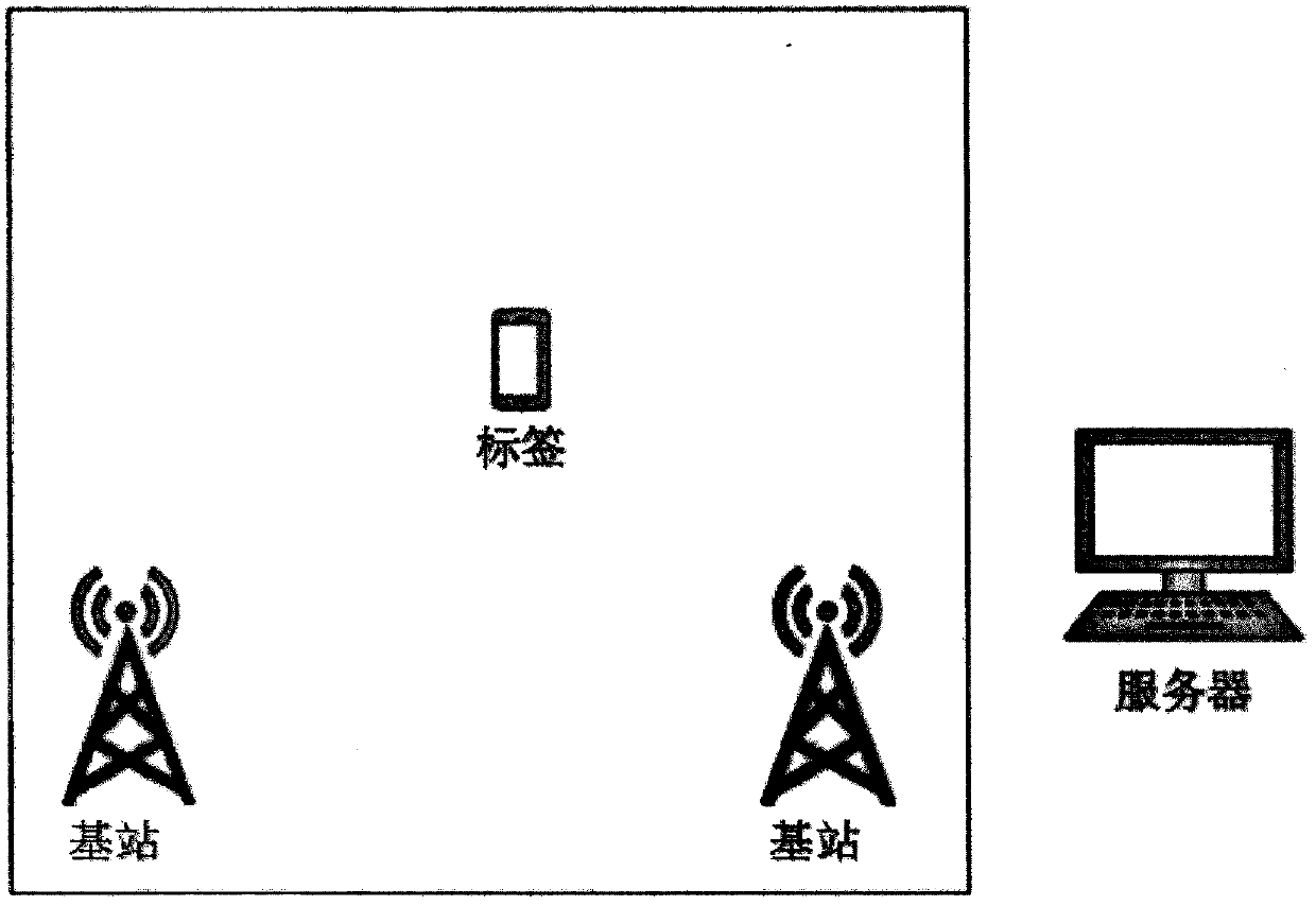
[0027] Embodiment 1: This embodiment relates to a positioning system, which mainly consists of three parts:

[0028] (1) base station

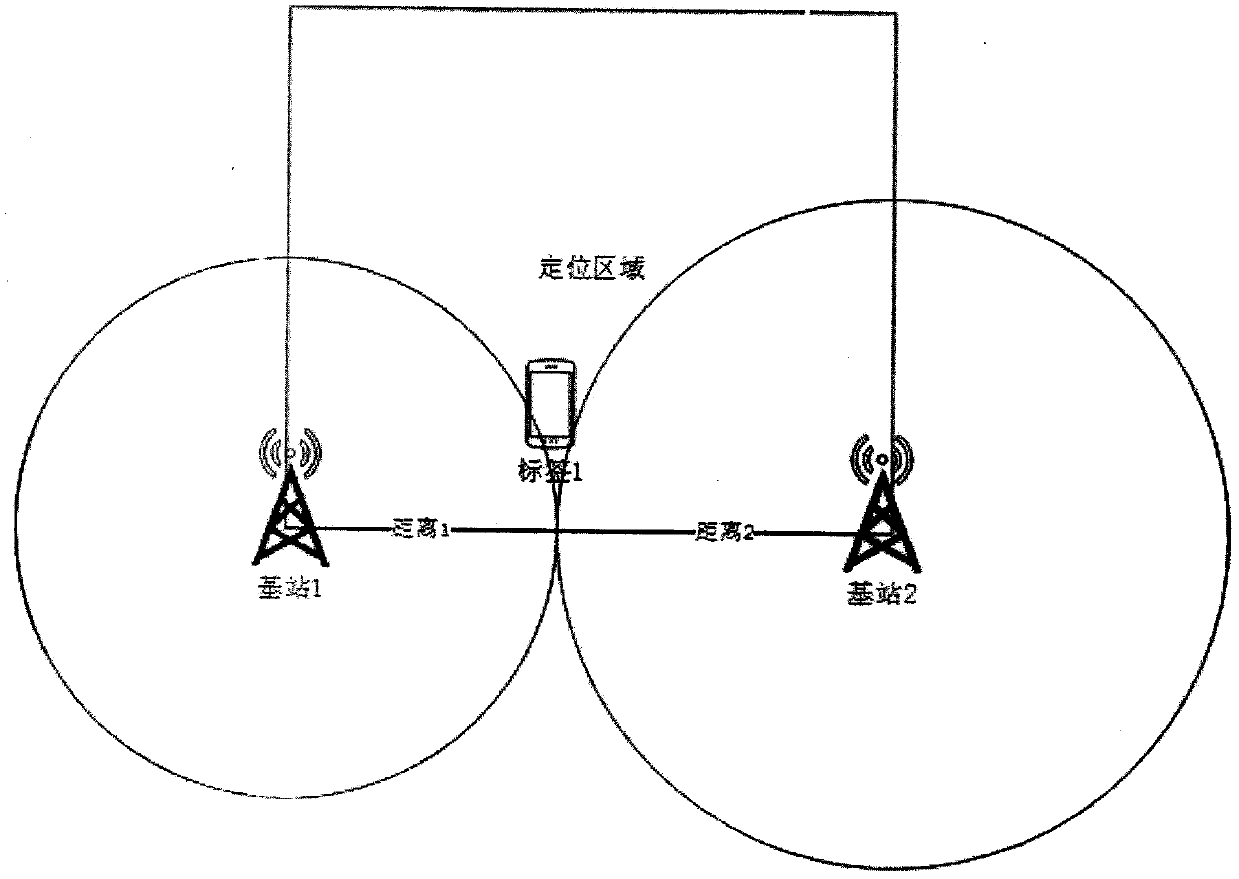
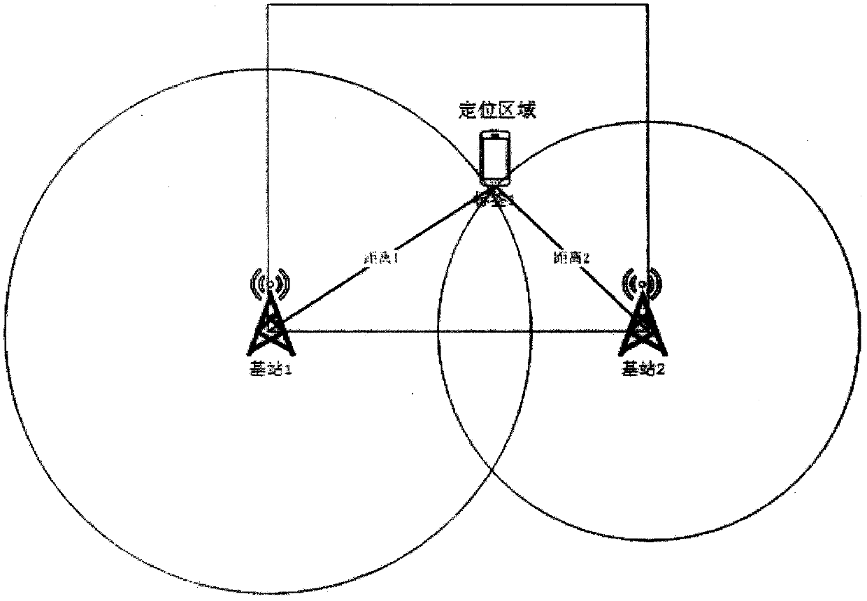
[0029] The base station and the tag communicate periodically and perform time measurement. The distance between the base station and the tag can be calculated according to the round-trip time:

[0030] D=(T r -T s -t tag )×C / 2

[0031] where D is the estimated distance between the base station and the tag, T s is the moment when the base station sends the positioning signal, T r is the moment when the base station receives the signal response from the tag, t tag is the antenna sending delay of the tag, and C is the speed of light.

[0032] (2) label

[0033] The tag has a wireless signal transmitting device, which can send positioning messages. The tag is associated with personnel, vehicles or materials, and is the object to be positioned.

[0034] (3) server

[0035] The calculation server receives the ranging data from each base st...


PUM


Abstract

The invention discloses a two-dimensional positioning method for two base stations, and relates to the technical field of real-time positioning systems. The method comprises the following steps that the deployment position of a base station is set; the tag periodically sends broadcast messages to surrounding base stations, and the base stations measure the distance between the base stations and the tag through communication with the tag; and a calculating server calculates the actual position of the tag through two-dimensional positioning algorithms of the two base stations. The two-dimensional positioning method for two base stations reduces the number of base stations required by two-dimensional positioning of the deployment area, reduces the minimum requirement of three base stations totwo base stations, reduces the deployment cost, has low complexity and simple calculation algorithm, and reduces the processing performance requirement of the calculation server; and the system is good in robustness, the algorithm is mature and stable, and the method can adapt to various different actual scenes.

Description

technical field [0001] The invention relates to the technical field of real-time positioning systems, in particular to a two-dimensional positioning method for two base stations. Background technique [0002] Real Time Location System RTLS (Real Time Location System) is a means of using the transmission delay of radio waves to locate tags. In the existing positioning methods, at least three positioning base stations are required to realize two-dimensional area positioning, and there are two implementation methods: TOF and TDOA. [0003] Among them, in the TOF method, the tag broadcasts the message, the base station receives the message, and calculates the distance between the tag and each base station according to the flight time of the electromagnetic wave between the base station and the tag. The distance is the radius to draw a circle, and multiple circles intersect to get a point, which is the actual positioning position. In the TDOA method, the tag broadcasts the mess...

Claims


Application Information

Patent Timeline
Patent Type & Authority Applications(China)
IPC IPC(8): G01S5/10H04W64/00
CPCG01S5/10H04W64/00
Inventor 赵瑞祥
Owner 赵瑞祥
Why Eureka
Try Eureka