A method for estimating storage capacity of reservoirs and dams in areas without data

A data-free and regional technology, applied in the field of estimating the storage capacity of reservoirs, ponds and dams in data-free areas, can solve the problems of increasing the difficulty of flood forecasting and dispatching, threatening the flood control safety of reservoirs and watersheds, and low accuracy of terrain data, so as to facilitate automatic generation , Promote in-depth development and reduce difficulty

Active Publication Date: 2022-03-29
HOHAI UNIV
View PDF6 Cites 0 Cited by
  • Summary
  • Abstract
  • Description
  • Claims
  • Application Information

AI Technical Summary

Problems solved by technology

At present, large-scale reservoirs can obtain water-level-discharge relationship curves and flow data during reservoir dispatching; while small and medium-sized reservoirs and ponds and dams are numerous and widely distributed, and most of them were built in the 1950s and 1960s. Limited by historical conditions, many of them are more complicated The technical problems of the dam have not been completely resolved, and no technical information has been left when the dam was built, which increases the difficulty of flood forecasting and dispatching, and may even threaten the flood control safety of the reservoir and the river basin.
[0005] In recent years, with the development of information technologies such as computers, remote sensing and geographic information systems, people can easily obtain spatial information of watersheds, but the accuracy of topographic data of large water bodies such as reservoirs is not high.

Method used


Image

  • A method for estimating storage capacity of reservoirs and dams in areas without data
  • A method for estimating storage capacity of reservoirs and dams in areas without data
  • A method for estimating storage capacity of reservoirs and dams in areas without data

Examples


Embodiment Construction

[0060] The present invention will be further described below with reference to the accompanying drawings and specific embodiments.

[0061] like figure 1 As shown in the present invention, a method for estimating the storage capacity of reservoirs, ponds and dams in areas with no data includes the following steps:

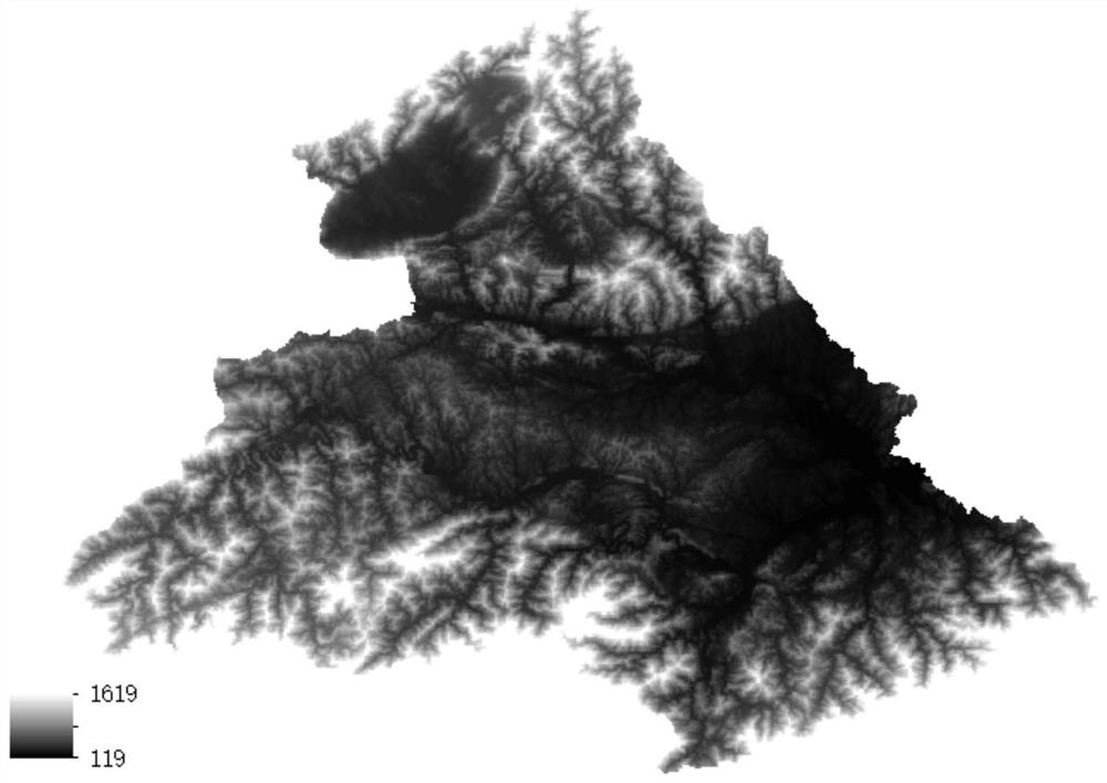
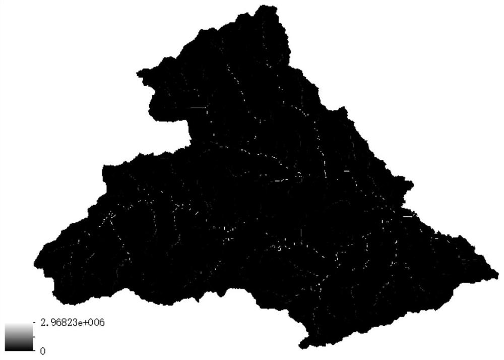
[0062] S1. Use watershed DEM data ( figure 2 ) calculates the cumulative catchment value for each grid cell above the catchment outlet point to generate a cumulative catchment grid ( image 3 ), including the following steps:

[0063] 1) Initialize the cumulative value of confluence of each grid cell in the watershed, taking the value 1;

[0064] 2) Taking the grid cell Cell as the center, calculate the ratio of the height difference and the distance between the surrounding grid and the grid cell, and find the grid cell Cell corresponding to the maximum value of the ratio D ;

[0065] 3) Make Cell a flow grid, Cell D As an inflow grid, the direction is from ...


PUM


Abstract

The invention discloses a method for estimating the storage capacity of reservoirs, ponds and dams in data-free areas, belonging to the field of hydrology technology. The cumulative value of confluence of each grid unit above the exit point is calculated by using the DEM data of the watershed; the river channel grid in the watershed is extracted; Remote sensing image data is used to identify water bodies in the basin, and rasterize the water body identification results; calculate the water body aggregation degree of the water body grid; calculate the water body reliability of the water body grid, and eliminate the water body grid whose water body reliability is lower than the reliability threshold; select several water bodies The grid is used as a sample, and the measured water depth of the sample water body grid is measured or estimated in the digital map; based on the measured water depth and water body aggregation degree of the selected sample water body grid, a relationship curve between water depth and water body aggregation degree is established, and the water body grid Estimate the corresponding calculated water depth; divide the water body, and obtain the storage volume of each hydraulic project according to the calculated water depth. The invention has high estimation efficiency, objective and reasonable results, and is beneficial to rapid estimation of reservoir, pond and dam storage volume in areas without data.

Description

technical field [0001] The invention belongs to the technical field of hydrology, and particularly relates to a method for estimating the storage capacity of reservoirs, ponds and dams in areas without data. Background technique [0002] There are many rivers in my country, with a drainage area of ​​200 to 3000 km 2 There are nearly 9,000 small and medium-sized rivers in China, and flood disasters occur frequently. Most of these small and medium-sized watersheds are located in mountainous areas. The water and soil conditions along the river basins are good, the arable land is large, and the population is dense. Once a flood occurs, it will seriously threaten people's lives and property safety. [0003] At present, the national small and medium river hydrological monitoring system construction project is fully implemented, and some new stations have been put into use. The hydrological conceptual model is the main method in flood forecasting research, and has achieved relativ...

Claims


Application Information

Patent Timeline
Patent Type & Authority Patents(China)
IPC IPC(8): G06Q10/04G06F16/29G06Q50/26G06T17/05
CPCG06Q10/04G06Q50/26G06F16/29G06T17/05
Inventor 徐杰马亚楠李致家
Owner HOHAI UNIV
Why Eureka
Try Eureka