Method and device for measuring visual pose of simulated satellite on air floating platform
A technology for simulating satellites and air-floating platforms. It is applied in measuring devices, satellite radio beacon positioning systems, and optical devices. It can solve the problems of third-party movement range restrictions, achieve low cost, simple implementation, and real-time output poses. Effect
- Summary
- Abstract
- Description
- Claims
- Application Information
AI Technical Summary
Problems solved by technology
Method used
Image
Examples
Embodiment Construction
[0029] In order to make the technical means, creative features, goals and effects achieved by the present invention easy to understand, the present invention will be further described below in conjunction with specific embodiments.
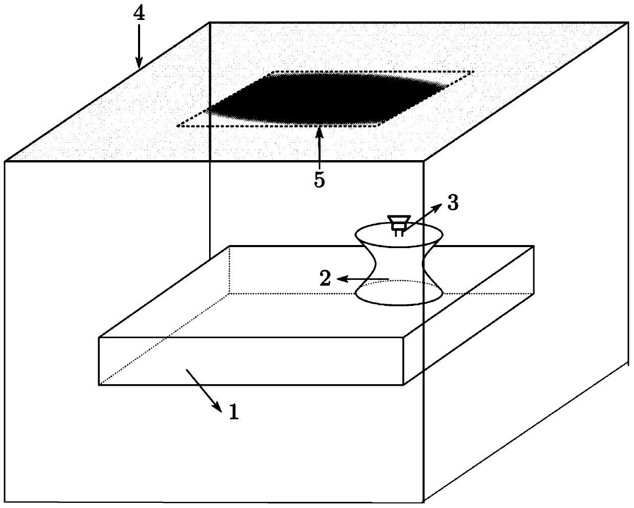
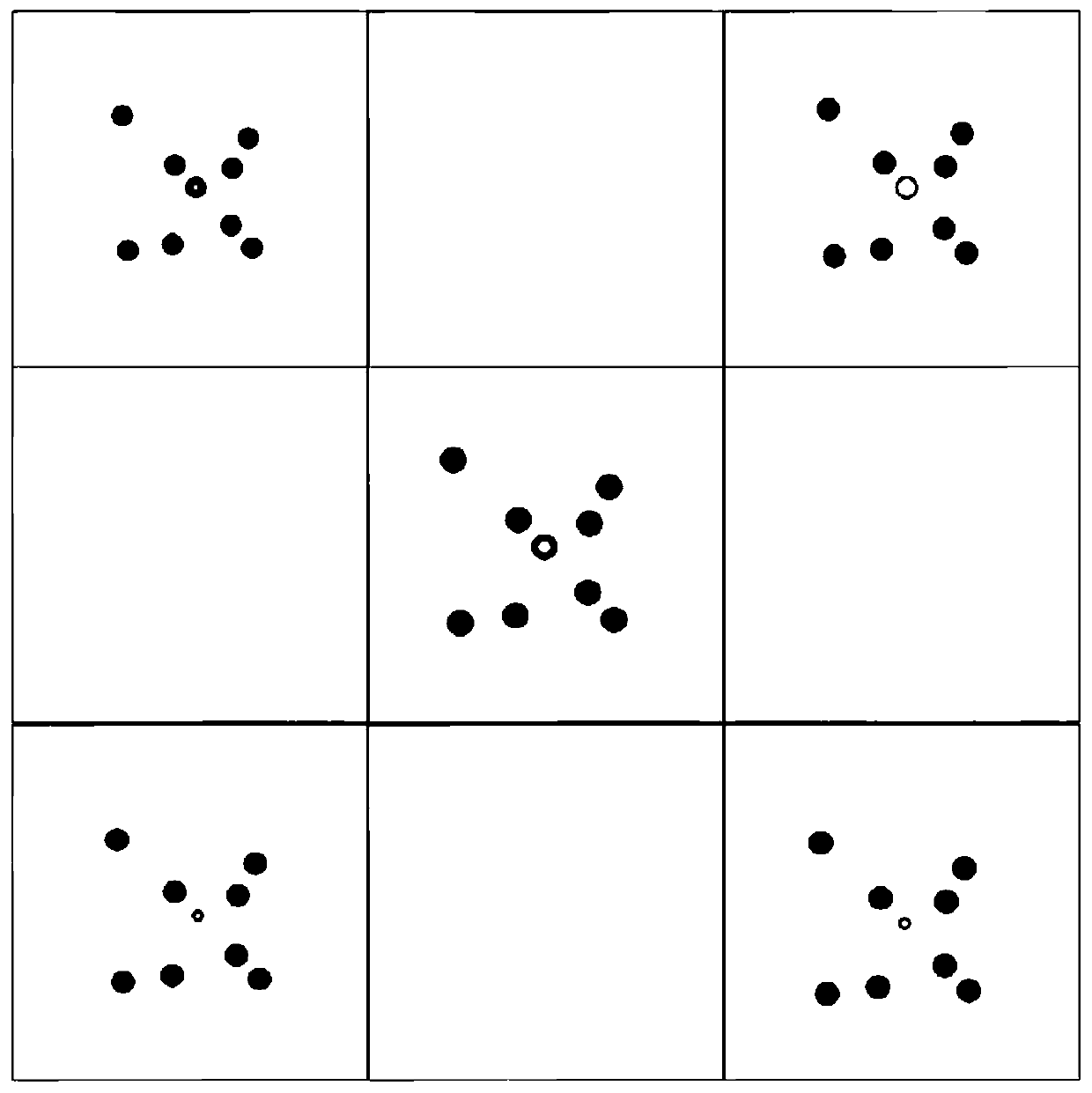
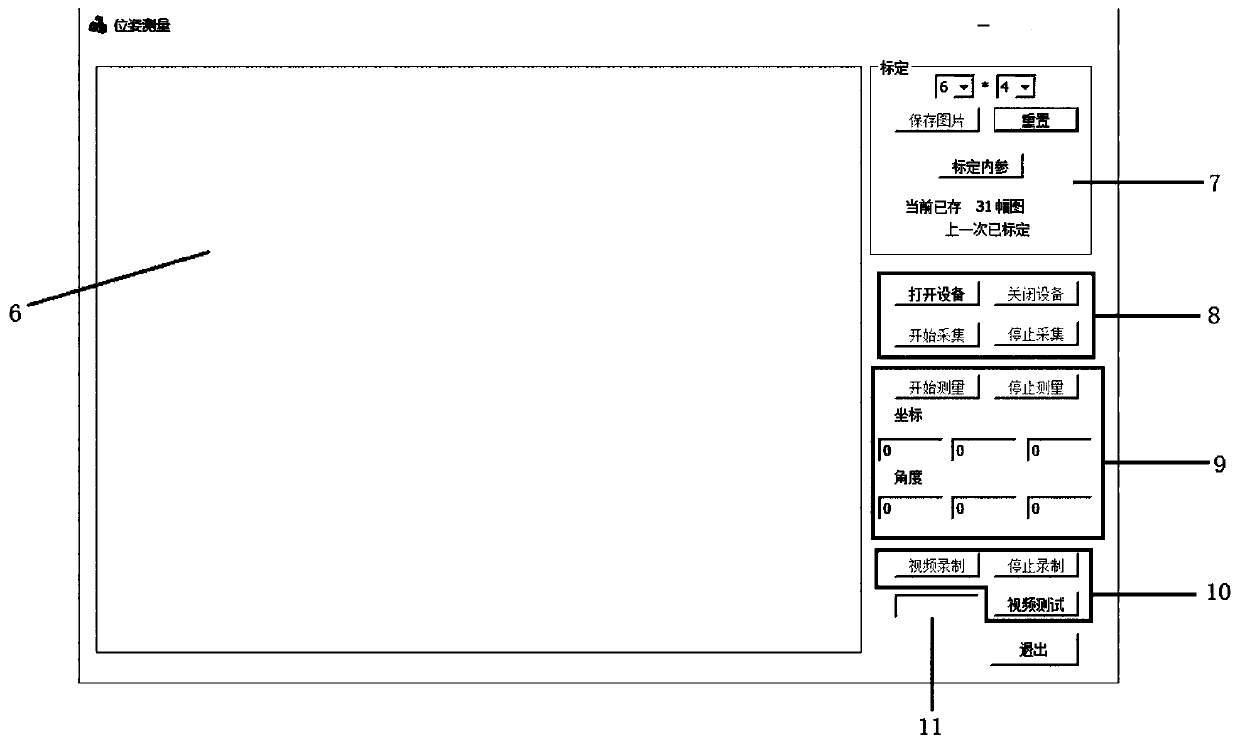
[0030] Such as Figure 1-3 As shown, a method for visual pose measurement of a simulated satellite on an air-floating platform is disclosed, and the method includes the following steps:
[0031] Arrange the cooperation target 5, establish the world coordinate system to obtain the three-dimensional coordinates of the cooperation target 5;
[0032] Obtain the current frame image in real time through the camera module 3;
[0033] Process the image to identify the cooperation target 5, match the two-dimensional pixel coordinates with the three-dimensional coordinates, and obtain matching point pairs;
[0034] According to the PNP algorithm, the pose is solved for the matching point pairs.
[0035] Specifically, the cooperative target 5 is designed ...
PUM
 Abstract
Description
Claims
Application Information
 - R&D
- Intellectual Property
- Life Sciences
- Materials
- Tech Scout
- Unparalleled Data Quality
- Higher Quality Content
- 60% Fewer Hallucinations
Browse by: Latest US Patents, China's latest patents, Technical Efficacy Thesaurus, Application Domain, Technology Topic, Popular Technical Reports.
© 2025 PatSnap. All rights reserved.Legal|Privacy policy|Modern Slavery Act Transparency Statement|Sitemap|About US| Contact US: help@patsnap.com


