

Terrain modeling method and system fusing geometric characteristics and mechanical characteristics
一种力学特性、几何特性的技术,应用在融合几何特性与力学特性的地形建模方法及系统领域,达到便于提取、保证准确度、保证准确性的效果
- Summary
- Abstract
- Description
- Claims
- Application Information
AI Technical Summary
Problems solved by technology
Method used
Image

Examples
Embodiment 1
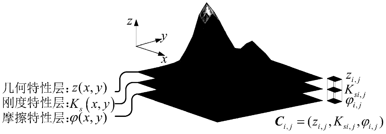
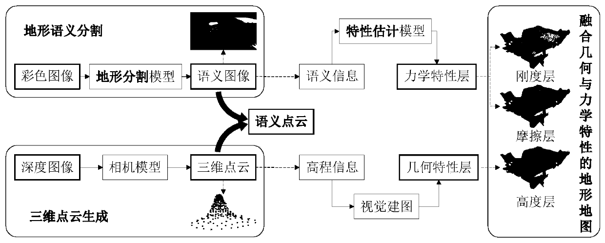
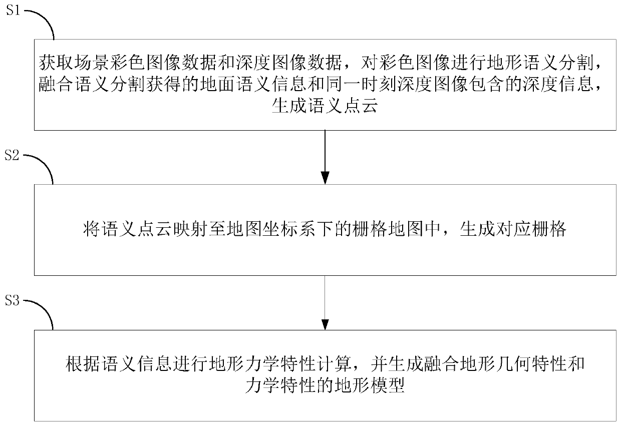
[0092] figure 1 Shown is a schematic diagram of the principle of the terrain model constructed by the embodiment of the present invention. The model is a layered structure consisting of a terrain geometric property layer and a mechanical property layer. Among them, the geometric property layer is used to express the geometric properties of the terrain surface, which is represented by the three-dimensional coordinates of the ground surface; the mechanical property layer is used to express the mechanical properties of the terrain surface, including the stiffness property layer and the friction property layer, respectively determined by the equivalent stiffness modulus of the ground K s and equivalent friction modulus To characterize the pressure-bearing characteristics of the surface matrix in the normal direction and the shear characteristics of the tangential direction. Therefore, the terrain model constructed in the embodiment of the present invention incorporates terrain ...
Embodiment 2
[0146] This embodiment is similar to Embodiment 1, the difference is that the terrain mechanics factor is determined by the k in the Bekker pressure bearing characteristic model c , n and c in the Janosi shear behavior model, K said. Among them, k c , n are expressed as cohesion modulus, friction modulus and subsidence index respectively; c, K represents cohesion, internal friction angle and shear modulus of elasticity, respectively. Then the terrain model is expressed as a finite sequence of nine terrain factors on a certain terrain area D:
[0147]
[0148] Similarly, the corresponding mechanical property layers are correspondingly increased to six layers, and the number of geometric property layers remains unchanged.
Embodiment 3
[0150] This embodiment is similar to Embodiment 1, except that a binocular camera is used to obtain a depth image. The same environment is captured by two calibrated 2D cameras to obtain image data streams. According to the image frames obtained by the two cameras at the same time, pixel stereo matching is performed on the content, and the depth calculation of the surrounding environment is performed to obtain depth image.
PUM
 Abstract
Description
Claims
Application Information