A Method of Urban Impervious Layer Extraction Based on Landsat Remote Sensing Image
A remote sensing image and extraction method technology, applied in the field of remote sensing mapping, can solve the problems of high applicability and reliability, and achieve the effects of improving efficiency, enhancing identification, and meeting timeliness requirements
- Summary
- Abstract
- Description
- Claims
- Application Information
AI Technical Summary
Problems solved by technology
Method used
Image
Examples
Embodiment Construction
[0060] The technical solution of the present invention will be further described below in conjunction with the accompanying drawings.
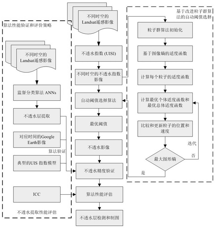
[0061] Such as figure 1 Shown is a flowchart of an urban impermeable layer extraction method based on Landsat remote sensing images. The model mainly includes the following steps:
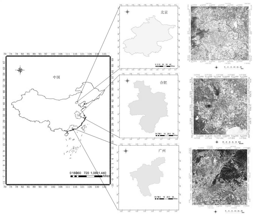
[0062] 1) Select the research area and extract test data;
[0063] 2) Establish an urban index model, and effectively display the permeable and impervious features in the city in the generated index image with differentiated gray values through the calculation of spectral bands;
[0064] 3) The automatic threshold selection algorithm based on the improved particle swarm optimization algorithm obtains the best gray threshold by solving the maximum value of image entropy to improve the accuracy of impermeable layer extraction;
[0065] 4) The comprehensive performance evaluation strategy adopts the relative accuracy comparison method based on artificial neural ne...
PUM
 Abstract
Description
Claims
Application Information
 - R&D
- Intellectual Property
- Life Sciences
- Materials
- Tech Scout
- Unparalleled Data Quality
- Higher Quality Content
- 60% Fewer Hallucinations
Browse by: Latest US Patents, China's latest patents, Technical Efficacy Thesaurus, Application Domain, Technology Topic, Popular Technical Reports.
© 2025 PatSnap. All rights reserved.Legal|Privacy policy|Modern Slavery Act Transparency Statement|Sitemap|About US| Contact US: help@patsnap.com


