Crop pest monitoring method based on multi-spectral remote sensing imagery based on deep learning

A deep learning and remote sensing image technology, applied in the field of satellite remote sensing image processing and application, can solve problems such as single index spectral information instability, hyperspectral UAV data acquisition difficulties, and poor timeliness of crop pest monitoring

Active Publication Date: 2022-07-01
JILIN UNIV
View PDF6 Cites 0 Cited by
  • Summary
  • Abstract
  • Description
  • Claims
  • Application Information

AI Technical Summary

Problems solved by technology

[0006] In order to solve the problems of poor timeliness of existing methods for monitoring crop pests, instability of single index spectral information, and difficulty in obtaining hyperspectral UAV data, etc.

Method used


Image

  • Crop pest monitoring method based on multi-spectral remote sensing imagery based on deep learning
  • Crop pest monitoring method based on multi-spectral remote sensing imagery based on deep learning
  • Crop pest monitoring method based on multi-spectral remote sensing imagery based on deep learning

Examples


Embodiment 1

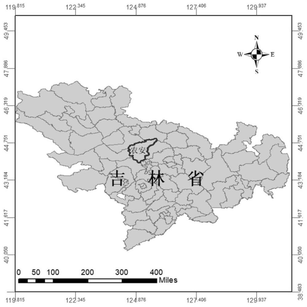
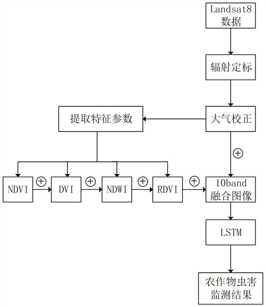
[0060] The LSTM network is used to classify the combination of 10 characteristic bands. As shown in Table 1, the Landsat8 multispectral image with a spatial resolution of 30m is used as the experimental data. The original Landsat8 data has 6 different bands, namely blue band, green band. Band, red band, near-infrared band, short-wave infrared 1 with a band range of 1.560-1.651um, and short-wave infrared 2 with a band range of 2.1-2.3um (Table 1). The experimental area is located in Nong'an City, Jilin Province ( figure 1 ), the surrounding crops are densely planted, mostly rice, corn, soybeans and other common crops in Northeast China. Thus use the Landsat8 data on August 9th, 2012 to verify the validity of the method for monitoring crop pests of the present invention, with reference to the overall flow chart of this example ( figure 2 ).

[0061] Table 1

[0062] band Band name Band range (um) Spatial resolution (m) 1 Blue band (Blue) 0.450~0.515 3...


PUM


Abstract

The invention discloses a multi-spectral remote sensing image-based crop pest monitoring method based on deep learning, and belongs to the technical field of satellite remote sensing image processing and application. The purpose of the present invention is to solve the problems of poor timeliness of crop pest monitoring, unstable single index spectral information, and difficulty in obtaining hyperspectral UAV data by the existing methods. The invention adopts the combination of 10 sets of characteristic band spectra to construct an LSTM long and short-term memory network, and trains a model capable of classifying crop pests in remote sensing images by means of deep learning. The method of the invention can automatically and efficiently The identification of crop pest disasters in multi-spectral satellite remote sensing images provides certain technical support for agricultural production disaster prediction and prevention, agricultural insurance claims and many other fields.

Description

technical field [0001] The invention belongs to the technical field of satellite remote sensing image processing and application. Background technique [0002] Crop pests are the number one natural biological disaster that threatens crop yield and quality. In recent years, the severe changes in the global climate have provided a good growth environment for the hatching and production of pests. The outbreak of pests in large areas has greatly threatened the normal growth of crops, resulting in an increasingly prominent problem of global food production security. For a long time, in order to monitor the scope and degree of occurrence of crop diseases and insect pests, the method of field investigation by plant protection personnel is mainly used. With the rapid development of remote sensing technology, traditional methods need to be combined with remote sensing data, which can play a greater role and achieve the purpose of monitoring crop pest disasters in a large area. At p...

Claims


Application Information

Patent Timeline
Patent Type & Authority Patents(China)
IPC IPC(8): G06V20/17G06V10/46G06V10/764G06V10/56G06V10/774G06V10/82G06K9/62G06N3/04G06N3/08
CPCG06N3/049G06N3/08G06V20/188G06V10/255G06V10/56G06F18/24G06F18/214
Inventor 顾玲嘉王钰涵任瑞治
Owner JILIN UNIV
Why Eureka
Try Eureka