Method for mutually converting plane coordinates and geodetic coordinates of grid points at equal intervals in polar region

A technology of geodetic coordinates and plane coordinates, applied in the field of geography, can solve problems such as uneven accuracy

Active Publication Date: 2019-11-05
SHANDONG JIAOTONG UNIV
View PDF5 Cites 7 Cited by
  • Summary
  • Abstract
  • Description
  • Claims
  • Application Information

AI Technical Summary

Problems solved by technology

However, in the two pole regions of the earth, due to the characteristics of high latitude, fast convergence of meridians, and the existence of poles in the polar regions, the actual distance corresponding to the grid with the same longitude and latitude spacing is quite different, and the accuracy of the calculation of the gravity field parameters in the discrete point grid interpolation process is not good. uniform

Method used


Image

  • Method for mutually converting plane coordinates and geodetic coordinates of grid points at equal intervals in polar region
  • Method for mutually converting plane coordinates and geodetic coordinates of grid points at equal intervals in polar region
  • Method for mutually converting plane coordinates and geodetic coordinates of grid points at equal intervals in polar region

Examples


Embodiment Construction

[0038] The present invention will be described in detail below in conjunction with specific embodiments.

[0039] In the process of projection calculation, the present invention selects the parameters of the earth ellipsoid adopted by the China Geodetic Coordinate System 2000 (CGCS2000 for short):

[0040] Semi-major axis a = 6378137m

[0041] The second-order harmonic coefficient of the earth's gravity field: J 2 =1.082629832258×10 -3

[0042] (Corresponding to flat rate: 1 / 298.257222101)

[0043] Gravitational constant GM = 3.986004418×10 14 m 3 / s 2

[0044] The angular velocity of the earth's rotation ω=7.292115×10 -5 rad / s

[0045] Polar plane rectangular coordinate system:

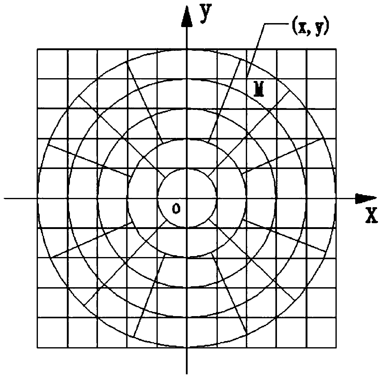
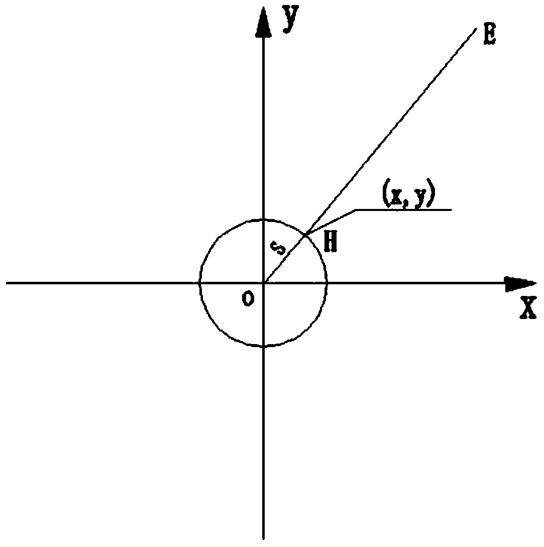
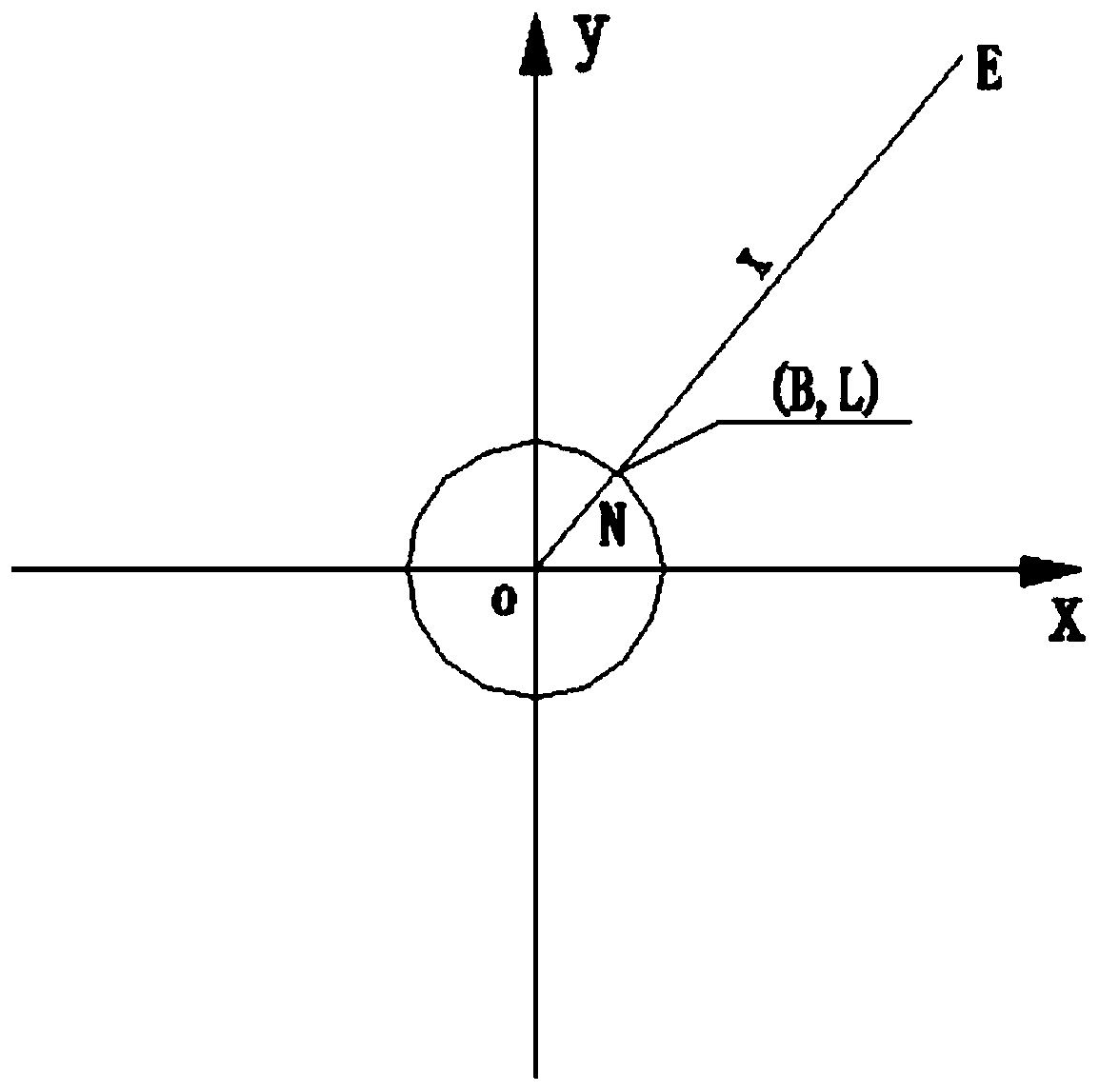
[0046] First, establish the polar plane rectangular coordinate system. Taking the North Pole region as an example, the polar ellipsoid is projected by the positive axis equiangular azimuth projection method, such as figure 1 , Take the pole as the coordinate origin O on the projection plane, the prime meridian di...


PUM


Abstract

The invention discloses a method for mutually converting plane coordinates and geodetic coordinates of grid points at equal intervals in a polar region. Firstly, a polar region rectangular plane coordinate system is established. A polar region ellipsoidal surface is projected by adopting a positive axis equiangular orientation projection method. An equidistant grid is established in the polar region rectangular plane coordinate system. Rectangular plane coordinates of polar region equidistant grid points are converted into geodetic coordinates, and then the geodetic coordinates on the ellipsoidal surface are converted into polar region rectangular plane coordinates. Mutual conversion between polar region plane rectangular coordinates and geodetic coordinates is completed. The method has the beneficial effect that the plane coordinates and the geodetic coordinates of the grid points at equal intervals in the polar region can be efficiently converted with each other.

Description

Technical field [0001] The invention belongs to the technical field of geography and relates to a method for mutual conversion between plane coordinates and geodetic coordinates of grid points at equal intervals in polar regions. Background technique [0002] The earth's gravity field model is usually expanded into a series of spherical or ellipsoidal harmonic functions. The gravity field parameters such as gravity anomalies, geoid undulations and vertical deviations can all be calculated using the earth's gravity field model as a factor of latitude and longitude. However, in the polar regions of the earth, due to the characteristics of high latitude, fast convergence of meridians, and extreme points in the polar regions, the actual distance corresponding to the grid with the same latitude and longitude spacing is quite different. The accuracy of the grid interpolation calculation of gravity field parameters at discrete points is not accurate. Evenly. Summary of the invention [...

Claims


Application Information

Patent Timeline
Patent Type & Authority Applications(China)
IPC IPC(8): G06T3/00
CPCG06T3/0037G06T3/005Y02A90/10
Inventor 宋雷
Owner SHANDONG JIAOTONG UNIV
Why Eureka
Try Eureka