Temporary construction project site selection and design method based on multi-source data fusion technology
A multi-source data and design method technology, applied in data processing applications, image data processing, electrical digital data processing, etc., to achieve the effect of facilitating project discussion and communication, high work efficiency, and strong promotion value
- Summary
- Abstract
- Description
- Claims
- Application Information
AI Technical Summary
Problems solved by technology
Method used
Image

Examples
Embodiment
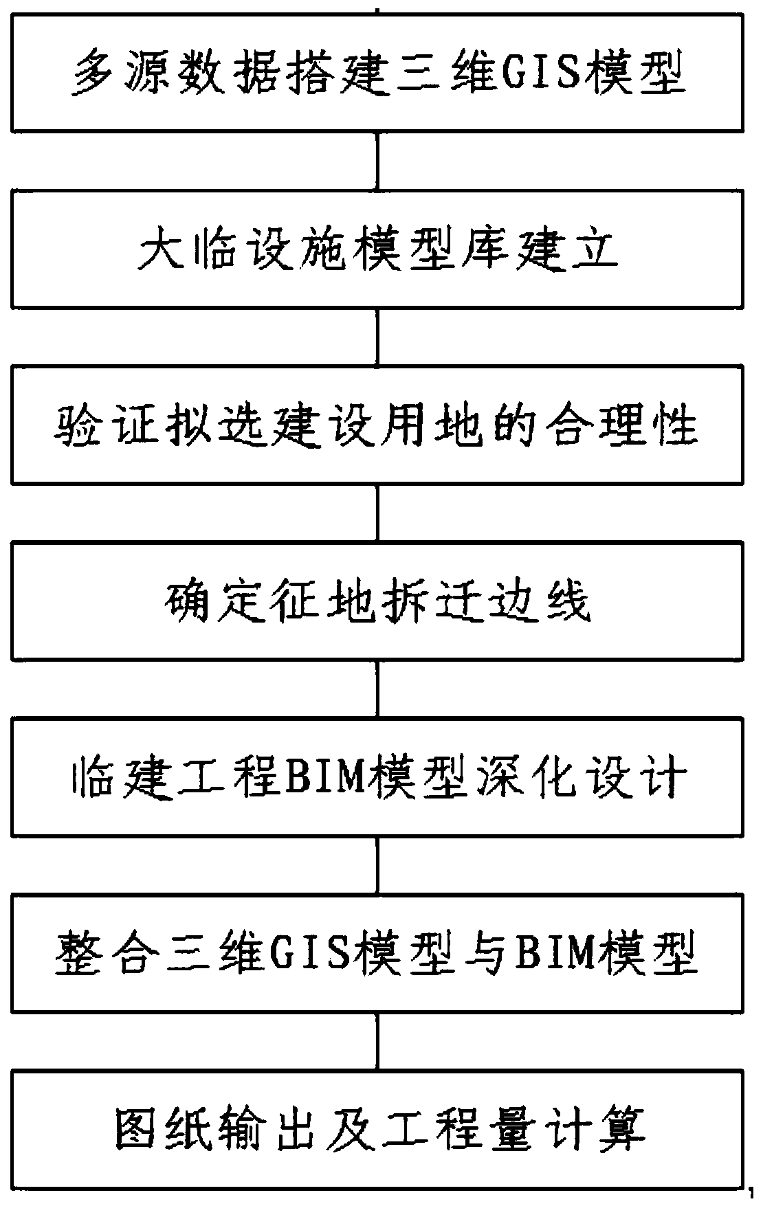
[0035] Refer to attached figure 1 , this embodiment provides a method for site selection and design of a temporary construction project based on multi-source data fusion technology, the specific method is as follows:
[0036] 1) Multi-source data to build a 3D GIS model
[0037] Download the high-precision digital surface model (DSM) .tif format file and the moderate-resolution digital orthophoto image (DOM) .tif format file in the construction area through the network map software. Note: If the resolution is too high, the image memory will be quite large , it is prone to problems such as download failure and data loading freeze;
[0038] UAVs collect images on site, establish aerial survey data processing procedures in the office, and produce high-definition 1:1 digital orthophoto (DOM).tif format files;
[0039] Through the global mapper software, the boundaries of the UAV orthophoto data are cropped, and the above three digital products are geo-calibrated respectively;
...
PUM
 Abstract
Description
Claims
Application Information
 - R&D
- Intellectual Property
- Life Sciences
- Materials
- Tech Scout
- Unparalleled Data Quality
- Higher Quality Content
- 60% Fewer Hallucinations
Browse by: Latest US Patents, China's latest patents, Technical Efficacy Thesaurus, Application Domain, Technology Topic, Popular Technical Reports.
© 2025 PatSnap. All rights reserved.Legal|Privacy policy|Modern Slavery Act Transparency Statement|Sitemap|About US| Contact US: help@patsnap.com