

A Method of Regional Fusion and Correction of Errors Between Satellite Rainfall and Measured Rainfall
A technology of satellite and error, which is applied in the field of regional fusion correction of satellite rainfall and measured rainfall error, which can solve the problems of large error of satellite monitoring rainfall data, inability to be directly applied, and poor accuracy, so as to improve overestimation or underestimation and improve accuracy , the effect of high spatio-temporal resolution
- Summary
- Abstract
- Description
- Claims
- Application Information
AI Technical Summary
Problems solved by technology
Method used
Image

Examples
Embodiment
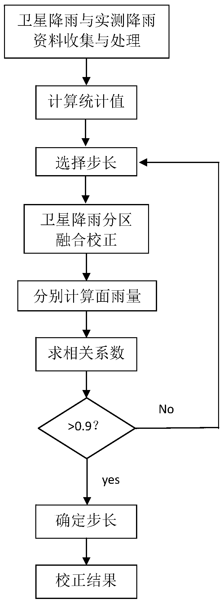
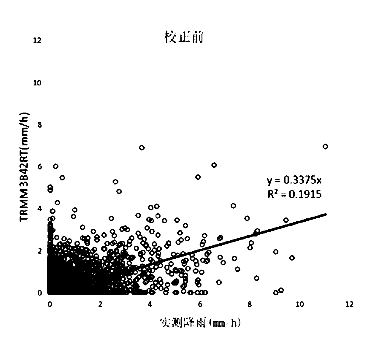
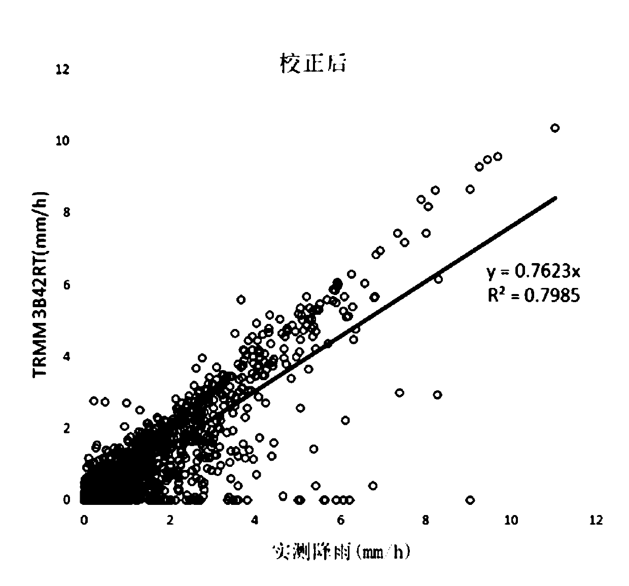
[0059] Select a certain watershed, and adopt the method that the present invention provides a kind of satellite rainfall and measured rainfall error partition fusion correction to correct the satellite rainfall data (TRMM 3B42RT), specifically comprising the following steps:
[0060] (1) According to the "Hydrological Yearbook" and other data sources, the measured rainfall data of the basin during the flood period from 2007 to 2014 and the TRMM 3B42RT satellite rainfall data during the flood period from 2007 to 2014 were selected, with the same time span and spatial resolution of 0.25°× 0.25°.
[0061] (2) Since the time interval of the TRMM 3B42RT satellite rainfall data is 1 hour, and the initial measured rainfall data are not at equal time intervals, the above-mentioned rainfall accumulation time series segmental linear interpolation method is used to interpolate the measured rainfall and convert it into 1 hour interval data.
[0062] (3) Using spatial interpolation method...
PUM
 Abstract
Description
Claims
Application Information