Iceberg remote sensing recognition method based on random forest

A technology of remote sensing identification and random forest, applied in the field of remote sensing applications, can solve the problem of difficulty in distinguishing the two, and achieve the effects of less manual participation, improved recognition speed, and simple and easy execution steps.

Active Publication Date: 2019-12-17
NANJING UNIV
View PDF3 Cites 0 Cited by
  • Summary
  • Abstract
  • Description
  • Claims
  • Application Information

AI Technical Summary

Problems solved by technology

However, in reality, due to the influence of natural factors such as temperature and wind speed, icebergs and sea ice appear very similar in SAR images, making it difficult for us to distinguish the two through one or two simple features in many cases.

Method used


Image

  • Iceberg remote sensing recognition method based on random forest
  • Iceberg remote sensing recognition method based on random forest
  • Iceberg remote sensing recognition method based on random forest

Examples


Embodiment Construction

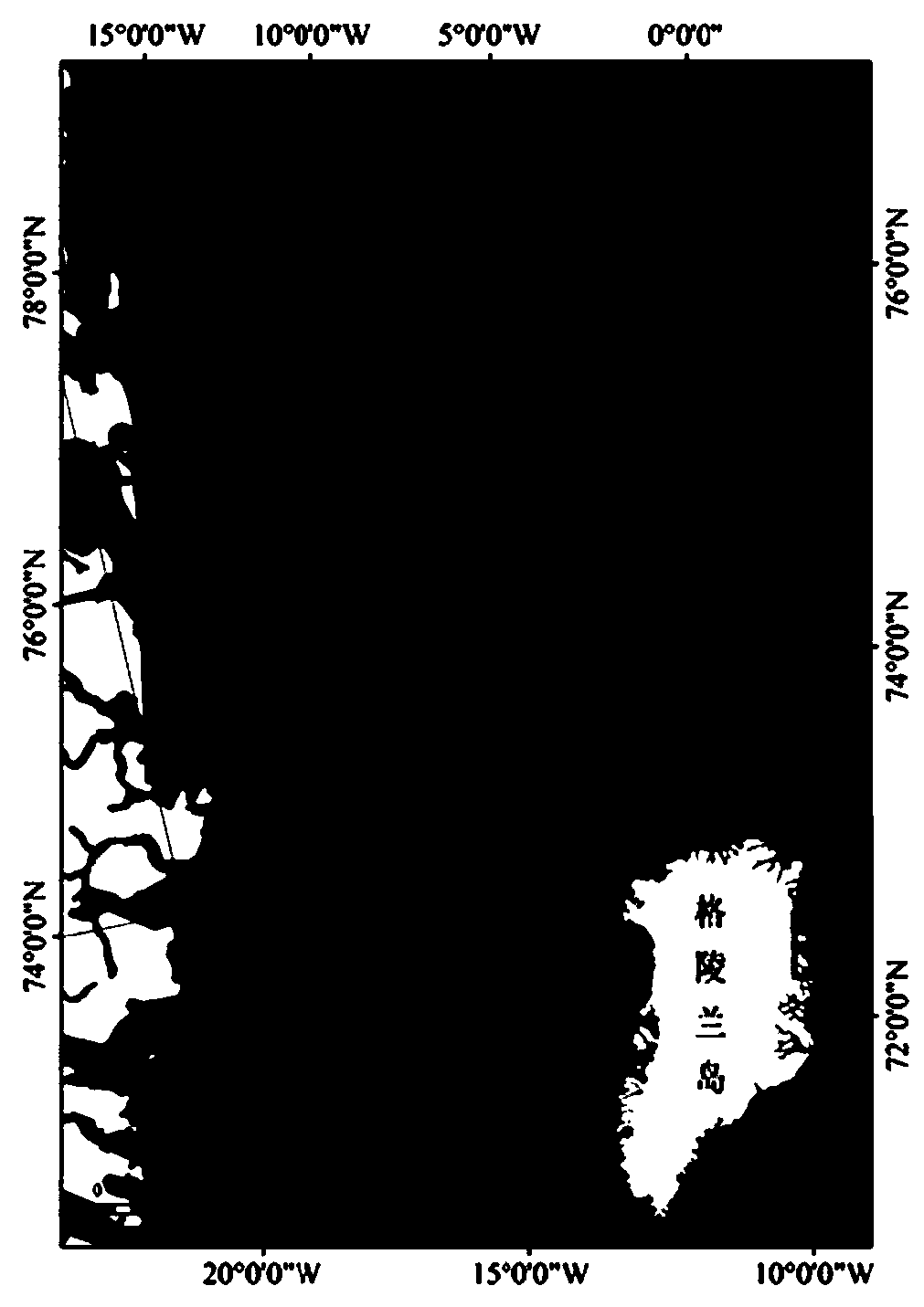
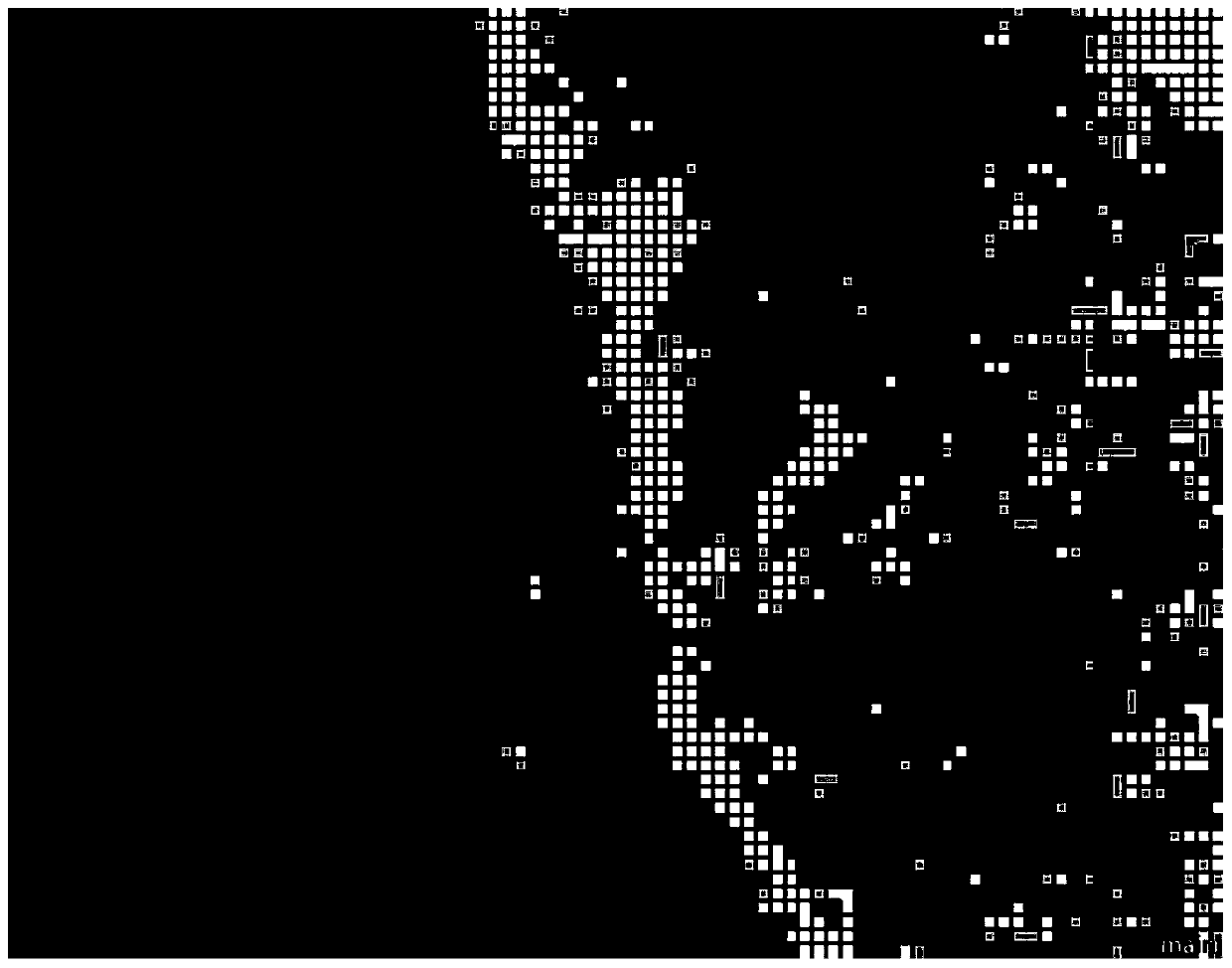
[0028] The present invention will be described in detail below according to the accompanying drawings, so as to make the technical route and operation steps of the present invention clearer. The image data used in the example of the present invention is the EW GRD (ultra-wide mode) first-level image of the Sentinel-1A satellite after geometric correction and other processing, and adopts the HH polarization mode. The sample data was acquired on September 30, 2017, and the geographic coordinates of the image center are N75°, W17°, located on the east coast of Greenland.

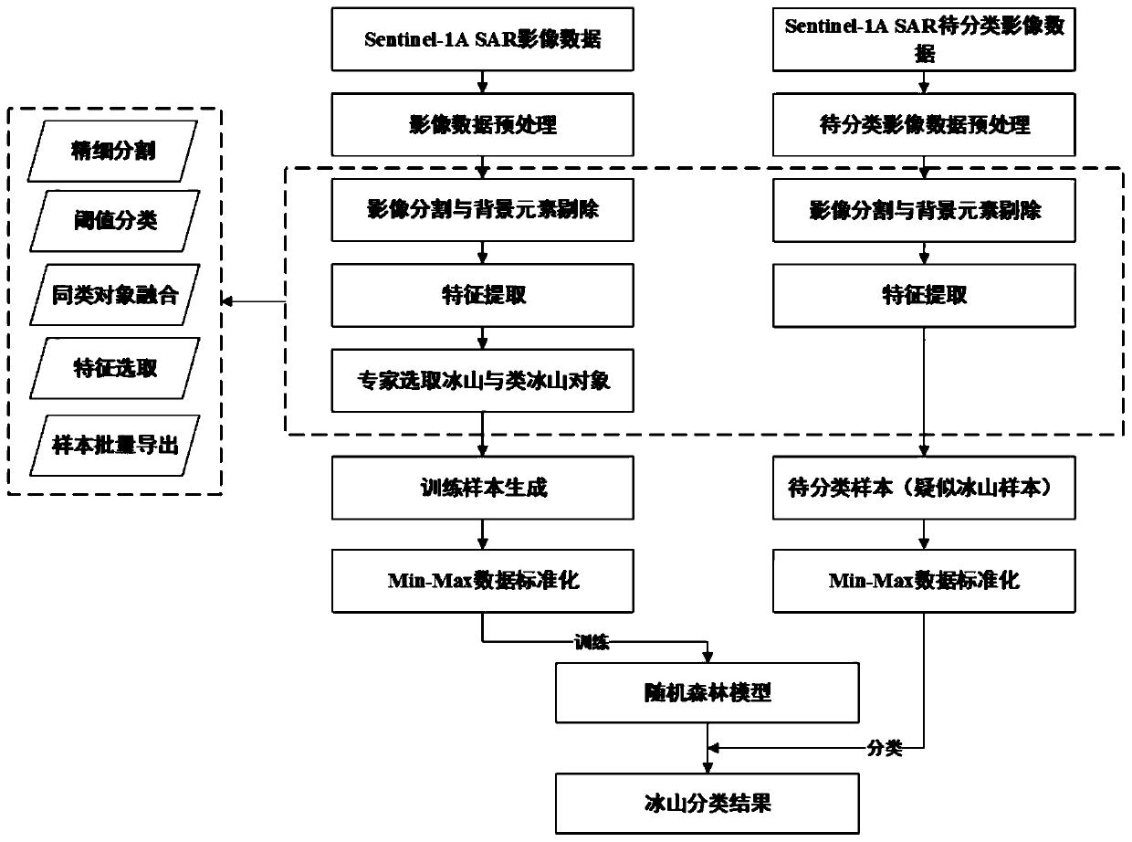
[0029] figure 1 It is a flow chart of the iceberg remote sensing identification method based on random forest, and the specific steps are as follows:

[0030] The first step is to prepare training data and data to be classified, including the following aspects:

[0031] 1a. Download the Sentinel-1A EW GRD (ultra-wide mode) first-level SAR image in the same period as the data to be classified as an example tra...


PUM


Abstract

The invention discloses an iceberg remote sensing recognition method based on a random forest algorithm. According to the method, SAR image data provided by sentinel-1A is adopted to recognize a sea ice mountain, and the method mainly comprises the steps that threshold segmentation is performed on a preprocessed SAR image, background elements are removed, and then sample features are selected according to prior knowledge. And meanwhile, ice mountain and ice mountain-like training samples are selected in an object-oriented mode. The suspected iceberg samples to be classified are processed in asimilar mode, but are completely exported without being selected. And then, the method has the steps of carrying out Min-Max data standardization on all the obtained samples, and finally training therandom forest model by using the generated training data, and using the trained model for classification of to-be-classified samples to obtain a final classification result, thereby realizing identification of the iceberg.

Description

technical field [0001] The invention relates to a random forest-based iceberg remote sensing identification method, which belongs to the technical field of remote sensing applications. [0002] technical background [0003] Icebergs are an important part of the marine environment, and their changes are of great significance to the detection of the marine environment and the early warning of maritime navigation risks. Early monitoring of icebergs could only be obtained through manual field surveys. In the 1990s, because of the advantages of all-weather, all-time and relatively high spatial resolution, SAR data began to be used by scholars for iceberg monitoring. However, in reality, due to the influence of natural factors such as temperature and wind speed, icebergs and sea ice appear very similar in SAR images, making it difficult for us to distinguish the two through one or two simple features in many cases. . In recent years, with the development of machine learning algor...

Claims


Application Information

Patent Timeline
Patent Type & Authority Applications(China)
IPC IPC(8): G06K9/00G06K9/62
CPCG06V20/13G06F18/22G06F18/241G06F18/214
Inventor 柯长青肖湘文沈校熠李萌萌李海丽
Owner NANJING UNIV
Why Eureka
Try Eureka