Starlight/inertia integrated navigation and error online calibration method

A technology of inertial combination and calibration method, applied in the field of navigation, can solve the problems of deviation of installation error, high cost, influence of compound navigation accuracy, etc., and achieve the effect of improving correction accuracy and navigation accuracy.

Active Publication Date: 2020-01-10
NAT UNIV OF DEFENSE TECH
View PDF12 Cites 8 Cited by
  • Summary
  • Abstract
  • Description
  • Claims
  • Application Information

AI Technical Summary

Problems solved by technology

However, its installation error can reach angular classification in practical applications, which seriously affects the accuracy of measuring star azimuth, thus affecting the accuracy of composite navigation
At present, there are two main methods for calibrating the installation error of the star sensor: one is to calibrate based on optical theory, but the cost is expensive; the other is to calibrate based on the inertial navigation information, but it depends on the inertial navigation accuracy.
Moreover, these two methods are calibrated on the ground, but during the ignition and launch of the ballistic missile / launch vehicle, due to the vibration of the projectile / rocket body, the actual installation error will deviate from the pre-calibrated error. A Starlight / Inertial Integrated Navigation and Error Online Calibration Method

Method used


Image

  • Starlight/inertia integrated navigation and error online calibration method
  • Starlight/inertia integrated navigation and error online calibration method
  • Starlight/inertia integrated navigation and error online calibration method

Examples


Embodiment Construction

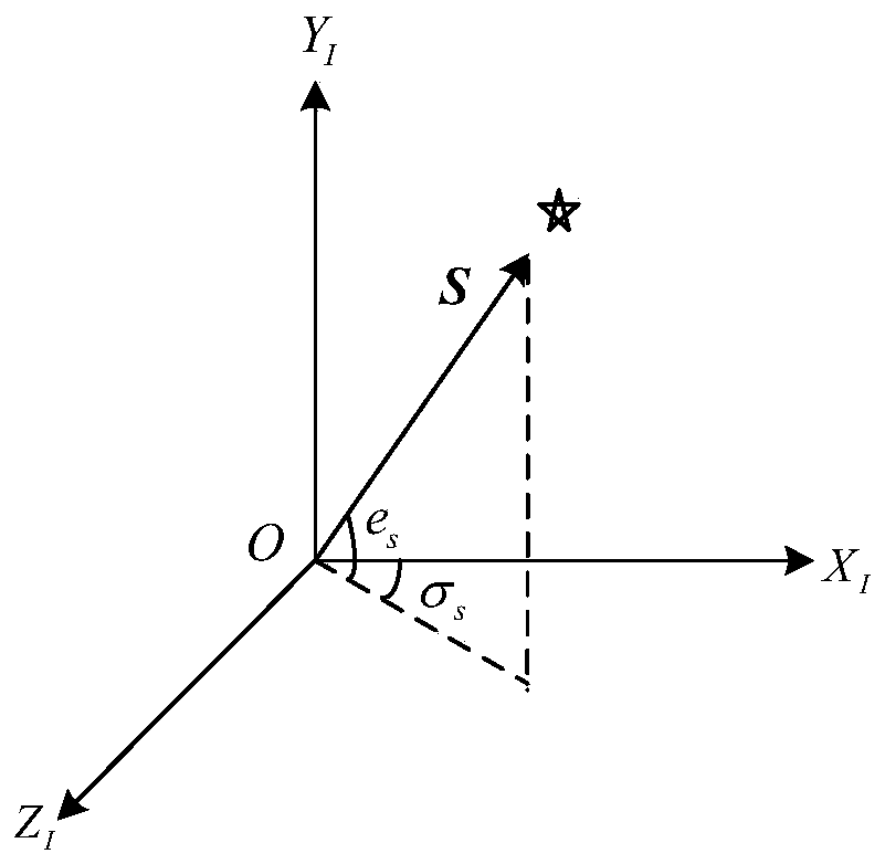
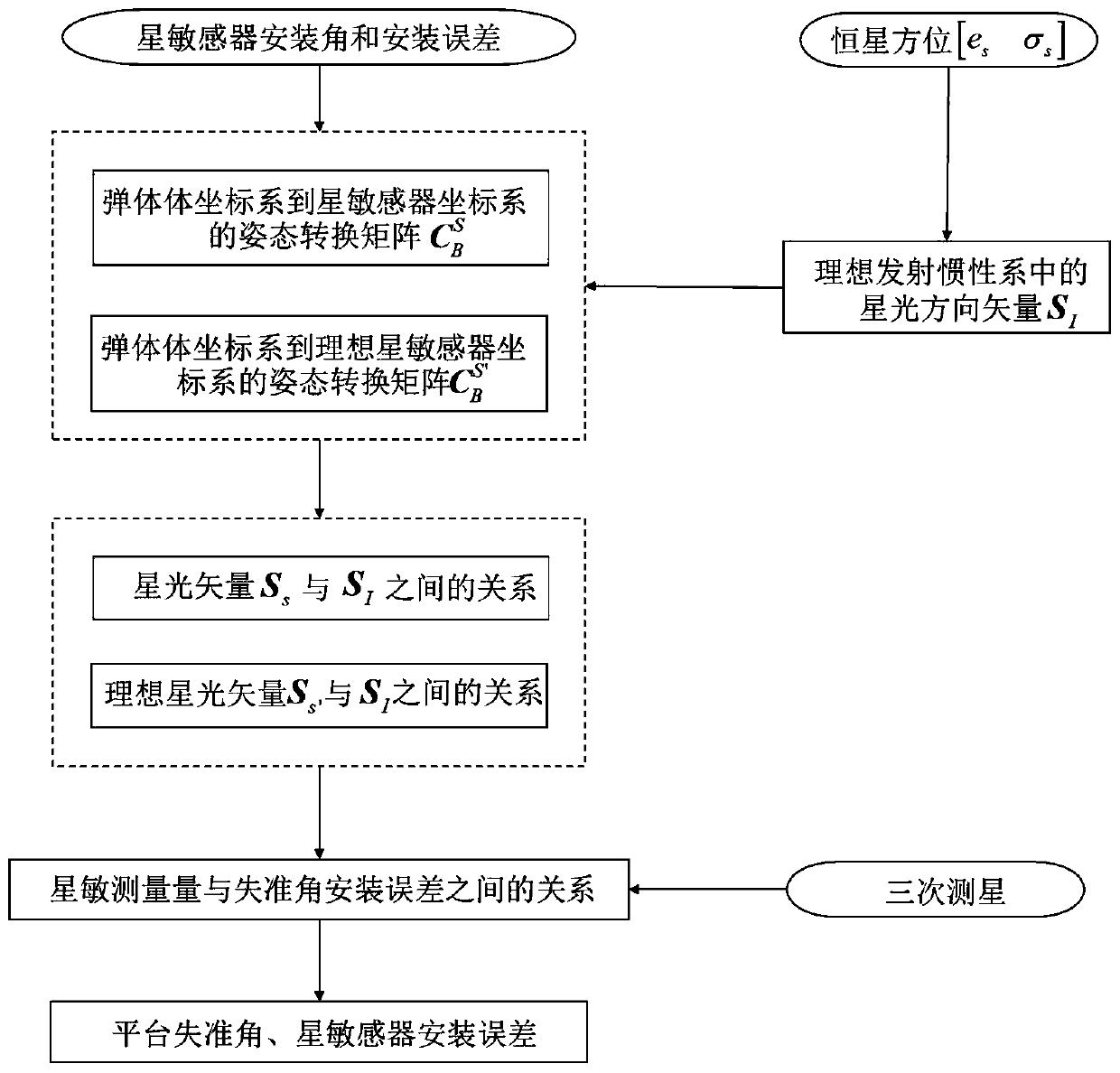
[0039] The platform misalignment angle represents the error angle between the mathematical platform and the ideal launch inertial coordinate system, which will cause navigation deviation and affect the landing point accuracy. The starlight / inertial composite guidance uses the misalignment angle of the platform for comprehensive compensation and correction.

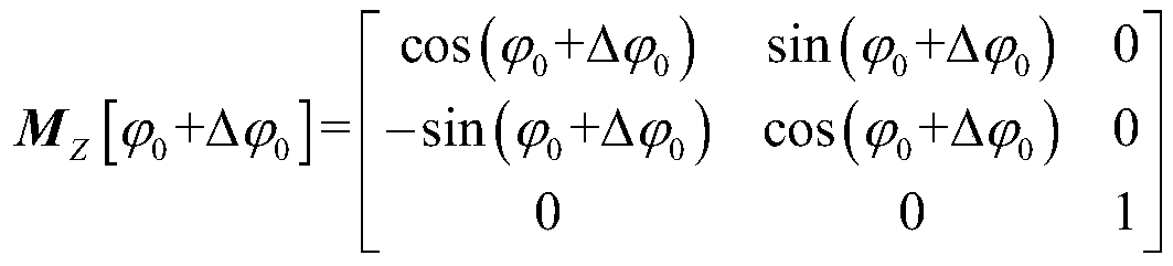
[0040] The initial alignment error and orientation error can be expressed by the misalignment angles of the coordinate system of the actual mathematical platform to the three axes of the launch inertial coordinate system, denoted as [ε 0x ε 0y ε 0z ] T , ε 0y Including orientation / aiming error two parts. [α dx alpha dy alpha dz ] T Indicates the misalignment angle between the actual mathematical platform coordinate system and the ideal mathematical platform coordinate system. Without considering the influence of other errors, the ideal mathematical platform coordinate system is parallel to the launch inertial c...


PUM


Abstract

The invention discloses a starlight / inertia integrated navigation and error online calibration method. The method comprises the steps: based on a three-time missile-turning star measurement result ofa star sensor, estimating a platform misalignment angle and a star sensor installation error by utilizing a least square method according to starlight direction unit vectors of three fixed stars in alaunching inertial coordinate system, so that the starlight / inertial integrated navigation precision is improved. According to the method, the misalignment angle of the platform and the installation error of the star sensor are calibrated simultaneously on line, and the correction precision of the star sensor to the inertial navigation system is improved.

Description

technical field [0001] The invention relates to the field of navigation and can be applied to the strapdown starlight / inertial combined navigation of ballistic missiles / carrier rockets, and is especially suitable for determining platform misalignment angles and installation errors of star sensors in navigation. . Background technique [0002] Starlight / inertial integrated navigation is based on inertial navigation and supplemented by starlight measurement information to correct the attitude error of the inertial navigation system, and further correct the drift error, initial misalignment angle and initial position error of the gyroscope, so as to obtain high-precision position, speed, posture. [0003] According to the different installation methods of the star sensor / gyroscope and accelerometer on the carrier, the inertial system can be divided into platform type and strapdown type. The strapdown inertial navigation system has no physical platform, and the star sensor and...

Claims


Application Information

Patent Timeline
Patent Type & Authority Applications(China)
IPC IPC(8): G01C25/00
CPCG01C25/00G01C25/005
Inventor 赵依张洪波安雪滢汤国建李鹏飞李兆亭
Owner NAT UNIV OF DEFENSE TECH
Why Eureka
Try Eureka