GIS-based project information management method, device, equipment and storage medium
A project information management and project technology, applied in the field of device, GIS project information management method, equipment and storage media, can solve the problem of failure to form a system, information update degree, poor usability, and little guidance for environmental protection consulting projects and other issues to achieve the effect of reasonable data structure
- Summary
- Abstract
- Description
- Claims
- Application Information
AI Technical Summary
Problems solved by technology
Method used
Image
Examples
Embodiment 1
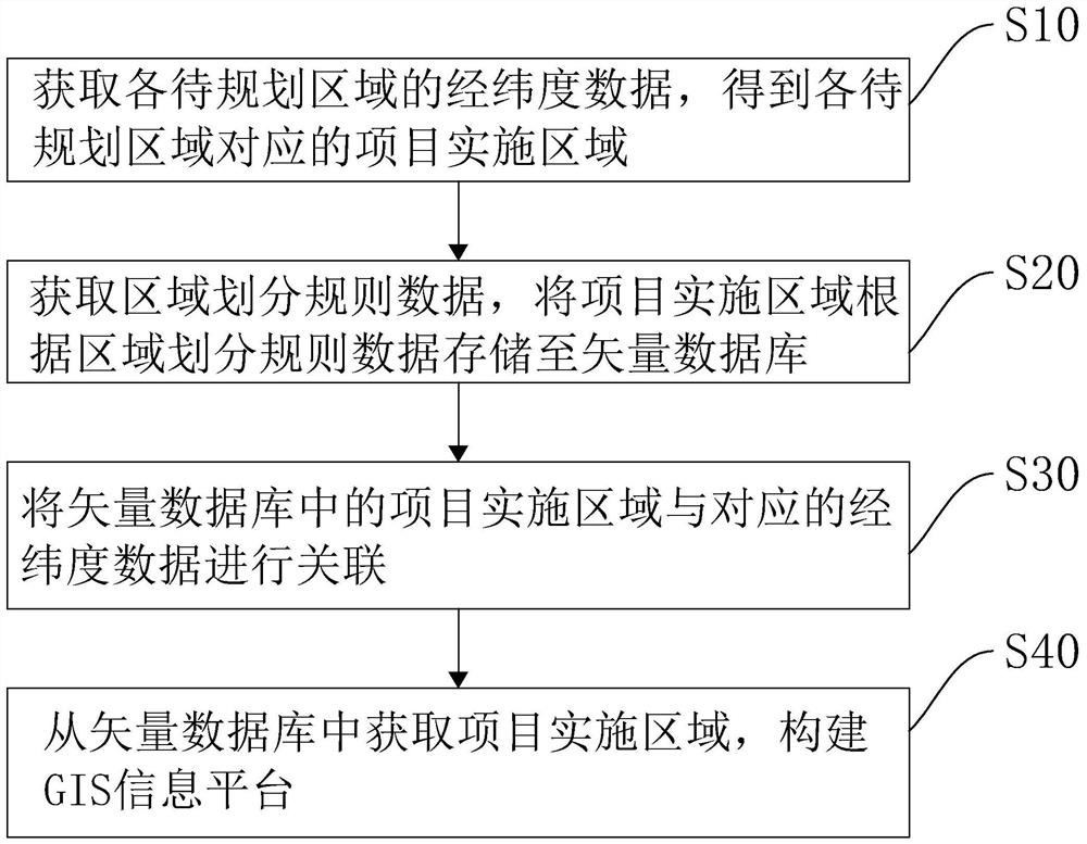
[0052] In one embodiment, as figure 1 As shown, the present invention discloses a method for managing project information based on GIS, which specifically includes the following steps:
[0053]S10: Obtain the latitude and longitude data of each area to be planned, and obtain the project implementation area corresponding to each area to be planned.
[0054] In this embodiment, the area to be planned refers to the area to be planned for project implementation in the pre-environment consulting project system. The latitude and longitude data refer to the longitude and latitude information of the area to be planned in the map. The project implementation area refers to the area specifically planned for the environmental consulting project.
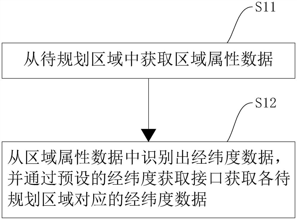
[0055] Specifically, the area to be planned is obtained from a pre-set or constructed system of environmental consulting projects. Further, the latitude and longitude data of each area to be planned is obtained from the area to be planned. W...
Embodiment 2
[0094] In one embodiment, a device for managing project information based on GIS is provided, and the device for managing project information based on GIS corresponds to the method for managing project information based on GIS in the above embodiments. like Image 6 As shown, the GIS-based project information management device includes an area division module 10 , a storage module 20 , an association module 30 and a platform construction module 40 . The detailed description of each functional module is as follows:
[0095] The area division module 10 is used to obtain the latitude and longitude data of each area to be planned, and obtain the project implementation area corresponding to each area to be planned;
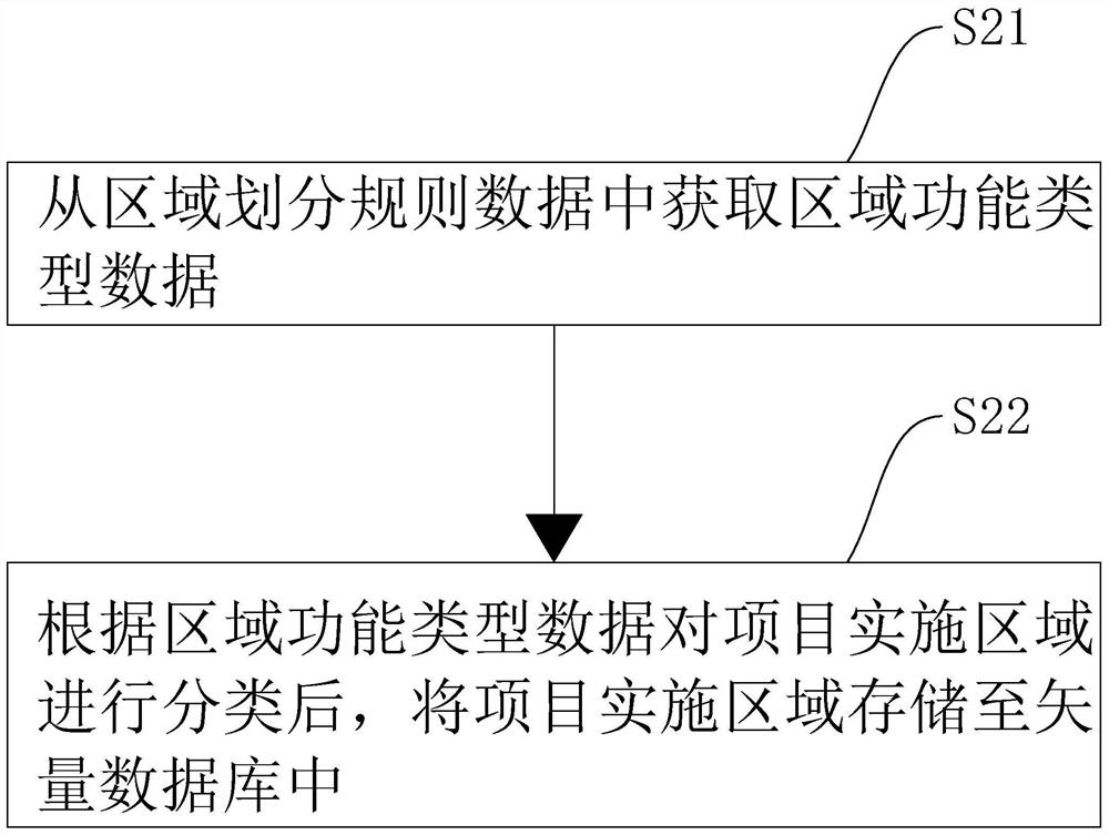
[0096]The storage module 20 is used to obtain the area division rule data, and store the project implementation area in the vector database according to the area division rule data;
[0097] An association module 30, configured to associate the project implementation...
Embodiment 3
[0113] In one embodiment, a computer device is provided, the computer device may be a server, and its internal structure diagram may be as follows Figure 7 shown. The computer device includes a processor, memory, network interface and database connected by a system bus. Wherein, the processor of the computer device is used to provide calculation and control capabilities. The memory of the computer device includes a non-volatile storage medium and an internal memory. The non-volatile storage medium stores an operating system, computer programs and databases. The internal memory provides an environment for the operation of the operating system and computer programs in the non-volatile storage medium. The database of the computer equipment is used to store project area data and data update content. The network interface of the computer device is used to communicate with an external terminal via a network connection. When the computer program is executed by a processor, a me...
PUM
 Abstract
Description
Claims
Application Information
 - R&D
- Intellectual Property
- Life Sciences
- Materials
- Tech Scout
- Unparalleled Data Quality
- Higher Quality Content
- 60% Fewer Hallucinations
Browse by: Latest US Patents, China's latest patents, Technical Efficacy Thesaurus, Application Domain, Technology Topic, Popular Technical Reports.
© 2025 PatSnap. All rights reserved.Legal|Privacy policy|Modern Slavery Act Transparency Statement|Sitemap|About US| Contact US: help@patsnap.com


