
Unmanned aerial vehicle laser radar aviation data remote measurement and analysis system based on satellite communication

A satellite communication and lidar technology, which is applied in the field of UAV lidar aerial data telemetry and analysis system to achieve the effect of improving accuracy

Inactive Publication Date: 2020-04-17
MEISHAN POWER SUPPLY CO STATE GRID SICHUAN ELECTRIC POWER CO
View PDF6 Cites 0 Cited by
  • Summary
  • Abstract
  • Description
  • Claims
  • Application Information

AI Technical Summary

Problems solved by technology

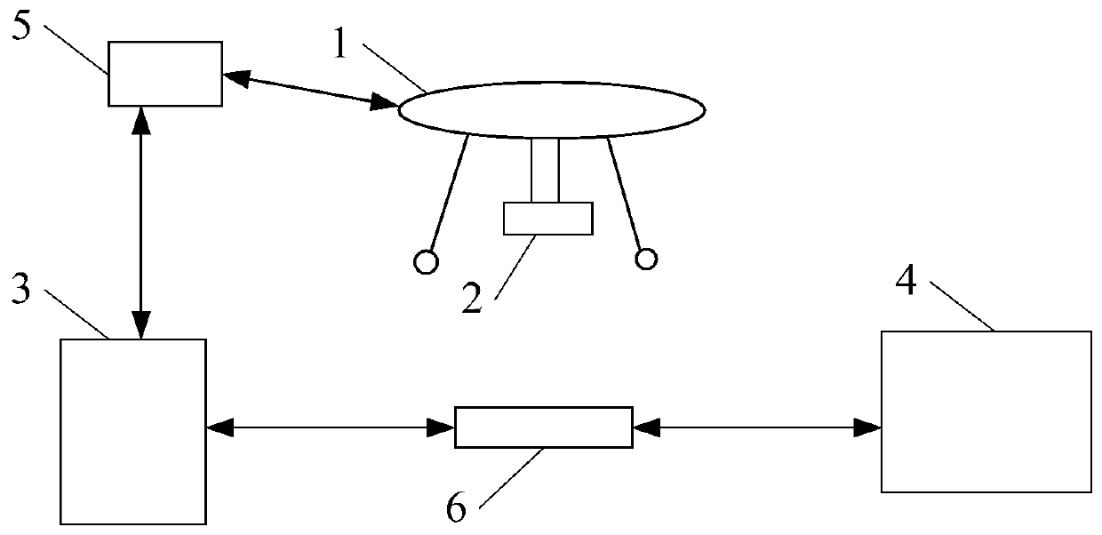
[0004] The purpose of the present invention is to solve the shortcomings of manual monitoring of power line disasters in the prior art. The present invention provides a satellite communication-based UAV laser radar aerial data telemetry and analysis system. This system can automatically, efficiently and accurately Monitoring and Analysis of Power Line Disaster Situation

Method used


Image

  • Unmanned aerial vehicle laser radar aviation data remote measurement and analysis system based on satellite communication

Examples


Embodiment Construction

[0038] In order to understand the above-mentioned purpose, features and advantages of the present invention more clearly, the present invention will be further described in detail below in conjunction with the accompanying drawings and specific embodiments. It should be noted that, under the condition of not conflicting with each other, the embodiments of the present application and the features in the embodiments can be combined with each other.

[0039] In the following description, many specific details are set forth in order to fully understand the present invention. However, the present invention can also be implemented in other ways different from the scope of this description. Therefore, the protection scope of the present invention is not limited by the following disclosure. limitations of specific examples.

[0040] Those skilled in the art should understand that in the disclosure of the present invention, the terms "vertical", "transverse", "upper", "lower", "front",...


PUM


Abstract

The invention discloses an unmanned aerial vehicle laser radar aviation data remote measurement and analysis system based on satellite communication. The system comprises the steps of scanning a target area to obtain scanning data; establishing a target area three-dimensional model based on the scanning data, and combining the target area three-dimensional model with topographic landscape data toform a power line asset management platform; establishing an asset management database based on the power asset information, and adding the topological relation of the target area three-dimensional model and the power asset information in the power line asset management platform by a mobile workstation; based on the data returned by monitoring equipment on an electric tower in the target area, performing power analysis based on the video monitoring data; sending the video monitoring data and the data in the power line asset management platform to a command center; and comparing the video monitoring data with three-dimensional point cloud data, and evaluating the disaster situation of the target area based on the comparison result. The system can automatically, efficiently and accurately monitor and analyze the disaster situation of the power line.

Description

technical field [0001] The invention relates to the field of power line disaster monitoring, in particular to an unmanned aerial vehicle laser radar aerial data telemetry and analysis system based on satellite communication. Background technique [0002] Due to the large area and long distance of the power lines, the power lines are prone to failure due to disasters on their paths. [0003] In the existing technology, the monitoring of power line disasters mainly uses manual inspections. For example, manual inspections are performed now, and other data such as the type and area of ​​the disaster are reported, and then the command center sends personnel to carry out emergency repairs. However, manual inspections and judgments exist. Low efficiency and relying on manual experience to judge, the accuracy of judgment cannot be guaranteed. Contents of the invention [0004] The purpose of the present invention is to solve the shortcomings of manual monitoring of power line dis...

Claims


Application Information

Patent Timeline
Patent Type & Authority Applications(China)
IPC IPC(8): G01S17/88B64C39/02
CPCG01S17/88B64C39/02B64U50/19B64U2101/00
Inventor 杨雪陈亮汪晓帆曹刚张云曾仕伦朱礼鹏吴红朱敏兰沂梅
Owner MEISHAN POWER SUPPLY CO STATE GRID SICHUAN ELECTRIC POWER CO
Learn More