Navigation method, system and device for unmanned aerial vehicle to pass through limited airspace and readable storage medium
A navigation method and navigation system technology, applied in the field of equipment and readable storage media, systems, and UAV navigation methods through restricted airspace, can solve the problems of reduced flight efficiency and achieve the effect of reducing reaction time
- Summary
- Abstract
- Description
- Claims
- Application Information
AI Technical Summary
Problems solved by technology
Method used
Image
Examples
Embodiment Construction
[0035] The present invention will be described in further detail below in conjunction with the accompanying drawings and specific embodiments.
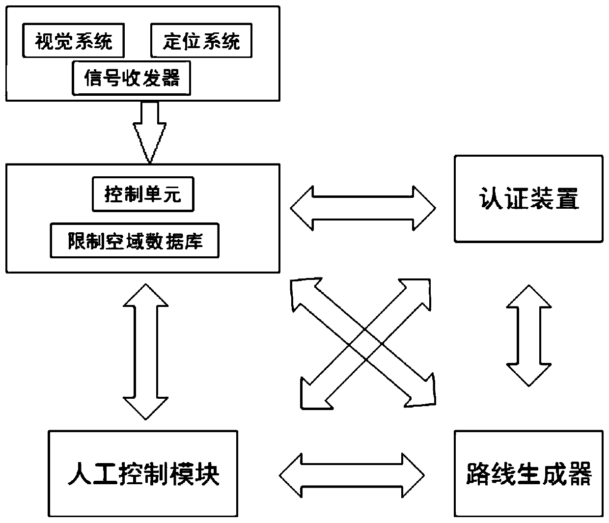
[0036] refer to figure 1 , a navigation system for unmanned aerial vehicles through restricted airspace, including a monitoring device, a control unit, an authentication device, a route generator, and a manual control module.
[0037] The monitoring device is used to obtain the geographic location of the drone and the flight restriction signal of the restricted airspace.
[0038] Monitoring devices include vision systems, positioning systems and signal transceivers.
[0039] A vision system consists of one or more cameras that provide picture or video data to drone surveillance devices and can be of various types including high definition cameras, night vision enabled cameras, infrared sensing cameras, X-ray imaging equipment , line scan imaging equipment, etc.
[0040] The positioning system may be a Global Positioning System (GPS...
PUM
 Abstract
Description
Claims
Application Information
 - R&D
- Intellectual Property
- Life Sciences
- Materials
- Tech Scout
- Unparalleled Data Quality
- Higher Quality Content
- 60% Fewer Hallucinations
Browse by: Latest US Patents, China's latest patents, Technical Efficacy Thesaurus, Application Domain, Technology Topic, Popular Technical Reports.
© 2025 PatSnap. All rights reserved.Legal|Privacy policy|Modern Slavery Act Transparency Statement|Sitemap|About US| Contact US: help@patsnap.com


