

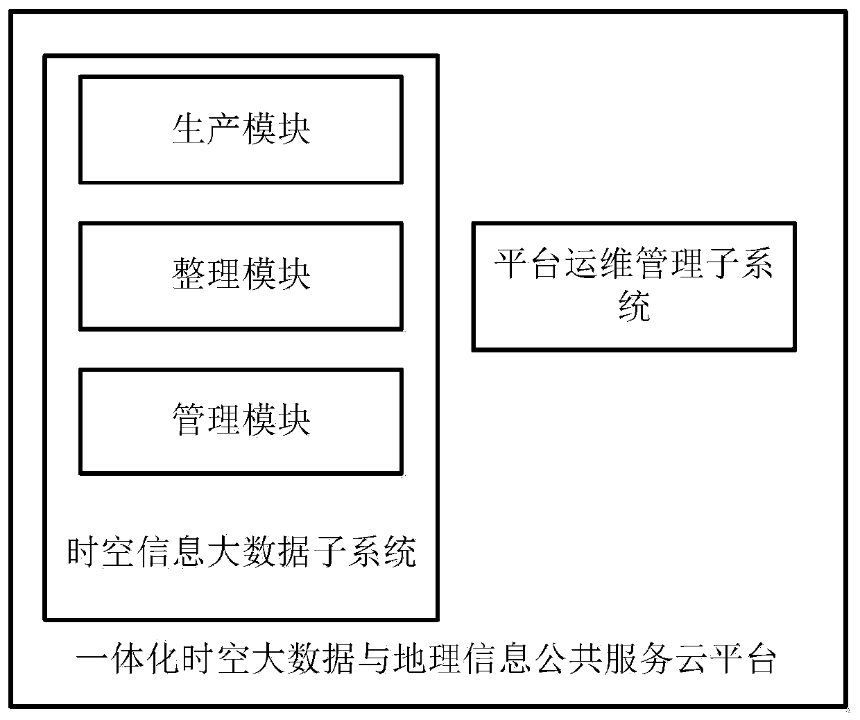
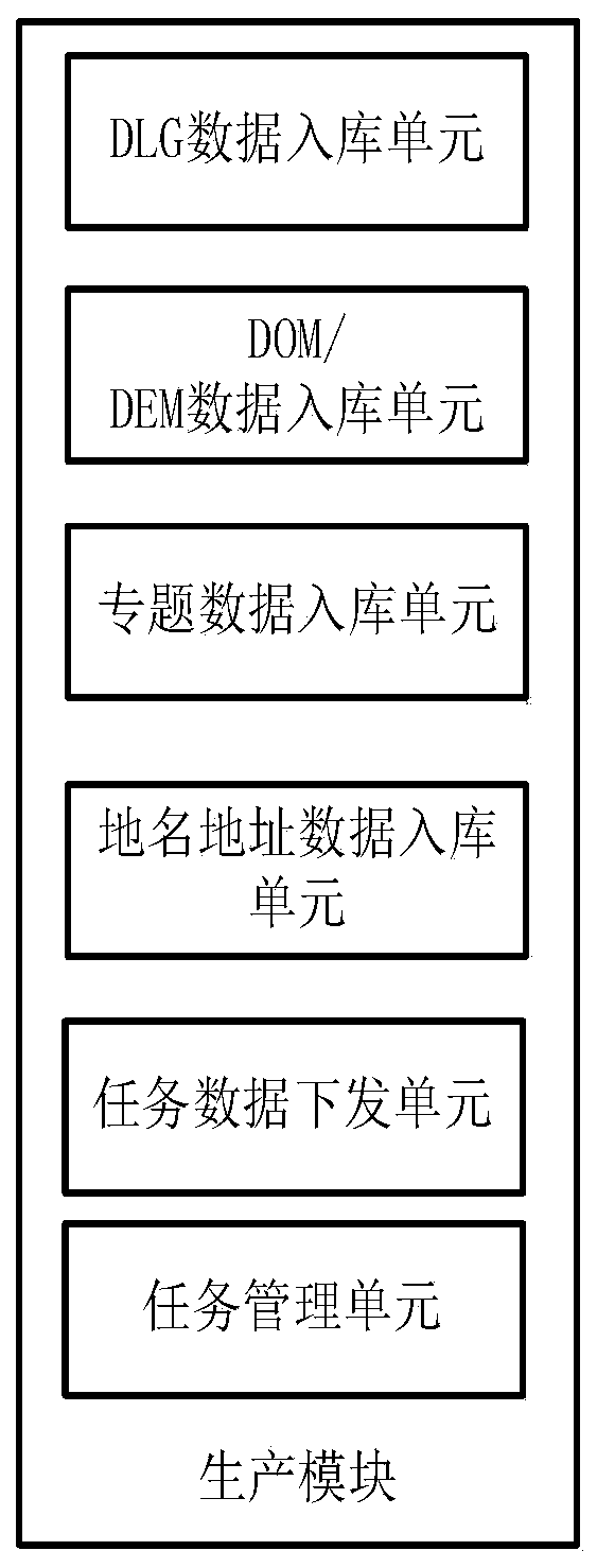
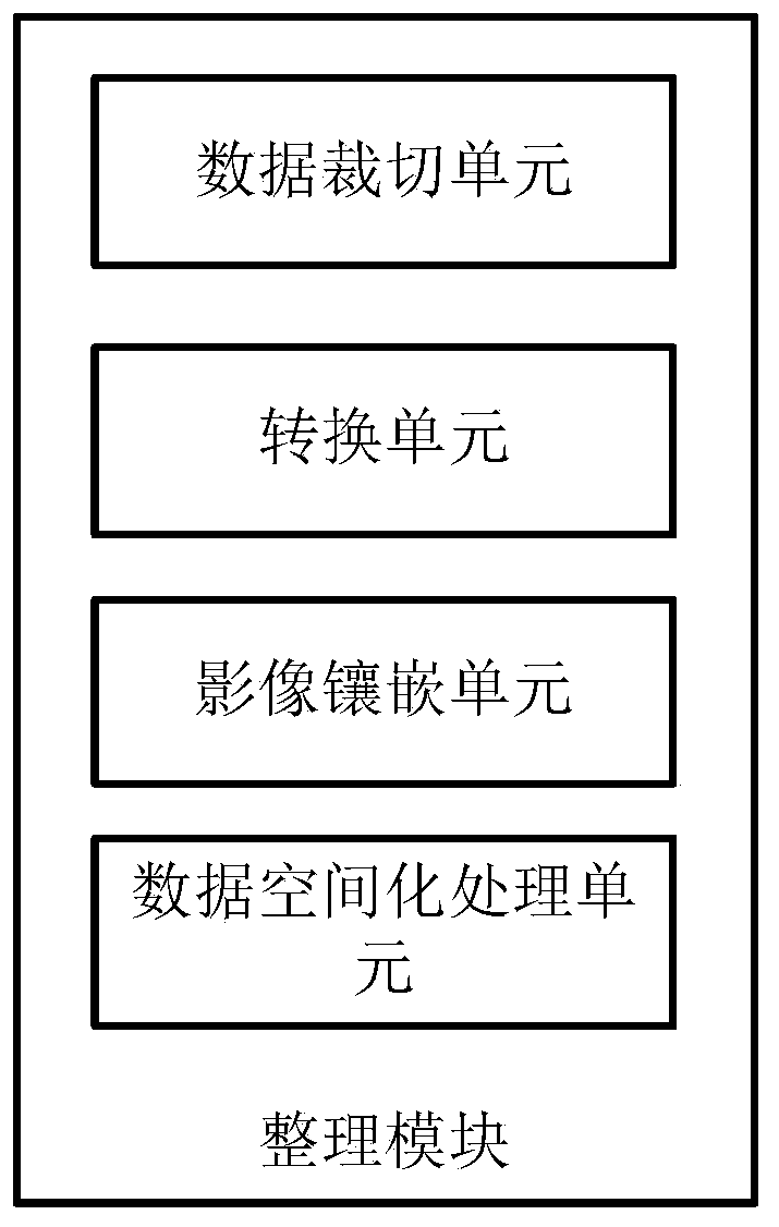
Integrated and space-time big data and geographic information public service cloud platform
A technology for geographic information and public services, applied in the field of integrated spatiotemporal big data and geographic information public service cloud platform, can solve the problems of reduced system practicability, inconsistent representation methods, lack of unified planning, etc. Technical requirements, reduce duplication of construction, and achieve the effect of sharing
- Summary
- Abstract
- Description
- Claims
- Application Information
AI Technical Summary
Problems solved by technology
Method used
Image

Examples
Embodiment Construction
[0050] The following will clearly and completely describe the technical solutions in the embodiments of the present invention with reference to the accompanying drawings in the embodiments of the present invention. Obviously, the described embodiments are some of the embodiments of the present invention, but not all of them. Based on the embodiments of the present invention, all other embodiments obtained by persons of ordinary skill in the art without making creative efforts belong to the protection scope of the present invention.
[0051] It should be understood that when used in this specification and the appended claims, the terms "comprising" and "comprises" indicate the presence of described features, integers, steps, operations, elements and / or components, but do not exclude one or Presence or addition of multiple other features, integers, steps, operations, elements, components and / or collections thereof.
[0052] It should also be understood that the terminology used ...
PUM
 Abstract
Description
Claims
Application Information