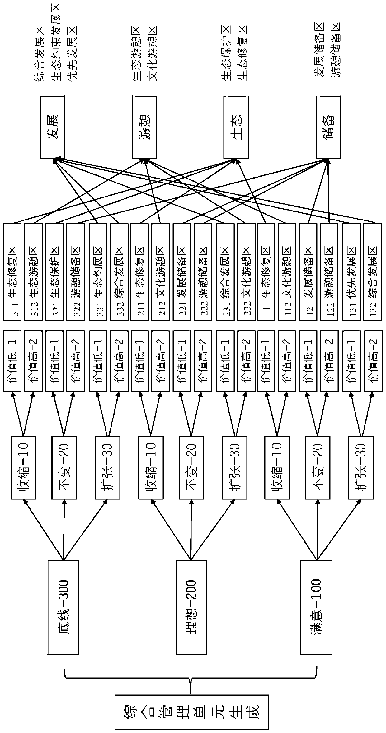
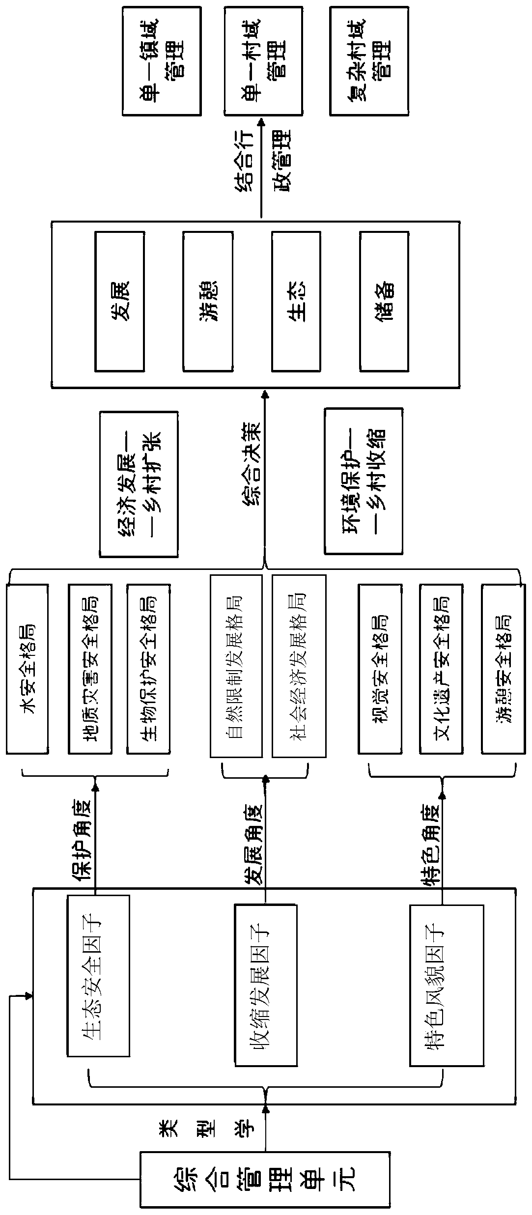
Landscape comprehensive management unit division method
A technology of comprehensive management and management units, applied in the field of landscape planning, can solve the problems of unsystematic development of natural characteristics and environmental management units, large scale, single elements of comprehensive natural divisions, etc.
- Summary
- Abstract
- Description
- Claims
- Application Information
AI Technical Summary
Problems solved by technology
Method used
Image
Examples
Embodiment approach
[0065] According to a preferred embodiment of the present invention, the scores of the ecological land under the low safety level, the ecological land under the medium safety level, and the ecological land under the high safety level are respectively recorded as 4, 2 and 1.
[0066] According to the present invention, in the water security pattern, using the GIS spatial overlay analysis function, the evaluation results of the water source protection safety factors and the rain and flood protection safety factors are weighted or graded. The Delphi method or empirically determines that the weight of the water source protection safety factor is 0.5, and the rain and flood protection safety factor is 0.5, and the evaluation results and evaluation distribution map of the water safety pattern are obtained.
[0067] According to a preferred embodiment of the present invention, the index layer of the geological disaster safety pattern includes slope, vegetation coverage and geological ...
Embodiment
[0307] Taking Wusheng County of Sichuan Province as an example, the division method of landscape comprehensive management units is explained.
[0308] Collect various raw data of Wusheng County, and divide the administrative area of Wusheng County into multiple grid units of 100m*100m.
[0309] Considering the management unit of landscape characteristics in Wusheng County from the three indicators of ecological security factor, shrinkage development factor and characteristic style factor, arcgis software is used to score and superimpose the evaluation factors.
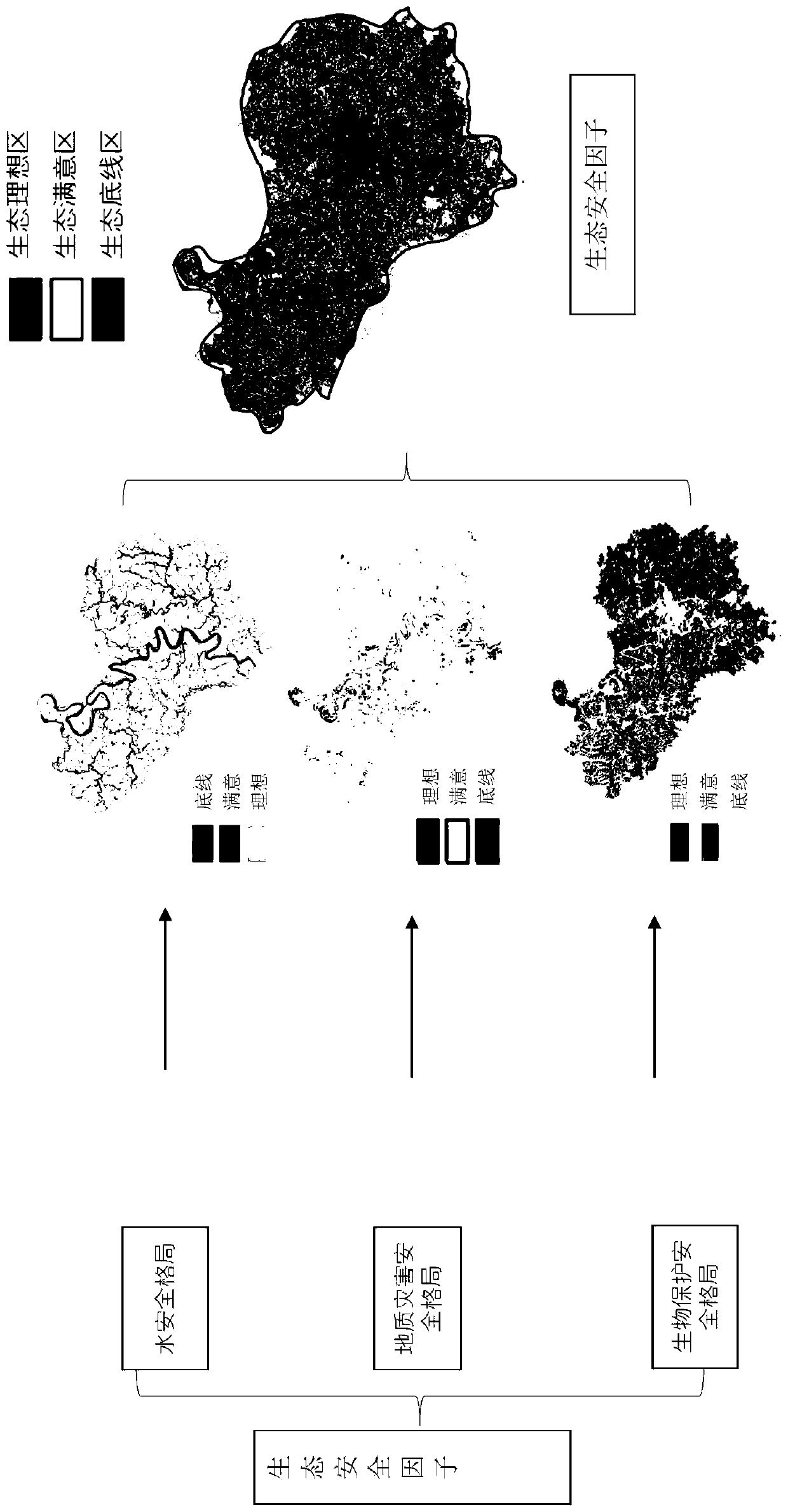
[0310] According to the expert scoring method, using the GIS spatial overlay analysis function, according to the index layer of the set ecological security factor, the scoring results of each grid unit are obtained, and the scoring results of the index layer are weighted and superimposed to obtain the grid unit in the pattern layer. The scores of the water security pattern, the geological disaster security pattern an...
PUM
 Abstract
Description
Claims
Application Information
 - R&D
- Intellectual Property
- Life Sciences
- Materials
- Tech Scout
- Unparalleled Data Quality
- Higher Quality Content
- 60% Fewer Hallucinations
Browse by: Latest US Patents, China's latest patents, Technical Efficacy Thesaurus, Application Domain, Technology Topic, Popular Technical Reports.
© 2025 PatSnap. All rights reserved.Legal|Privacy policy|Modern Slavery Act Transparency Statement|Sitemap|About US| Contact US: help@patsnap.com


