
Remote sensing satellite fire point identification method, device and equipment and storage medium

A technology of remote sensing satellites and fire points, applied in scene recognition, neural learning methods, character and pattern recognition, etc., can solve problems such as low recall rate and accuracy rate, ignore fire features, and inconsistent window determination, etc., and achieve high accuracy rate and Effect of low recall rate and low dependence on expert knowledge

Pending Publication Date: 2020-06-19
应急管理部大数据中心
View PDF8 Cites 13 Cited by
  • Summary
  • Abstract
  • Description
  • Claims
  • Application Information

AI Technical Summary

Problems solved by technology

Among them, the absolute threshold method identifies fire points by comparing certain channel values ​​of remote sensing data with fixed thresholds, but the absolute threshold method has a low recall rate and is easily affected by factors such as different regions, seasons, and weather. Artificially adjusting the threshold according to factors such as regions, seasons, and weather, relies on expert experience and knowledge and takes a lot of time and labor costs; while the adaptive threshold method determines the threshold by setting the channel window to calculate the mean and variance, which can solve different regions, Seasons, weather and other factors affect the problem, but the window determination between different remote sensing satellites is inconsistent, and only a single channel feature is used, ignoring the potential fire features that may be included in other channels, and also relying on expert experience knowledge, recall rate and Accuracy is also lower

Method used


Image

  • Remote sensing satellite fire point identification method, device and equipment and storage medium
  • Remote sensing satellite fire point identification method, device and equipment and storage medium
  • Remote sensing satellite fire point identification method, device and equipment and storage medium

Examples


Embodiment Construction

[0077] Exemplary embodiments of the present application are described below in conjunction with the accompanying drawings, which include various details of the embodiments of the present application to facilitate understanding, and they should be regarded as exemplary only. Accordingly, those of ordinary skill in the art will recognize that various changes and modifications of the embodiments described herein can be made without departing from the scope and spirit of the application. Also, descriptions of well-known functions and constructions are omitted in the following description for clarity and conciseness.

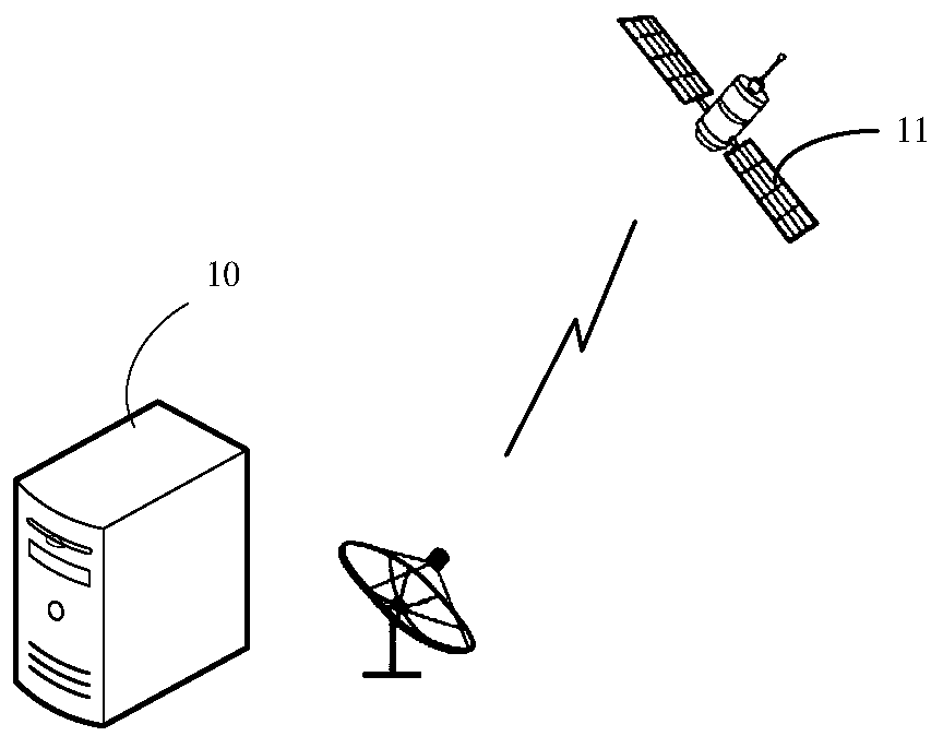
[0078] The method provided by the embodiment of this application is applied as figure 1 The communication system shown, the communication system includes a server 10 and a satellite 11, the satellite 11 can collect the satellite remote sensing image of the target area, and send it to the server 10, the server 10 can also obtain the weather information corresponding t...


PUM


Abstract

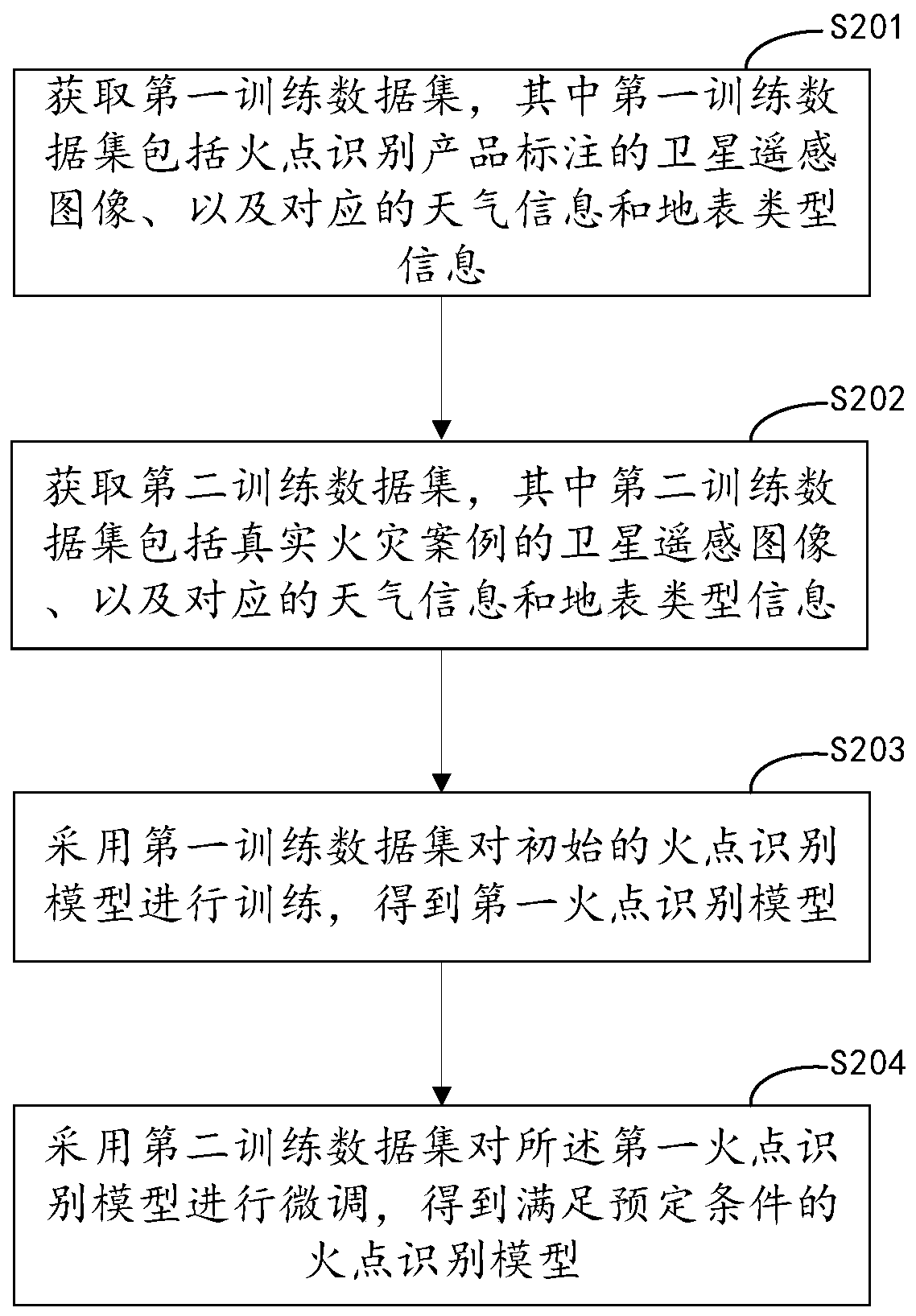
The invention discloses a remote sensing satellite fire point identification method, device and equipment and a storage medium, and relates to the technical field of artificial intelligence. Fire point recognition is carried out through the fire point recognition model, high accuracy and recall rate are achieved, complex preprocessing does not need to be carried out on satellite remote sensing data, dependence on expert knowledge is low, and the method is suitable for different remote sensing satellites. Weather information and earth surface type information are considered on the basis of a remote sensing satellite image, the remote sensing satellite image is prevented from being influenced by weather factors and earth surface types, and the method is suitable for fire point identificationof different area scenes. In the fire point recognition model training stage, method of learning by migration, on the basis of a first fire point identification model trained by a first training dataset formed by disclosed fire point identification product data, the first fire point recognition model is finely adjusted through the second training data set formed by a small number of real fire cases, the problem of lack of real data is solved, and the finally obtained fire point recognition model has high accuracy and recall rate.

Description

technical field [0001] This application relates to the field of computer technology, in particular to the field of artificial intelligence technology. Background technique [0002] Fire is a common and frequent disaster, which is characterized by strong suddenness, great destructiveness, and difficulty in handling and rescue. Especially, forest overload is extremely destructive to forests and causes serious economic losses. Therefore, in the fire detection link, the timeliness and accuracy of finding the fire point are particularly important, so that effective emergency measures and protective measures can be taken as soon as possible to reduce the loss caused by the fire. [0003] The fire point identification methods of remote sensing satellites in the prior art include absolute threshold method, adaptive threshold method and so on. Among them, the absolute threshold method identifies fire points by comparing certain channel values ​​of remote sensing data with fixed thre...

Claims


Application Information

Patent Timeline
Patent Type & Authority Applications(China)
IPC IPC(8): G06K9/00G06K9/62G06N3/04G06N3/08
CPCG06N3/084G06V20/13G06N3/044G06N3/045G06F18/253G06F18/214
Inventor 周厚谦钟辉强刘亮尹存祥方军何加伟
Owner 应急管理部大数据中心
Learn More