Map construction method of laser radar trolley in slope environment

A technology of laser radar and map construction, which is applied in the directions of electromagnetic wave re-radiation, re-radiation, and measurement devices, which can solve problems such as the deterioration of autonomous navigation capabilities, and achieve the effects of improving robustness, real-time performance, and reducing costs

Active Publication Date: 2020-07-28
HANGZHOU NORMAL UNIV QIANJIANG COLLEGE
View PDF10 Cites 3 Cited by
  • Summary
  • Abstract
  • Description
  • Claims
  • Application Information

AI Technical Summary

Problems solved by technology

[0003] The purpose of the present invention is to provide a method for constructing a map of a lidar car in an environment with a slope, so as to solve the problem of complex lidar SLAM compo...

Method used


Image

  • Map construction method of laser radar trolley in slope environment
  • Map construction method of laser radar trolley in slope environment
  • Map construction method of laser radar trolley in slope environment

Examples


Embodiment Construction

[0034] The present invention will be further described below in conjunction with accompanying drawing.

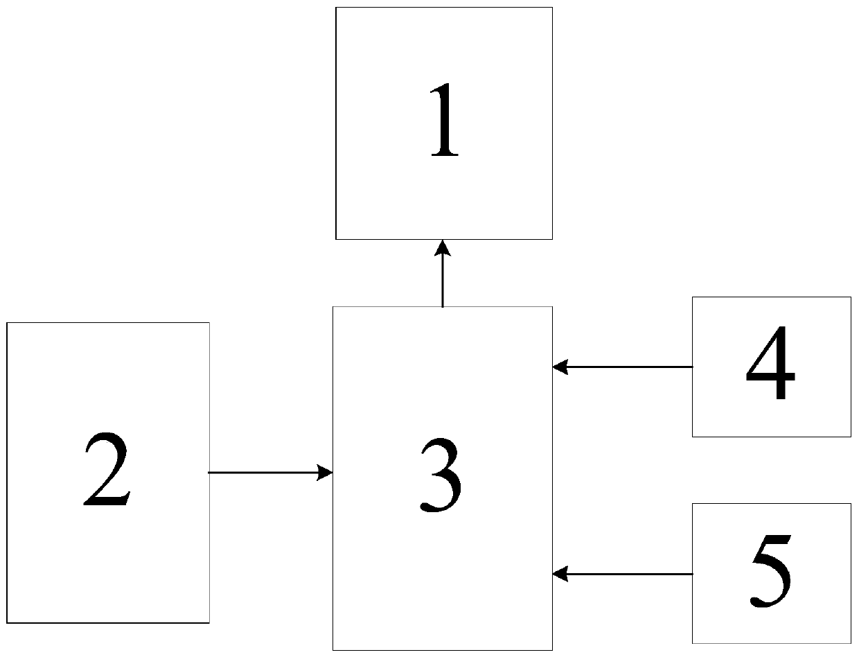
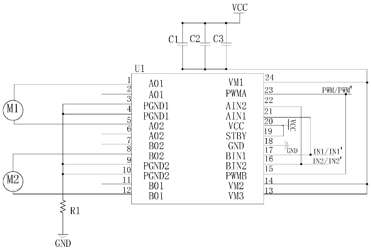
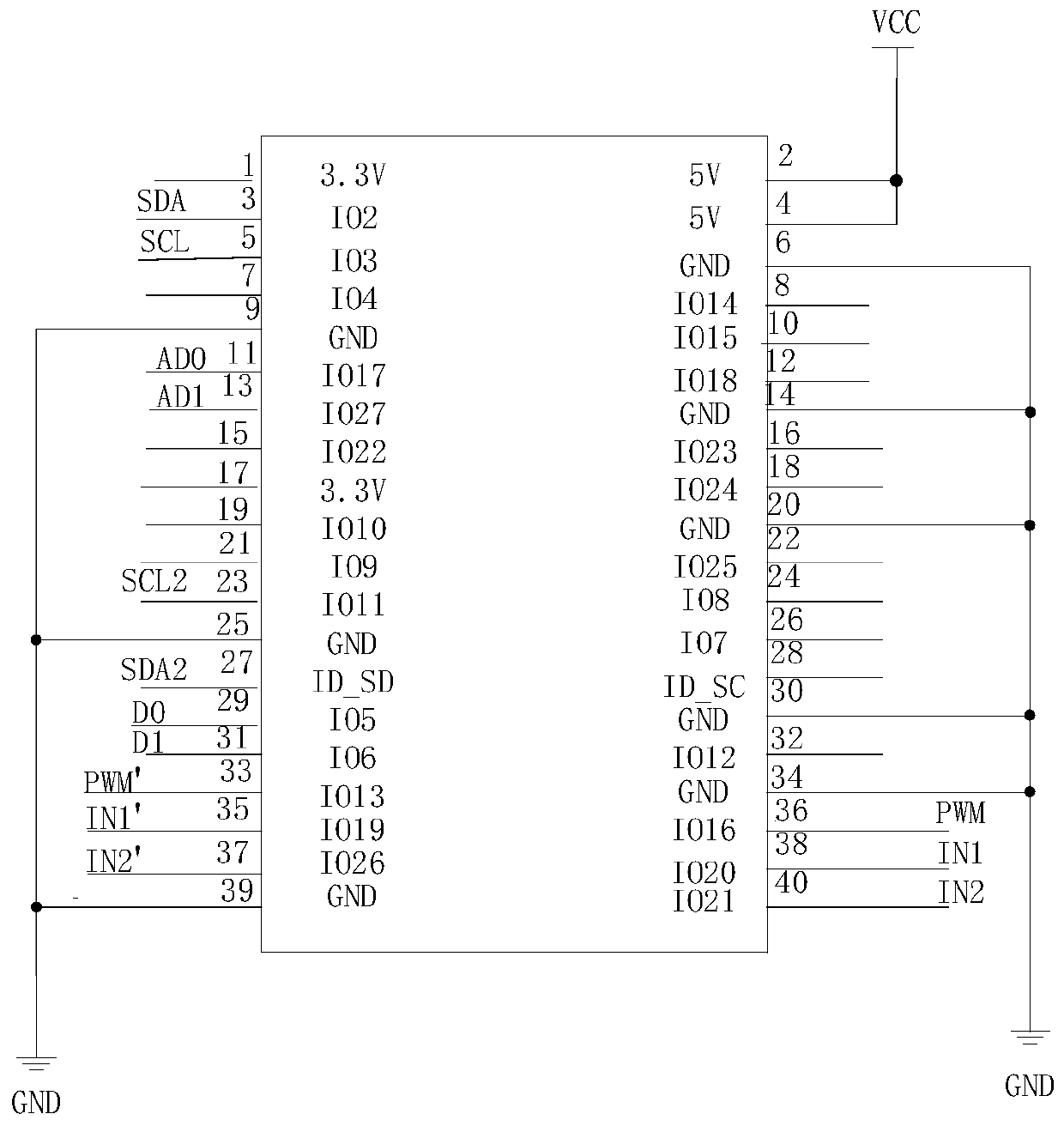
[0035] Such as figure 1 As shown, a map construction method of a LiDAR car in a complex slope environment, the LiDAR car used includes a LiDAR sensor 2, a gyroscope 4, a DC power supply module 5, a control module 3, a motor drive circuit 1 and a car chassis . Both the laser radar sensor 2 and the gyroscope 4 are installed on the laser radar car. The main body of the trolley includes the body, wheels and motor. The four wheels are mounted on the bottom of the body and driven by motors to power the lidar car. The motor is controlled by the control module 3 . The DC power supply module 5 adopts a lithium-ion battery to supply power for the laser radar sensor 2, the gyroscope 4, the control module 3 and the motor. The model of the gyroscope is MPU-6050.

[0036] The gyroscope 4 senses angle information and acceleration information, and transmits the data to the control mo...


PUM


Abstract

The invention discloses a map construction method of a laser radar trolley in a complex slope environment, and aims to solve the problem that the SLAM composition and autonomous navigation capabilityof complex laser radar is poor. Firstly, laser radar data is preprocessed, and data exceeding the effective range of a laser radar is eliminated. Then, predicted navigation information of a laser radar trolley is recursively derived according to the data of an accelerometer and a gyroscope and is transmitted to a slope algorithm for laser radar data correction, and Kalman fusion filtering is performed to obtain the navigation information of the laser radar trolley. Finally, an environment map is updated according to the filtered navigation information of the laser radar trolley. In a complex slope environment, through the SLAM method disclosed by the invention, laser radar navigation information with higher precision can be obtained, and an accurate map can be drawn.

Description

technical field [0001] The invention belongs to the technical field of automatic control, and in particular relates to a map construction method for a laser radar car in an environment with a slope. Background technique [0002] With the advent of the modern era, global satellite navigation systems (GNSS) represented by the US Global Positioning System (GPS), China's Beidou System (BDS), the European Union's Galileo system (Galileo), and Russia's GLONASS system (GLONASS) are rapidly developing. With the development, the outdoor positioning technology attached to the global satellite navigation system has gradually developed and matured, making great contributions to human production, life and social development. However, with the economic development in recent years, more and more production activities are carried out indoors. Compared with the outdoor environment, the GNSS system in the indoor environment cannot well meet people's needs for free navigation and positioning. ...

Claims


Application Information

Patent Timeline
IPC IPC(8): G01S17/89
CPCG01S17/89
Inventor 张文剑叶霞王李冬王玉槐王婧杨越孙亚萍邵壮壮孟龄昊
Owner HANGZHOU NORMAL UNIV QIANJIANG COLLEGE
Why Eureka
Try Eureka