
Rapid and efficient visible light remote sensing image sea-land accurate segmentation method

A remote sensing image and visible light technology, applied in image analysis, neural learning methods, image enhancement and other directions, can solve the problems of low accuracy, many artificial wrong judgments and missed judgments, and high efficiency, to improve accuracy and speed, and parameter adaptation. Powerful and efficient effects

Pending Publication Date: 2020-09-04
王程
View PDF0 Cites 2 Cited by
  • Summary
  • Abstract
  • Description
  • Claims
  • Application Information

AI Technical Summary

Problems solved by technology

[0011] Aiming at the deficiencies of the prior art, the fast and efficient sea and land precise segmentation method of the visible light remote sensing image provided by the present invention solves the problem that the manual detection process in the prior art consumes a lot of manpower and material resources, and the interpretation speed is slow, the accuracy is low, and manual misjudgments and missed judgments are solved. There are many shortcomings, the sea and land segmentation effect is good, the efficiency is high, and the cost is low
Aiming at the problems of high computational complexity and many adjustable parameters of the existing neural network model, a pulse-coupling optimization neural network model is proposed. The pulse-coupling optimization neural network model has the characteristics of the human visual system by introducing Weber-Fechner's law. Aiming at the problem that the structure of the pulse-coupled neural network model in the existing technology is too complicated, there are many parameters and manual intervention is required, a pulse-coupled optimization neural network parameter automatic setting is proposed, and it has been better applied in the sea-land segmentation of visible light remote sensing images, and the parameter self-adaptive ability Stronger, no need to pre-delineate the range of image characteristics, which improves the accuracy and speed of sea and land segmentation of remote sensing images

Method used


Image

  • Rapid and efficient visible light remote sensing image sea-land accurate segmentation method
  • Rapid and efficient visible light remote sensing image sea-land accurate segmentation method
  • Rapid and efficient visible light remote sensing image sea-land accurate segmentation method

Examples


Embodiment Construction

[0068] The technical solution of the fast and efficient visible light remote sensing image sea and land accurate segmentation method provided by the present invention is further described below with reference to the accompanying drawings, so that those skilled in the art can better understand the present invention and implement it.

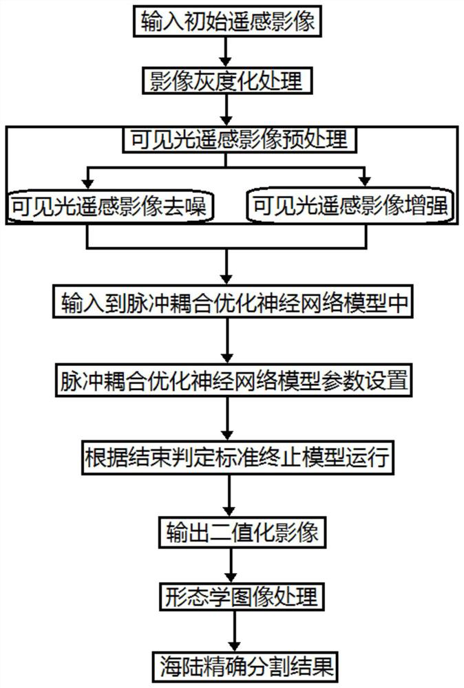
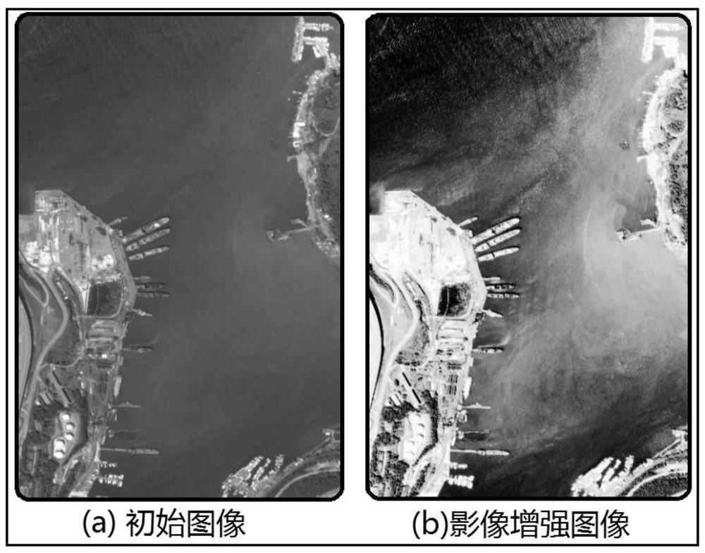
[0069] The fast and efficient visible light remote sensing image sea and land accurate segmentation method provided by the present invention is based on pulse coupling optimization neural network to perform sea and land segmentation on visible light remote sensing images. The schematic flowchart is as follows: figure 1 shown. First, the input initial remote sensing image is subjected to image grayscale processing, and then the visible light remote sensing image preprocessing is performed. The visible light remote sensing image preprocessing includes visible light remote sensing image denoising and visible light remote sensing image enhancement. In...


PUM


Abstract

The rapid and efficient visible light remote sensing image sea-land accurate segmentation method provided by the invention overcomes the defects that a large amount of manpower and material resourcesare consumed in a manual detection process, the interpretation speed is low, the accuracy is low, and many manual misjudgments and missed judgments exist, and is good in sea-land segmentation effect,relatively high in efficiency and relatively low in cost. In order to solve the problem that a neural network model in the prior art is high in calculation complexity and the adjustable parameters aremany, a pulse coupling optimization neural network model is provided and has the characteristics of a human vision system; in order to solve the problem that in the prior art, a pulse coupling neuralnetwork model structure is too complex, is large in the number of parameters and needs manual intervention, pulse coupling optimization neural network parameter automatic setting is provided, the method is well applied to visible light remote sensing image sea-land segmentation, the parameter adaptive capacity is high, the image characteristic range does not need to be defined in advance, and theaccuracy and speed of remote sensing image sea-land segmentation are improved.

Description

technical field [0001] The invention relates to a remote sensing image sea and land segmentation method, in particular to a fast and efficient visible light remote sensing image sea and land precise segmentation method, and belongs to the technical field of image sea and land segmentation. Background technique [0002] China has a vast territory, and at the same time has the characteristics of a long coastline and a large sea area, and has very rich marine resources. It is increasingly difficult for the state to manage the administrative management and safety monitoring of the boundary area between the ocean and land, and the requirements for related technologies are also increasing. high. Vessel detection and monitoring in sea and land image segmentation is an important safety management task for countries with coastlines in the world. It can effectively monitor vessels entering my country's waters and determine the location of vessels. Sea and land image segmentation can ...

Claims


Application Information

Patent Timeline
IPC IPC(8): G06T7/11G06N3/04G06N3/08G06T5/00G06T5/40G06T7/90G06N3/06
CPCG06T7/11G06T7/90G06N3/082G06T5/40G06N3/061G06T2207/10032G06T2207/20024G06T2207/20084G06N3/045G06T5/70
Inventor 王程何克慧
Owner 王程
Learn More