Urban main and auxiliary center boundary identification method based on population raster data

A raster data, boundary recognition technology, applied in data processing applications, special data processing applications, instruments, etc., can solve the problems of high data acquisition difficulty and complex operation

Pending Publication Date: 2020-10-27
SOUTHEAST UNIV
View PDF0 Cites 4 Cited by
  • Summary
  • Abstract
  • Description
  • Claims
  • Application Information

AI Technical Summary

Problems solved by technology

However, the non-parametric method often requires more detailed urban basic data and pre-delineates the CBD

Method used


Image

  • Urban main and auxiliary center boundary identification method based on population raster data
  • Urban main and auxiliary center boundary identification method based on population raster data
  • Urban main and auxiliary center boundary identification method based on population raster data

Examples


Embodiment Construction

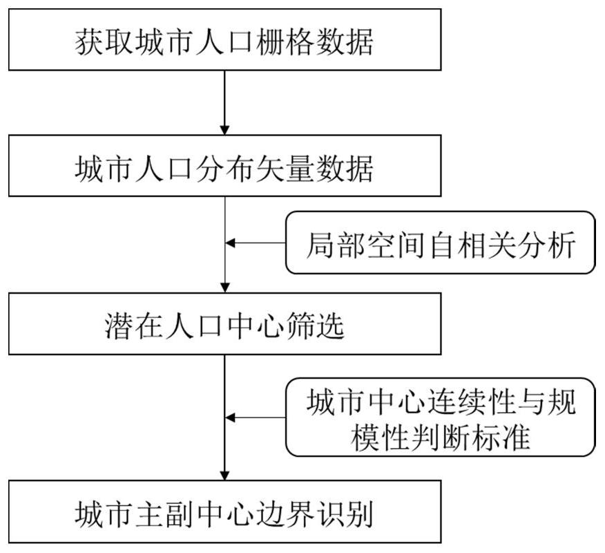
[0033] like figure 1 As shown, a method for identifying the boundaries of major and sub-centers of a city based on population raster data includes the following steps:

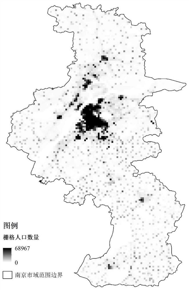
[0034] (1) Extract the population raster data of the cities studied from the free and open global population raster datasets such as LandScan and WorldPop;

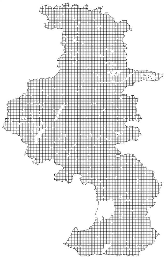
[0035] (2) import the urban population raster data obtained in step (1) into ArcGIS software for preprocessing, and generate vector data of urban population distribution for further analysis;

[0036] (3) Carry out local spatial autocorrelation analysis on the urban population distribution vector data generated in step (2), obtain the spatial clustering characteristics of urban population distribution, and screen out population grids with high-high (HH) attribute values Regions serve as potential city centers, and the boundaries of the composed regions serve as potential city center boundaries;

[0037] (4) Combined with the continuity and scale require...


PUM


Abstract

The invention discloses an urban main and auxiliary center boundary identification method based on population raster data, and the method comprises the following steps: firstly obtaining urban population raster data, importing the urban population raster data into ArcGIS software, carrying out the preprocessing of the urban population raster data, and generating the vector data of urban populationdistribution; secondly, performing local space autocorrelation analysis on the urban population distribution vector data generated in the previous step, and selecting an area formed by population grids with high-high attribute values as a potential urban center; thirdly, according to continuity and large-scale requirements of the urban center range, screening areas meeting the requirements from the potential urban centers recognized in the last step to serve as urban centers, wherein the area with the largest population number serves as a main center, and the rest are auxiliary centers. According to the invention, the boundaries of the main and auxiliary centers of the city are identified by depending on the free open population raster data; the method has the characteristics of low cost,easy operation and high speed, and scientific and reasonable demarcation of the boundary of the city center in city planning is facilitated.

Description

technical field [0001] The invention relates to the technical field of urban planning data analysis, in particular to a method for identifying the boundaries of major and sub-centers of a city based on population raster data. Background technique [0002] With the rapid advancement of my country's urbanization process, urban space continues to expand outwards, and a series of "urban diseases" such as traffic congestion, sharp reduction of cultivated land and open space, and environmental pollution have emerged. Against this background, urban research at home and abroad pays close attention to the study of urban spatial development models, hoping to find a spatial structure model that is conducive to urban sustainable development. The research on the impact of these factors has become the focus of scholars' attention. Among them, the identification of urban polycenters is the premise and basis for carrying out research on urban polycentric spatial structure, and improving th...

Claims


Application Information

Patent Timeline
IPC IPC(8): G06Q50/26G06F30/20
CPCG06Q50/26G06F30/20
Inventor 李迎成李金刚涂曼娅
Owner SOUTHEAST UNIV
Why Eureka
Try Eureka