Urban green land high-resolution remote sensing monitoring method and system
A technology of remote sensing monitoring and green space, applied in neural learning methods, instruments, biological neural network models, etc., can solve problems such as poor model generalization ability, lack of spectral information, and model misclassification
- Summary
- Abstract
- Description
- Claims
- Application Information
AI Technical Summary
Problems solved by technology
Method used
Image
Examples
Embodiment Construction
[0039] The present invention will be described below in conjunction with the accompanying drawings.
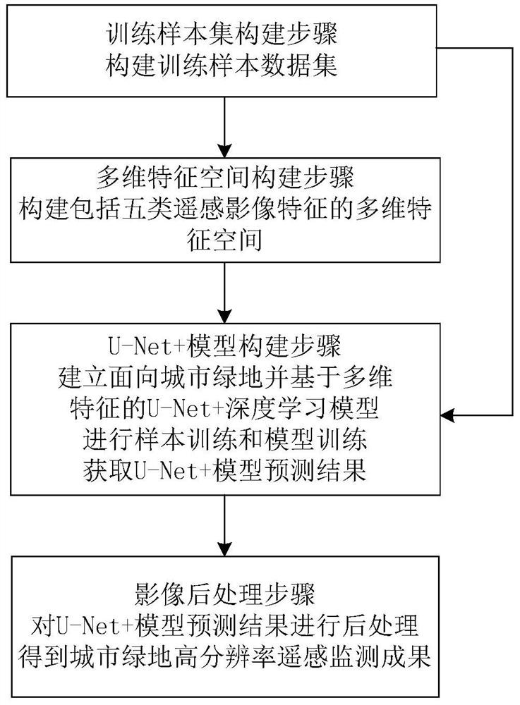
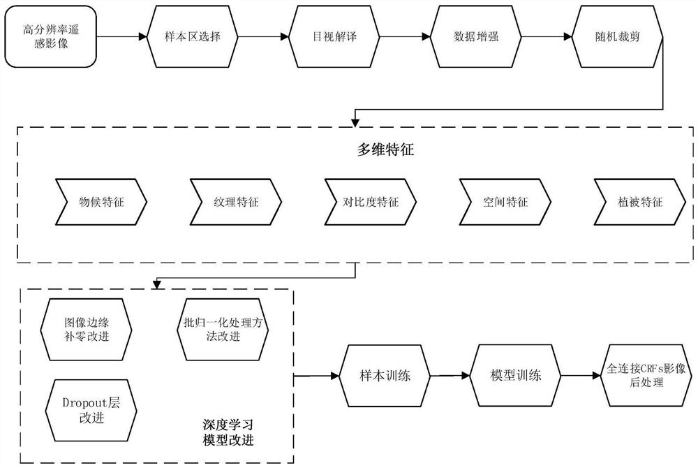
[0040] The present invention relates to a kind of high-resolution remote sensing monitoring method of urban green space, and its process is as follows figure 1 As shown, it includes: the training sample set construction step, for the high-resolution remote sensing image features, select the sample area and construct the training sample data set in the sample area; the multi-dimensional feature space construction step, the training sample data set is subjected to data enhancement, random cropping and Feature calculation processing, that is to say, perform feature calculation processing on the training sample data set after data enhancement and random cropping processing, and construct a multi-dimensional feature space including five types of features including vegetation features, spatial features, contrast features, texture features and phenological features ; By constructing ...
PUM
 Abstract
Description
Claims
Application Information
 - R&D
- Intellectual Property
- Life Sciences
- Materials
- Tech Scout
- Unparalleled Data Quality
- Higher Quality Content
- 60% Fewer Hallucinations
Browse by: Latest US Patents, China's latest patents, Technical Efficacy Thesaurus, Application Domain, Technology Topic, Popular Technical Reports.
© 2025 PatSnap. All rights reserved.Legal|Privacy policy|Modern Slavery Act Transparency Statement|Sitemap|About US| Contact US: help@patsnap.com


