

Surveying and mapping device for geological information acquisition
A technology of surveying and mapping device and geographic information, applied in surveying device, surveying and mapping and navigation, surveying instrument, etc., can solve the problems of slow progress of surveying and mapping, blurred surveying and mapping mirror surface, increasing the time of instrument transfer, etc., so as to improve the efficiency of surveying and mapping, improve surveying and mapping environment, the effect of improving accuracy
- Summary
- Abstract
- Description
- Claims
- Application Information
AI Technical Summary
Problems solved by technology
Method used
Image

Examples
Embodiment Construction
[0040] In order to make the technical means, creative features, goals and effects achieved by the present invention easy to understand, the present invention will be further described below in conjunction with specific embodiments.
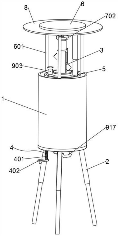
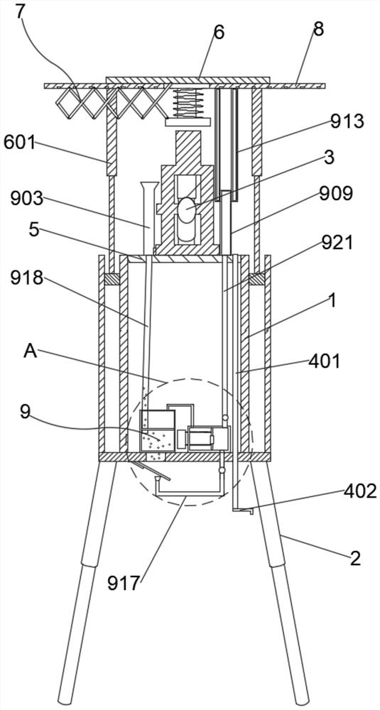
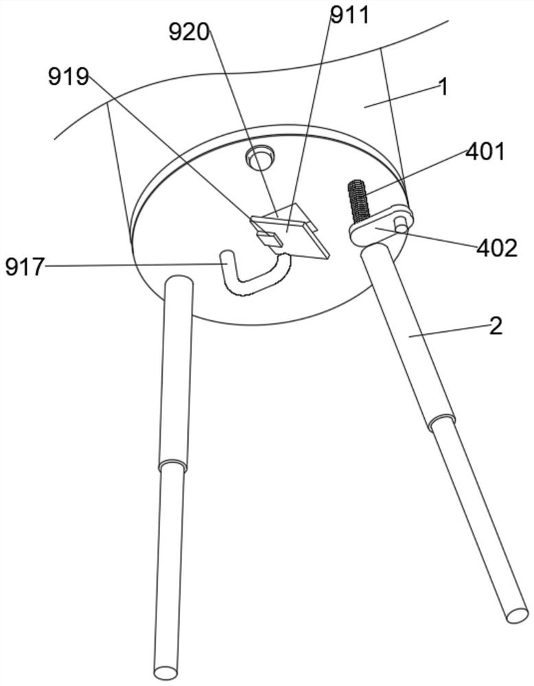
[0041] Such as Figure 1 to Figure 11 As shown, the present invention provides a surveying and mapping device for geographic information collection, which can improve the surveying and mapping environment and improve the efficiency of surveying and mapping transitions. specific:
[0042] The surveying device includes a protective cover 1 , a telescopic tripod 2 and a measuring instrument 3 . Both the measuring instrument 3 and the telescopic tripod 2 can be telescopically placed inside the protective cover 1 .
[0043] Wherein, the protective cover 1 is used as a protective device for the surveying instrument 3, and the surveying instrument 3 can be retracted to its inside when the surveying and mapping is changed, and the surveying instrument 3...
PUM
 Abstract
Description
Claims
Application Information