

On-satellite rapid calculation method and system suitable for multiple time windows of ground detection tasks
A fast calculation, multi-time technology, applied in the field of ground detection, can solve the problem that the modeling method needs to be improved, and achieve the effect of simple algorithm, low computational complexity, and narrowing of the search range.
- Summary
- Abstract
- Description
- Claims
- Application Information
AI Technical Summary
Problems solved by technology
Method used
Image

Examples
Embodiment Construction
[0028] The present invention will be described in detail below in conjunction with specific embodiments. The following examples will help those skilled in the art to further understand the present invention, but do not limit the present invention in any form. It should be noted that those skilled in the art can make several changes and improvements without departing from the concept of the present invention. These all belong to the protection scope of the present invention.
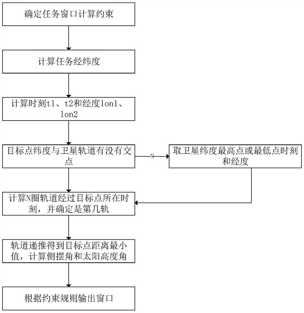
[0029] Such as Figure 1-2 As shown, according to the present invention, a method suitable for on-board rapid calculation of multiple time windows for earth exploration missions includes: step S1: determine the calculation constraints of the mission window; step S2: calculate the coordinates of the longitude and latitude of the mission in the J2000 system; Step S3: Calculate the time parameter and longitude parameter when the first orbit of the satellite passes the latitude of the target point after the...
PUM
 Abstract
Description
Claims
Application Information