Correction method and device for laser radar, and environment sensing system

A technology of laser radar and correction method, which is applied in the direction of measuring device, radio wave measuring system, and utilization of re-radiation, can solve the problems of unable to collect point cloud data for a long time and huge energy consumption, so as to reduce energy consumption and improve work performance , the effect of quality assurance

Active Publication Date: 2020-11-20
HESAI TECH CO LTD
View PDF0 Cites 1 Cited by
  • Summary
  • Abstract
  • Description
  • Claims
  • Application Information

AI Technical Summary

Problems solved by technology

However, the continuous high output laser power of the lidar will accumulate huge e

Method used


Image

  • Correction method and device for laser radar, and environment sensing system
  • Correction method and device for laser radar, and environment sensing system
  • Correction method and device for laser radar, and environment sensing system

Examples


Embodiment Construction

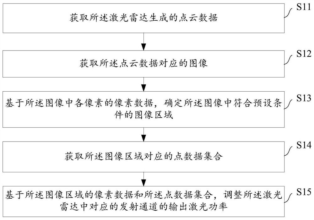
[0081] The invention provides a correction method, which is applied to laser radar. After determining the image area in the collected image that meets the preset conditions, a point data set matching the image area can be obtained, and based on the image area's The pixel data and point data are set to adjust the output laser power of the corresponding transmission channel in the laser radar, so the energy consumption of the laser radar can be reduced, and the working performance of the laser radar can be effectively improved.

[0082] In order to enable those skilled in the art to more clearly understand and implement the concept, implementation and advantages of the present invention, the following describes in detail through specific application scenarios with reference to the accompanying drawings.

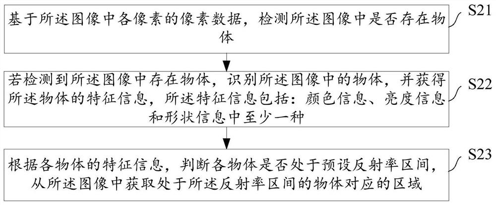
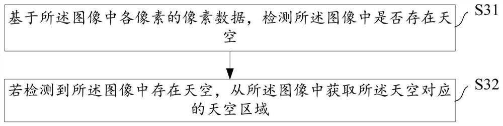
[0083] In an application scenario, LiDAR can be used as a sensor in the environment perception system. LiDAR can calculate the physical information of the object, such as distan...


PUM


Abstract

The invention discloses a correction method and device for a laser radar, and an environment sensing system. The correction method comprises the steps: obtaining point cloud data generated by the laser radar; acquiring an image corresponding to the point cloud data; determining an image area meeting a preset condition in the image based on the pixel data of each pixel in the image; obtaining a point data set corresponding to the image area; and adjusting the output laser power of a corresponding transmitting channel in the laser radar based on the pixel data of the image area and the point data set. By adopting the scheme, the quality of the point cloud data generated by the laser radar can be effectively guaranteed, the energy consumption of the laser radar can be reduced, and the workingperformance of the laser radar can be improved.

Description

technical field [0001] The invention relates to the field of laser radar, in particular to a correction method and device for laser radar, and an environment perception system. Background technique [0002] At present, the laser radar can calculate the physical information of the object through the detection signal sent to the object and the echo signal reflected by the object, such as distance information, orientation information, height information, speed information, attitude information, etc. These physical information form a three-dimensional space Point data of information, a large amount of point data can be processed to generate three-dimensional point cloud data, so as to realize the purpose of target object recognition, parameter measurement and motion tracking. [0003] In practical applications, in order to ensure that the lidar has long-distance detection capabilities, the lidar needs to set a higher detection light output laser power and output a higher intensi...

Claims


Application Information

Patent Timeline
IPC IPC(8): G01S7/497G01S17/04G01S17/89
CPCG01S7/497G01S17/04G01S17/89Y02A90/10
Inventor 张程向少卿
Owner HESAI TECH CO LTD
Why Eureka
Try Eureka