

Block chain-based satellite group cooperative operation control planning consensus method
A block chain and planning technology, applied in the field of remote sensing satellites, can solve the problems of long time-consuming ground image processing and information extraction and distribution, lack of independent perception and independent planning capabilities, poor information coordination ability between constellations, etc., to improve information coordination Ability, fast insertion, and the effect of improving consensus efficiency
- Summary
- Abstract
- Description
- Claims
- Application Information
AI Technical Summary
Problems solved by technology
Method used
Image

Examples
Embodiment Construction
[0029] The present invention will be further explained and illustrated below in conjunction with the accompanying drawings of the description.
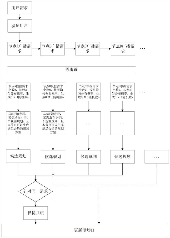
[0030] The present invention proposes a blockchain-based constellation for long-term requirements such as dynamic change monitoring services, autonomous perception and dynamic planning services, collaboration requirements such as the completion of regional coverage by constellation collaboration, and one-time requirements such as single remote sensing image acquisition services. Consensus method for collaborative operation and control planning.
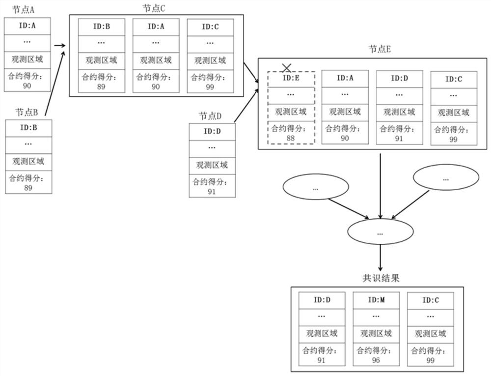
[0031] The core of the block chain in the present invention is the planning chain, and the record chain includes the demand chain.
[0032] like figure 1 As shown, a blockchain-based consensus method for constellation collaborative operation and control planning, the specific steps include:
[0033] (1) Receive user requirements and perform user verification.
[0034] (2) The node that fir...
PUM
 Abstract
Description
Claims
Application Information