
Airport boundary patrol robot local path planning method and system based on Bezier curve

A local path planning and Bezier curve technology, applied in control/regulation systems, instruments, two-dimensional position/channel control, etc., can solve problems such as poor real-time performance and poor optimization performance, and achieve easy control and real-time calculation , the effect of efficient speed planning

Active Publication Date: 2021-01-22
NANJING UNIV OF SCI & TECH
View PDF9 Cites 8 Cited by
  • Summary
  • Abstract
  • Description
  • Claims
  • Application Information

AI Technical Summary

Problems solved by technology

However, most optimization algorithms still have poor real-time performance and poor optimization performance when dealing with environments with multiple obstacles

Method used


Image

  • Airport boundary patrol robot local path planning method and system based on Bezier curve
  • Airport boundary patrol robot local path planning method and system based on Bezier curve
  • Airport boundary patrol robot local path planning method and system based on Bezier curve

Examples


Embodiment Construction

[0048]In order to make the purpose, technical solution and advantages of the present application clearer, the present application will be further described in detail below in conjunction with the accompanying drawings and embodiments. It should be understood that the specific embodiments described here are only used to explain the present application, and are not intended to limit the present application.

[0049] It should be noted that if there is a directional indication (such as up, down, left, right, front, back...) in the embodiment of the present invention, the directional indication is only used to explain the position in a certain posture (as shown in the accompanying drawing). If the specific posture changes, the directional indication will also change accordingly.

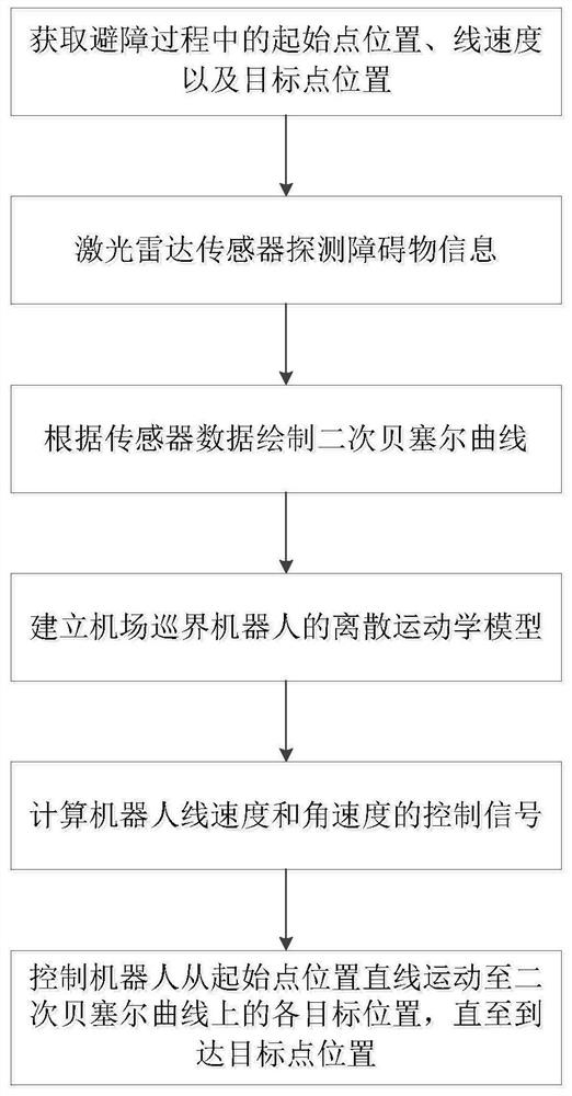
[0050] In one embodiment, combined with figure 1 , provides a kind of local path planning method of airport patrol robot based on Bezier curve, described method comprises the following steps:

[0051] ...


PUM


Abstract

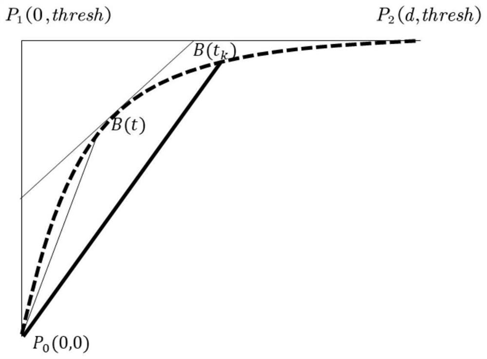
The invention discloses an airport boundary patrol robot local path planning method and system based on a Bezier curve. The method comprises the steps: acquiring the starting point position, the linear speed and the target point position in an obstacle avoidance process of an airport boundary patrol robot; detecting obstacle information by using a laser radar sensor carried by the airport boundarypatrol robot, and drawing a quadratic Bezier curve according to sensor measurement data; and establishing the discrete kinematics model of the airport boundary patrol robot, calculating the control signals of the linear speed and the angular speed of the robot, and controlling the robot to linearly move from the starting point position to each target position on the quadratic Bezier curve by thesignals until the robot reaches the target point position. According to the invention, the influence of the target point direction and the local obstacle position is comprehensively considered, path planning parameters are adjusted, and the robot motion trail is optimized; and a quadratic Bezier curve algorithm is adopted, speed planning is efficiently carried out, real-time calculation is guaranteed, and the pose of the robot during movement is easy to control.

Description

technical field [0001] The invention belongs to the technical field of local path planning, and in particular relates to a local path planning method and system for an airport patrol robot based on Bezier curves. Background technique [0002] With the continuous development of human society towards intelligence, more and more intelligent robots are used in all walks of life. For the field of mobile robots, path planning has always been the focus of research. Local obstacle avoidance path planning refers to providing the robot with the task of reaching a specific target point in an environment with obstacles in the local area. [0003] The existing path algorithms for local obstacle avoidance include circular expansion method, fuzzy control method, artificial potential field method, vector field histogram method and so on. But the above algorithm has some defects, such as the artificial potential field algorithm is easy to fall into the local minimum and cannot move to the ...

Claims


Application Information

Patent Timeline
Patent Type & Authority Applications(China)
IPC IPC(8): G05D1/02
CPCG05D1/024G05D1/0223
Inventor 赵栩鹤张天亮田庆郭健
Owner NANJING UNIV OF SCI & TECH
Learn More