Pipeline high-consequence area dynamic identification method based on image identification
A technology of dynamic recognition and image recognition, applied in the field of pipeline management, can solve problems such as difficulty in dynamic recognition with high consequence degree
- Summary
- Abstract
- Description
- Claims
- Application Information
AI Technical Summary
Problems solved by technology
Method used
Image

Examples
Embodiment 1
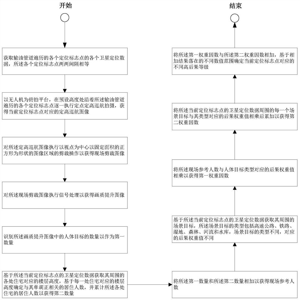
[0049] figure 1 It is a flow chart of the steps of the method for dynamically identifying high-consequence areas of pipelines based on image recognition according to Embodiment 1 of the present invention.
[0050] Such as figure 1 As shown, the image recognition-based dynamic identification method for pipeline high-consequence areas includes:
[0051] Obtain each satellite positioning data of each positioning marker point traversed by the oil pipeline, and each pair of each positioning marker point is equally spaced;
[0052]Using the UAV as the overhead shooting platform, perform fixed-point and fixed-altitude cruise shooting one by one along each positioning mark point traversed by the oil pipeline at a preset height, and obtain the fixed-altitude cruise image corresponding to the current positioning mark point;
[0053] Performing a clipping operation on the fixed-altitude cruise image with the viewpoint as the center and an image area in the shape of a square with a fixe...
Embodiment 2
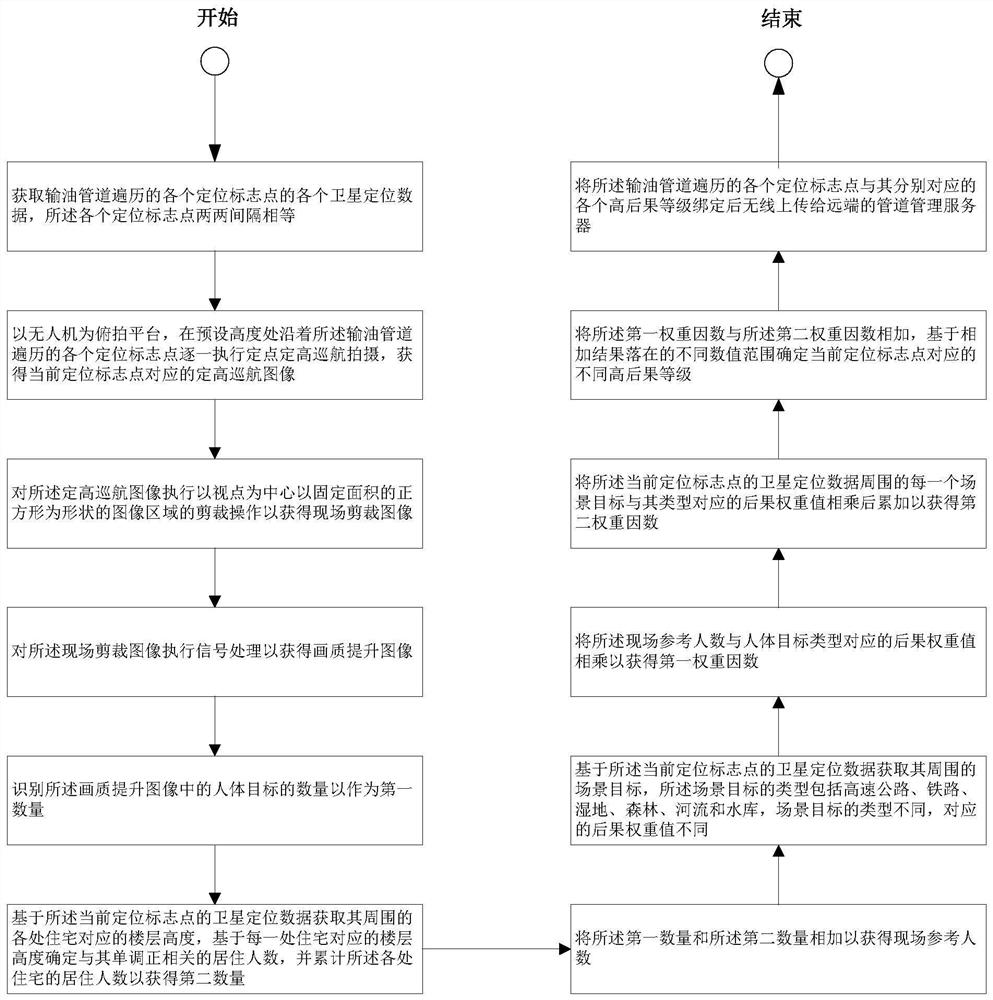
[0065] image 3 It is a flow chart of the steps of the method for dynamically identifying high-consequence areas of pipelines based on image recognition according to Embodiment 2 of the present invention.
[0066] Such as image 3 As shown, the image recognition-based dynamic identification method for pipeline high-consequence areas also includes:
[0067] After binding each positioning marker point traversed by the oil pipeline with each corresponding high consequence level, it wirelessly uploads it to the remote pipeline management server.
[0068] For example, the pipeline management server can be selected as a cloud storage server, a big data server, and other network-side servers. The cloud storage server can be a single network node, or multiple network nodes set in parallel. The big data server can also be a single network node, or multiple network nodes of multiple parallel devices.
Embodiment 3
[0070] Figure 4 It is a flow chart of the steps of the method for dynamically identifying high-consequence areas of pipelines based on image recognition according to Embodiment 3 of the present invention.
[0071] Such as Figure 4 As shown, the image recognition-based dynamic identification method for pipeline high-consequence areas also includes:
[0072] The pipeline management server stores the binding data of each oil pipeline together with the number of the oil pipeline in the preserved pipeline database;
[0073] Wherein, the pipeline management server has a built-in database storage unit and a wireless transceiver unit, and the wireless transceiver unit is electrically connected to the database storage unit;
[0074] Wherein, a two-way wireless communication link is established between the wireless transceiver unit and the wireless communication interface of the drone.
[0075] Wherein, the database type of the database storage unit can be a Mysql database, a SqlSe...
PUM
 Abstract
Description
Claims
Application Information
 - R&D
- Intellectual Property
- Life Sciences
- Materials
- Tech Scout
- Unparalleled Data Quality
- Higher Quality Content
- 60% Fewer Hallucinations
Browse by: Latest US Patents, China's latest patents, Technical Efficacy Thesaurus, Application Domain, Technology Topic, Popular Technical Reports.
© 2025 PatSnap. All rights reserved.Legal|Privacy policy|Modern Slavery Act Transparency Statement|Sitemap|About US| Contact US: help@patsnap.com