Unmanned aerial vehicle for surveying and mapping aerial photography
A drone and aerial photography technology, applied in the field of drones, can solve problems such as reducing stability, and achieve the effect of ensuring shooting pictures, precise control, high speed and maneuverability
- Summary
- Abstract
- Description
- Claims
- Application Information
AI Technical Summary
Problems solved by technology
Method used
Image
Examples
Embodiment Construction
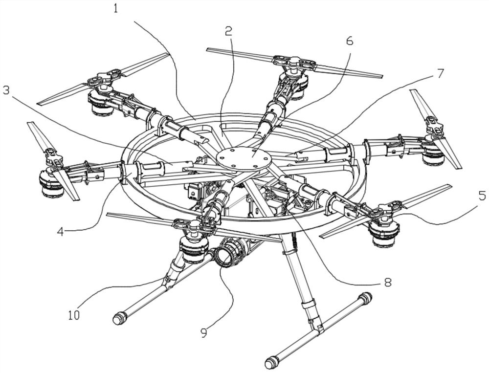
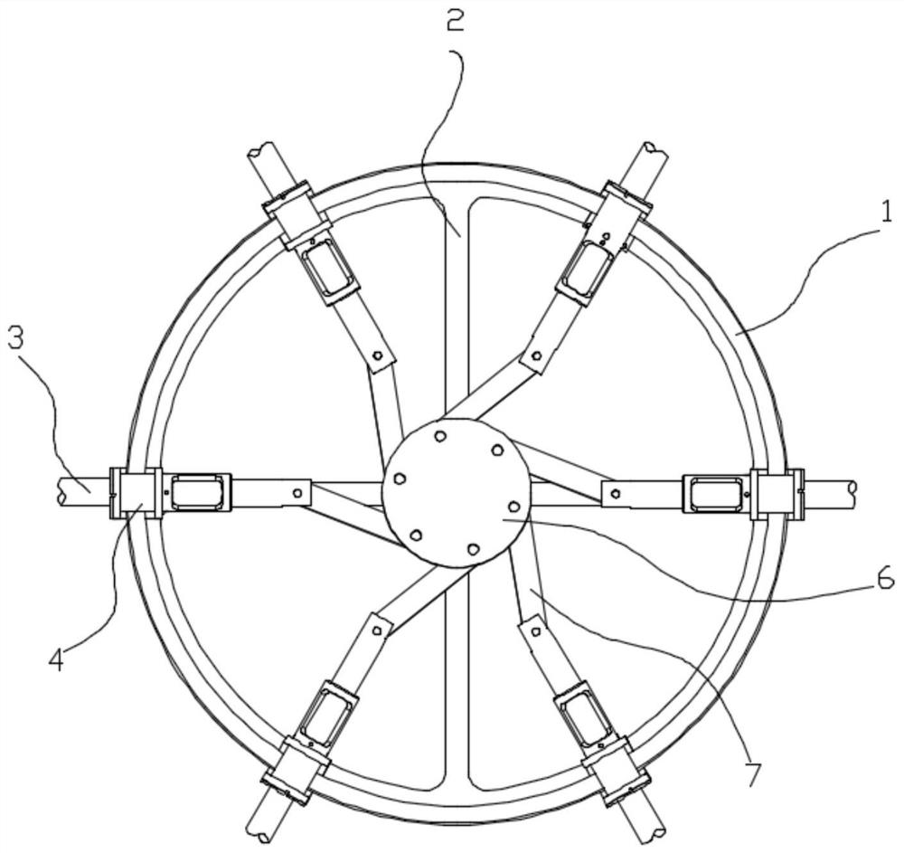
[0027] see figure 1 , in an embodiment of the present invention, an unmanned aerial vehicle for surveying, mapping and aerial photography includes a frame ring 1, a propeller arm 3, and a propeller assembly 5, wherein, there are multiple Spokes 2, six piston sleeves 4 are uniformly distributed on the upper circumference of the frame ring 1, the axis of the piston sleeves 4 points to the center of the frame ring 1, and a coaxial A slidingly fitted propeller arm 3, the end of the propeller arm 3 away from the center of the circle is provided with a propeller assembly 5;
[0028] The underside of the frame ring 1 is fixed with an undercarriage 10 through the spokes 2 , the undercarriage 10 is provided with a battery flight control device 8 , and the center under the undercarriage 10 is provided with a camera pan-tilt device 9 .
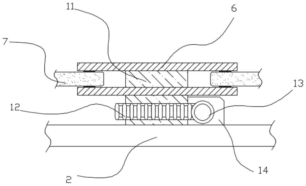
[0029] see figure 1 and figure 2 , in this embodiment, the center of the spoke 2 is rotatably provided with a turntable 6, the edge of the turntable...
PUM
 Abstract
Description
Claims
Application Information
 - R&D
- Intellectual Property
- Life Sciences
- Materials
- Tech Scout
- Unparalleled Data Quality
- Higher Quality Content
- 60% Fewer Hallucinations
Browse by: Latest US Patents, China's latest patents, Technical Efficacy Thesaurus, Application Domain, Technology Topic, Popular Technical Reports.
© 2025 PatSnap. All rights reserved.Legal|Privacy policy|Modern Slavery Act Transparency Statement|Sitemap|About US| Contact US: help@patsnap.com


