

Spatial data indexing method based on GeoSOT global subdivision grid coding
A grid coding and spatial data technology, applied in database indexing, structured data retrieval, database update, etc., can solve the problems of cross-departmental data sharing, difficult data fusion, low efficiency, and inconsistent data formats
- Summary
- Abstract
- Description
- Claims
- Application Information
AI Technical Summary
Problems solved by technology
Method used
Image

Examples
Embodiment Construction
[0055] In order to enable those skilled in the art to better understand the solutions of the present application, the technical solutions in the embodiments of the present application will be clearly and completely described below in conjunction with the drawings in the embodiments of the present application.
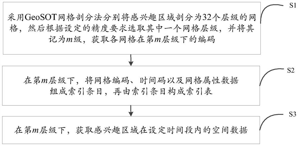
[0056] Such as figure 1 As shown, a spatial data index method based on GeoSOT global subdivision grid coding, including the following steps:
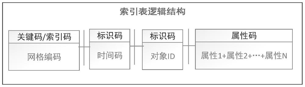
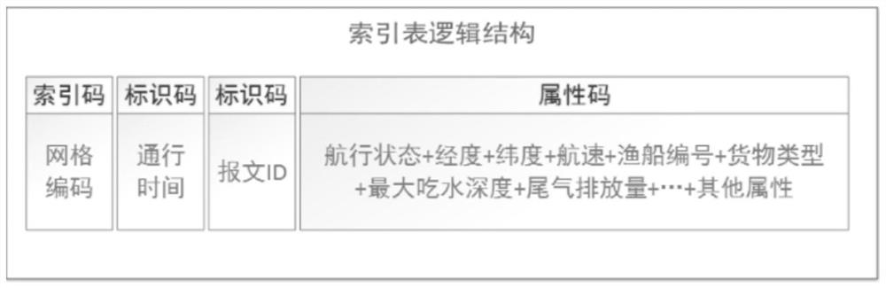
[0057] S1: Use the GeoSOT grid subdivision method to divide the whole world into 32 levels of grids. Among them, the larger the level of the grid, the higher the corresponding accuracy, and then select one of the grids according to the set accuracy requirements level, and record it as m level, and obtain the code of each grid under the mth level.
[0058] That is to say, the GeoSOT grid division scheme recursively divides the earth’s surface space according to the quadtree to form a uniform multi-level grid ranging from global t...
PUM
 Abstract
Description
Claims
Application Information