

InSAR atmospheric delay correction method assisted by GNSS chromatography technology
An atmospheric delay and technical technology, applied in the direction of radio wave reflection/re-radiation, instruments, measuring devices, etc., can solve problems such as inconsistency in observation time, achieve the effect of solving inconsistency in observation time, avoiding estimation errors, and high-precision correction
- Summary
- Abstract
- Description
- Claims
- Application Information
AI Technical Summary
Problems solved by technology
Method used
Image

Examples
Embodiment Construction
[0046] The following will clearly and completely describe the technical solutions in the embodiments of the present invention with reference to the accompanying drawings in the embodiments of the present invention. Obviously, the described embodiments are only some, not all, embodiments of the present invention. Based on the embodiments of the present invention, all other embodiments obtained by those skilled in the art without creative efforts fall within the protection scope of the present invention.
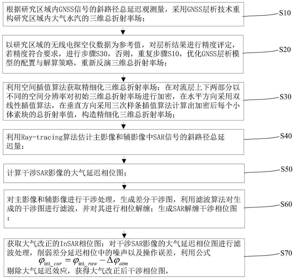
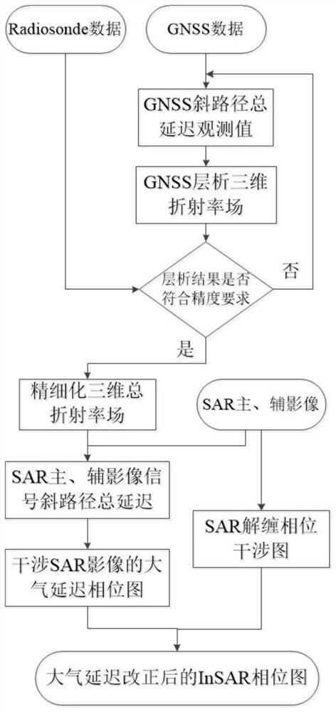
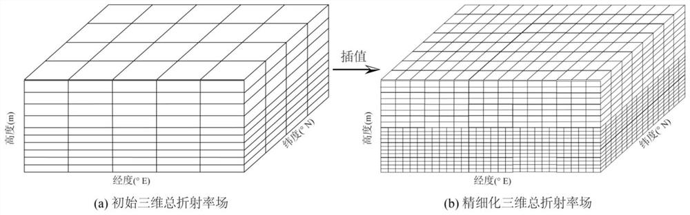
[0047] This embodiment provides an InSAR atmospheric delay correction method assisted by GNSS tomographic technology, such as Figure 1~2 As shown, it includes the following steps: S10 uses GNSS tomographic technology to reconstruct the three-dimensional total refractive index field of atmospheric water vapor in the research area according to the total delay observation of the oblique path of the GNSS signal in the research area. S20 uses the radiosonde data in the research ar...
PUM
 Abstract
Description
Claims
Application Information