Drilling geological detection system and overlying strata comprehensive fracture angle and caving form actual measurement methods
A technology for geological detection and overlying rock, which is applied in radio wave measurement systems, measuring devices, radio wave reflection/reradiation, etc., can solve problems such as incomplete and correct reflection of overlying rock fracture forms, and achieve three-dimensional graphic images and actual measurement methods Simple, clear results
- Summary
- Abstract
- Description
- Claims
- Application Information
AI Technical Summary
Problems solved by technology
Method used
Image
Examples
Embodiment 1
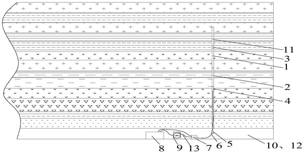
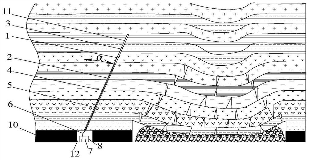
[0039] Example 1, see figure 1 and figure 2 , a method for measuring the comprehensive breaking angle of the overlying strata in coal seam mining, comprising the following steps: the first step is to design the parameters of the pre-detection borehole 11, the borehole 11 is perpendicular to the mining roadway 12, and the included angle with the vertical direction is α, and the depth is designed The second step is to drill to the edge of the goaf according to the design parameters; the third step is to completely assemble the mining drilling geological radar detection system (connect the guide wheel 3, the transmitting antenna 1, the receiving antenna 2, the transmission connection device 4, push rod 5, detection host 8 and depth recorder 7); the fourth step is to set the detection parameters after starting the inspection to confirm that there is a signal connected, and slowly advance to the deep part of the borehole 11 for detection until it is pushed to the bottom of the bor...
Embodiment 2
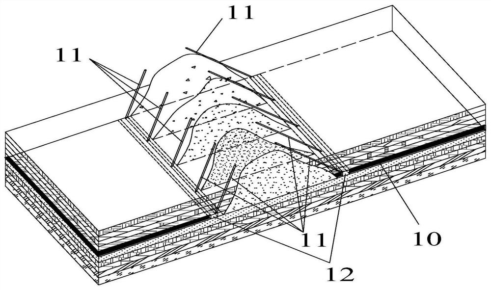
[0040] Example 2, see image 3, a method for measuring the spatial form of overlying rock collapse in a coal seam mining goaf, comprising the following steps: the first step, designing the parameters (inclination angle, hole depth, aperture, quantity); in the second step, according to the design parameters in the mining roadway 12, drilling is carried out to the edge area of the goaf; in the third step, the complete assembly of the mining drilling geological radar detection system (connecting the guide wheel 3, the transmitting antenna 1, Receiving antenna 2, transmission connector 4, push rod 5, detection host 8 and depth recorder 7); the fourth step is to set the detection parameters after starting the inspection to confirm that there is a signal connected, and slowly advance to the deep part of the borehole 11 for detection until the push To the bottom of hole 11 or can not continue to advance, then save the data, turn off the detection host 8, slowly pull out the detecti...
PUM
 Abstract
Description
Claims
Application Information
 - R&D
- Intellectual Property
- Life Sciences
- Materials
- Tech Scout
- Unparalleled Data Quality
- Higher Quality Content
- 60% Fewer Hallucinations
Browse by: Latest US Patents, China's latest patents, Technical Efficacy Thesaurus, Application Domain, Technology Topic, Popular Technical Reports.
© 2025 PatSnap. All rights reserved.Legal|Privacy policy|Modern Slavery Act Transparency Statement|Sitemap|About US| Contact US: help@patsnap.com


