
Vehicle path planning method based on improved bidirectional informed-RRT*

A vehicle path and path technology, applied in vehicle position/route/altitude control, motor vehicle, two-dimensional position/flight control and other directions, can solve the problem that the vehicle cannot reach the target point, cannot meet the vehicle driving requirements, and waste search time. and other problems, to achieve the effect of high path planning efficiency, reducing time consumption and reducing randomness

Active Publication Date: 2021-08-06
HEFEI UNIV OF TECH
View PDF6 Cites 0 Cited by
  • Summary
  • Abstract
  • Description
  • Claims
  • Application Information

AI Technical Summary

Problems solved by technology

However, when the algorithm plans the initial path, there are many useless searches for blank areas, which wastes search time, and the planning efficiency is low, and the planned path cannot meet the requirements of vehicle driving, so that the vehicle cannot reach the target point quickly and effectively.

Method used


Image

  • Vehicle path planning method based on improved bidirectional informed-RRT*
  • Vehicle path planning method based on improved bidirectional informed-RRT*
  • Vehicle path planning method based on improved bidirectional informed-RRT*

Examples


Embodiment Construction

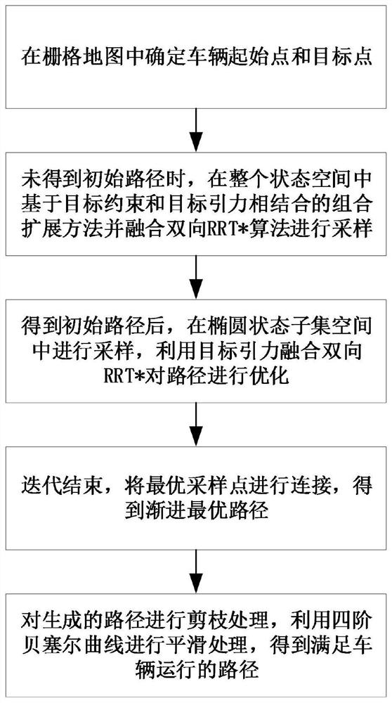
[0061] In this example, if figure 1 As shown, a vehicle path planning method based on the improved two-way informed-RRT* includes the following steps:

[0062] Step 1. Use the vehicle's built-in lidar sensor or depth camera sensor to collect environmental information around the vehicle and use it to build a grid map. Mark each grid in the grid map as obstacle space or free space. After marking Choose a starting point x in the grid map of start and target point x goal ; image 3 and Figure 4 In , the black part is the obstacle space, and the white part is the free space;

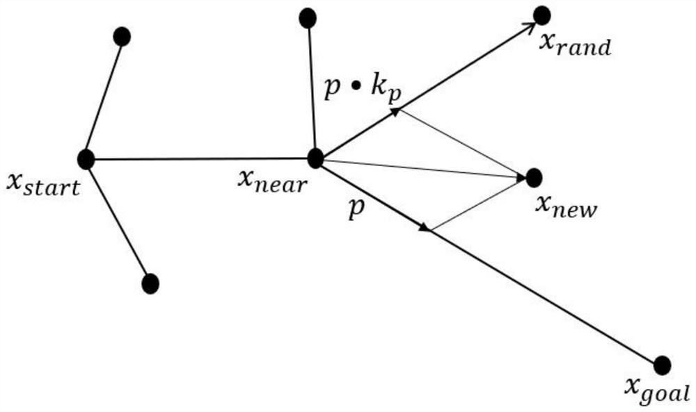
[0063] Step 2. Use the combination expansion strategy combining target constraints and target gravity and integrate the traditional two-way RRT* algorithm to sample in the free space of the grid map to obtain the initial path;

[0064] Step 2.1, define two fast-exploring random trees Ta and Tb;

[0065] Step 2.2. Obtain a new node x of the fast-exploring random tree Ta new_a , to the target point x g...


PUM


Abstract

The invention discloses a vehicle path planning method based on an improved bidirectional informed-RRT *. The method comprises the steps: 1, building a grid map, and determining a starting point and a target point; 2, sampling by utilizing a combined extension strategy and fusing a bidirectional RRT * algorithm to obtain an initial path; 3, obtaining an elliptical state subset space by using an improved bidirectional informed-RRT * algorithm, and obtaining sampling points; 4, optimizing the initial path by using a target gravity fusion bidirectional RRT * algorithm to obtain an optimized path, updating an elliptical region according to the length of the optimized path, and sampling in the updated elliptical region to obtain sampling points; 5, repeating the step 4 to obtain a final path; and 6, after pruning the final path, smoothing by using a fourth-order Bezier curve. Sampling randomness is reduced, convergence efficiency is improved, and the generated path is optimal and meets vehicle dynamic constraints, so that a vehicle can successfully avoid obstacles and quickly reach a target point.

Description

technical field [0001] The invention relates to a vehicle path planning method based on an improved two-way informed-RRT*, belonging to the field of vehicle path planning. Background technique [0002] At present, with the rapid development of unmanned driving technology, path planning, as one of the key technologies of unmanned vehicles, has received more and more attention. The path planning of unmanned vehicles is based on a certain environment model, given the starting point and the target point, successfully planning a collision-free feasible path in free space from the starting point to the target point. [0003] Traditional path planning algorithms include artificial potential field method based on construction potential field, genetic algorithm, Dijkstra and A* based on graph search, etc., but the above algorithms need to model obstacles in a certain space, which is not suitable for complex environment for path planning. Rapid Exploration Random Tree (RRT) uses ran...

Claims


Application Information

Patent Timeline
IPC IPC(8): G05D1/02
CPCG05D1/0236G05D1/024G05D1/0253G05D1/0257G05D1/0276
Inventor 姜平于海涛黄鹤吴润晨汤德江
Owner HEFEI UNIV OF TECH
Learn More