

Beidou GNSS monitoring system layout method based on slope stability state analysis
A stable state and monitoring system technology, applied in the field of geotechnical engineering, can solve the problems of single slope monitoring and monitoring items, and cannot be combined with each other to analyze slope deformation, and achieve the effect of improving monitoring work efficiency and strong applicability
- Summary
- Abstract
- Description
- Claims
- Application Information
AI Technical Summary
Problems solved by technology
Method used
Image

Examples
Embodiment Construction
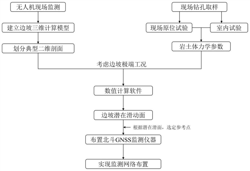
[0028] In order to make the object, technical solution and advantages of the present invention clearer, the present invention will be further described in detail below in conjunction with the accompanying drawings and embodiments. It should be understood that the specific embodiments described here are only used to explain the present invention, not to limit the present invention. In addition, the technical features involved in the various embodiments of the present invention described below may be combined with each other as long as they do not constitute a conflict with each other.
[0029] The first step is to establish a 3D model of the slope
[0030] Use unmanned aerial vehicle photography equipment to take oblique photography of the area where the slope is located, and combine the geological survey drilling data to establish a three-dimensional topographic geological model of the area where the slope is located.
[0031] The second step is to divide the typical two-dime...
PUM
 Abstract
Description
Claims
Application Information