
Urban building three-dimensional automatic modeling and visualization method

An automatic modeling and building technology, applied in the field of three-dimensional modeling of buildings, can solve the problems of building distance and height distortion, and achieve high-fidelity effects

Pending Publication Date: 2021-10-19
天讯方舟(北京)信息科技有限公司
View PDF0 Cites 2 Cited by
  • Summary
  • Abstract
  • Description
  • Claims
  • Application Information

AI Technical Summary

Problems solved by technology

[0004] The purpose of the present invention is to provide a three-dimensional automatic modeling and visualization method of urban buildings to solve the problem of distortion of the distance and height of buildings in the existing three-dimensional automatic modeling of urban buildings proposed in the background technology

Method used


Image

  • Urban building three-dimensional automatic modeling and visualization method

Examples


Embodiment

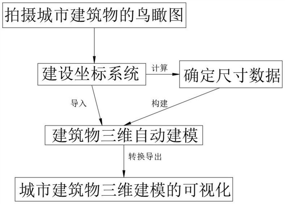
[0024] see figure 1 , the present invention provides a technical solution: a method for automatic three-dimensional modeling and visualization of urban buildings, the method for automatic three-dimensional modeling and visualization of urban buildings is as follows:

[0025] Step 1: Take a bird's-eye view of urban buildings from multiple angles, record the shooting position and angle when shooting, and then use the image recognition system to identify the urban buildings in the bird's-eye view. Through identification, urban buildings can be distinguished, and at the same time distinguish the categories of urban buildings;

[0026] Step 2: Build a city coordinate system and manage the city in a grid, so that it is convenient to accurately determine the location of the building, and then use the beam method aerial triangulation to establish the location coordinates of the city buildings, and bring the location coordinates of the city buildings into the City coordinate system, s...


PUM


Abstract

The invention belongs to the technical field of building three-dimensional modeling, and particularly relates to an urban building three-dimensional automatic modeling and visualization method. The urban building three-dimensional automatic modeling and visualization method comprises the steps of shooting an aerial view of an urban building, building a coordinate system, determining size data, performing three-dimensional automatic modeling of the building and visualizing three-dimensional modeling of the urban building. According to the method, the coordinate system is determined through the existing city coordinate system and the site coordinates of the constructed city building, so that the actual position of the building can be determined, and then the size data of the building is calculated by using the size boundary of the building, so that the size data of the building is determined; and the distance and the height of the building after three-dimensional automatic modeling can have high trueness through accurate size data.

Description

technical field [0001] The invention relates to the technical field of three-dimensional modeling of buildings, in particular to a method for automatic three-dimensional modeling and visualization of urban buildings. Background technique [0002] Three-dimensional modeling of urban buildings is a three-dimensional model made on the basis of two-dimensional geographic information. The use of three-dimensional geographic information can facilitate the analysis of the natural elements and construction elements of the city, and at the same time, it can also facilitate the observer to obtain a real and intuitive feeling of the virtual urban environment. The core content of 3D modeling of urban buildings is to reproduce the 3D space world in digital form and the application simulation in 3D space, so as to meet the needs of various application fields. Buildings are the most important part of a city's 3D simulation model, including houses, roads, pedestrian bridges, bridges, tunne...

Claims


Application Information

Patent Timeline
IPC IPC(8): G06T17/20G06T15/04G06T7/60G06K9/00G06F16/53G06F16/51G06F16/901
CPCG06T17/20G06T15/04G06T7/60G06F16/53G06F16/51G06F16/9027
Inventor 张小辉
Owner 天讯方舟(北京)信息科技有限公司
Learn More