GPS equipment for topographic survey

A technology for GPS equipment and terrain measurement, applied in the field of GPS equipment, can solve problems such as equipment damage and collision, and achieve the effect of slowing down the rebound speed

Inactive Publication Date: 2021-11-02
段超
View PDF0 Cites 0 Cited by
  • Summary
  • Abstract
  • Description
  • Claims
  • Application Information

AI Technical Summary

Problems solved by technology

[0003] At present, GPS devices for topographical surveys on the market need to pass through areas with complex terrain conditions when performing topographical surveys. The bumps on the road surface will easily cause the GPS devices to collide with the box wall in the storage box, and in rainy weather, moisture will pass through the box. The outer gap enters the box, and the moisture accumulated in the box will cause damage to the equipment

Method used


Image

  • GPS equipment for topographic survey
  • GPS equipment for topographic survey
  • GPS equipment for topographic survey

Examples


Embodiment Construction

[0023] The following will clearly and completely describe the technical solutions in the embodiments of the present invention with reference to the accompanying drawings in the embodiments of the present invention. Obviously, the described embodiments are only some, not all, embodiments of the present invention.

[0024] Examples of the described embodiments are shown in the drawings, wherein like or similar reference numerals designate like or similar elements or elements having the same or similar functions throughout. The embodiments described below by referring to the figures are exemplary and are intended to explain the present invention and should not be construed as limiting the present invention.

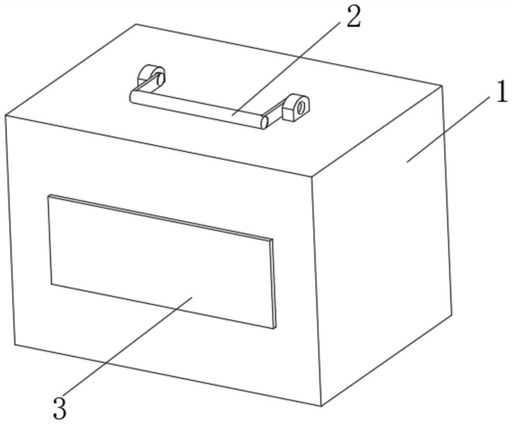
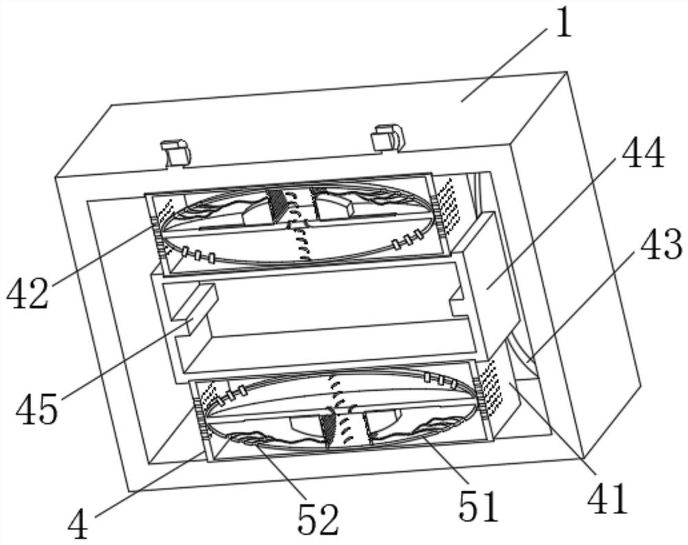
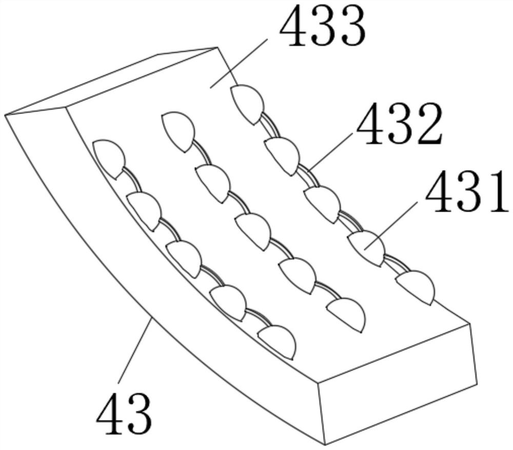
[0025] see Figure 1-5 , the present invention provides a technical solution: a GPS device for terrain surveying, comprising a box body 1, a handle 2 is mounted on the top center of the box body 1 for rotation, a closing plate 3 is movably installed at the front center of th...


PUM


Abstract

The invention discloses GPS equipment for topographic survey, and relates to the technical field of GPS equipment. The GPS equipment for topographic survey comprises a box body, a handle is rotatably installed in the center of the top of the box body, a closing plate is movably installed in the center of the front face of the box body, an anti-falling mechanism is arranged on the inner side of the box body, a moisture removal mechanism is arranged on the inner side of the box body, and the anti-falling mechanism comprises partition plates, ventilation holes, elastic pieces, a storage box and a limiting block. The partition plates are fixedly installed on the inner sides of the top and the bottom of the box body, the ventilation holes are formed in the left side and the right side of each partition plate, and the elastic pieces are fixedly installed on the inner sides of the top and the bottom of the box body. According to the GPS equipment for topographic survey, the anti-falling mechanism is arranged to be matched with a dehumidification mechanism, so that the GPS equipment is prevented from being collided and damaged due to road bumping in the topographic survey process, and the situation that the equipment is damaged due to the fact that water enters the box body to be affected with damp and moisture enters the equipment in rainy days, and the measurement precision of topographic survey is affected is avoided.

Description

technical field [0001] The invention relates to the technical field of GPS equipment, in particular to a GPS equipment for terrain surveying. Background technique [0002] GPS equipment (Global Position System) is the global positioning system, which is used to receive and analyze the orbit information and time information in the radio waves returned by several satellites in space to calculate the longitude, latitude, horizontal altitude and movement of the GPS receiver's location Speed, the basic configuration of GPS equipment usually includes a GPS receiver, resolver and a high-efficiency microcomputer. GPS equipment is needed in topographical surveying to detect terrain conditions; After measuring the projected position and elevation of surface features and topography on the horizontal plane, they are scaled down to a certain scale, and then drawn into a topographic map with symbols and annotations. [0003] At present, GPS devices for topographical surveys on the market...

Claims


Application Information

Patent Timeline
Patent Type & Authority Applications(China)
IPC IPC(8): G01S19/14G01S19/02
CPCG01S19/14G01S19/02
Inventor 段超
Owner 段超
Why Eureka
Try Eureka