SPOT-6 satellite image RFM orthorectification method based on FPGA hardware

A SPOT-6, orthorectification technology, applied in the field of satellite remote sensing image processing, can solve the problems of slow processing speed and time-consuming, and achieve the effect of meeting the timeliness

Pending Publication Date: 2021-11-16
NANJING UNIV OF TECH
View PDF0 Cites 1 Cited by
  • Summary
  • Abstract
  • Description
  • Claims
  • Application Information

AI Technical Summary

Problems solved by technology

This kind of RFM orthorectification method based on the ground platform cannot meet the application scenarios that have high requirements for timeliness (such as disaster prevention and mitigation, dynamic target tracking, etc.), the main reasons include: (1) using the ground platform to perform RFM-based When

Method used


Image

  • SPOT-6 satellite image RFM orthorectification method based on FPGA hardware
  • SPOT-6 satellite image RFM orthorectification method based on FPGA hardware
  • SPOT-6 satellite image RFM orthorectification method based on FPGA hardware

Examples


Embodiment Construction

[0024] The vertical direction wave buoy detection device and method based on the lead screw and the linear guide rail of the present invention will be described in detail below in combination with the embodiments and the accompanying drawings.

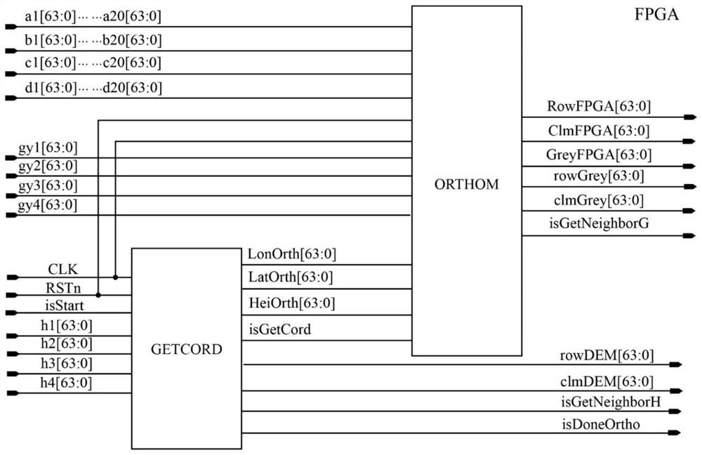
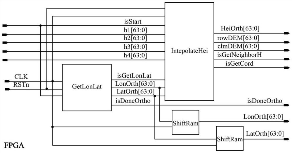
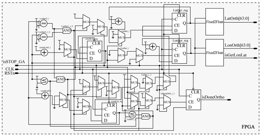
[0025] The SPOT-6 satellite image RFM orthorectification method based on FPGA hardware of the present invention comprises the steps:

[0026] 1) Obtain the geodetic coordinates of the orthophoto pixel points; including:

[0027] Let the four vertices of the original image be p 1 ,p 2 ,p 3 and p 4 , and their corresponding ground points P 1 ,P 2 ,P 3 and P 4 The geodetic coordinates of are (Lon1,Lat1), (Lon2,Lat2), (Lon3,Lat3) and (Lon4,Lat4), then the ground range covered by the orthophoto is determined according to the following formula, namely:

[0028]

[0029] After determining the range of the orthophoto, determine the number of rows and columns of the orthophoto according to the given longitude and latitude ground samp...


PUM


Abstract

The invention discloses an SPOT-6 satellite image RFM ortho-rectification method based on FPGA hardware. The method comprises the following steps: obtaining geodetic coordinates of ortho-image pixel points; performing coordinate conversion by using an RFM model, namely converting geodetic coordinates of a ground point into pixel row coordinates and column coordinates of an original image; carrying out gray scale interpolation on the orthoimage; and repeating the process until the gray values of all the pixel points on the orthoimage are obtained, thereby obtaining the image subjected to orthorectification. According to the SPOT-6 satellite image RFM ortho-rectification method based on the FPGA hardware, the FPGA serves as a hardware acceleration platform, Verilog hardware language serves as a design language, RFM ortho-rectification of remote sensing images is achieved under the condition of limited hardware resources, and the requirements for timeliness, portability and miniaturization of satellite image ortho-rectification in the satellite remote sensing field are met.

Description

technical field [0001] The invention relates to a satellite remote sensing image processing method. In particular, it relates to an FPGA hardware-based RFM orthorectification method for SPOT-6 satellite imagery. Background technique [0002] With the continuous development of aerospace, sensing and other technologies, the resolution of satellite remote sensing images continues to increase, the number of bands continues to increase, and the revisit cycle continues to shorten. At the same time, the amount of image data acquired is also increasing at an alarming rate. However, ordinary users need to go through the following process if they want to obtain the satellite image thematic products they are interested in: the satellite sensor acquires data, the satellite downloads the data to the data receiving center, and then the ground professionals process the data according to the user's requirements, and finally the processing Results are distributed to users. This process is ...

Claims


Application Information

Patent Timeline
IPC IPC(8): G06T5/00
CPCG06T5/006G06T2207/10032
Inventor 张荣庭周国清张广运朱强
Owner NANJING UNIV OF TECH
Why Eureka
Try Eureka