Landslide depth inversion method using InSAR elevating track deformation data
A lifting rail and deformation technology, applied in the direction of re-radiation, radio wave reflection/re-radiation, and measuring devices, can solve problems such as inability to accurately reflect the depth distribution of landslides, improve reliability and applicability, and improve The effect of accuracy
- Summary
- Abstract
- Description
- Claims
- Application Information
AI Technical Summary
Problems solved by technology
Method used
Image

Examples
Embodiment 1
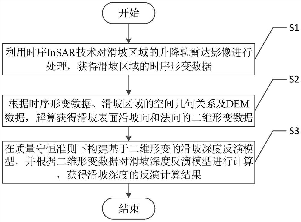
[0051] Such as figure 1 As shown, a landslide depth inversion method using InSAR lift rail deformation data includes the following steps:
[0052] S1. Use the time-series InSAR technology to process the radar images of the ascending and descending rails in the landslide area, and obtain the time-series deformation data of the landslide area;
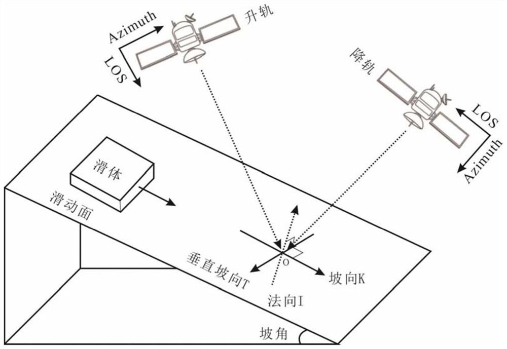
[0053] S2. According to the time-series deformation data, the spatial geometric relationship of the landslide area and the DEM data, obtain the two-dimensional deformation data of the landslide surface along the slope direction and the normal direction;
[0054] S3. Construct a landslide depth inversion model based on two-dimensional deformation under the principle of mass conservation, and calculate the landslide depth inversion model according to the two-dimensional deformation data, and obtain the inversion calculation result of landslide depth.
[0055] This embodiment considers that the small baseline interferometry (SBAS-InSAR) te...
Embodiment 2
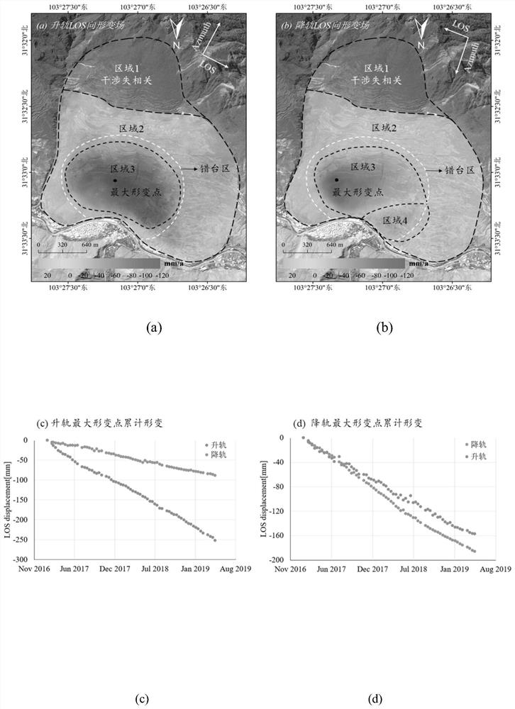
[0091] In this example, the landslide depth inversion is carried out in the ancient landslide area of Taoping Township through the method in Example 1 above. The mountainous monsoon climate zone has a wide range of elevation differences and complex terrain. Affected by the climate, there is more rainfall in this region from July to September every year, and relatively less precipitation in winter, with annual rainfall between 650mm and 1000mm. The ancient landslide in Taoping Township is generally in the shape of a chair. The terrain is high in the south-west and low in the north-east. The slope is narrow at the top and wide at the bottom. The average slope is about 27°-53°. The edge elevation is about 2710m, the relative height difference is ~1230m, the longitudinal length is about 2700m, and the lateral width is ~2000m, which belongs to a large landslide.
[0092] In this example, the SAR images of the ascending and descending orbits observed under the interferometric wid...
PUM
 Abstract
Description
Claims
Application Information